Malga Crocifisso - Rifugio Baita Cuz (Via Ferrata I Magnifici 4)
Starting point: Malga Crocifisso (1599 m)
Starting point Lat/Lon: 46.41995°N 11.72798°E 
Path name: Via Ferrata I Magnifici 4
Time of walking: 2 h 40 min
Difficulty: extremely difficult marked way
Ferrata: E
Difficulty of skiing: no data
Altitude difference: 614 m
Altitude difference (by path): 614 m
Map: Tabacco 06 1:25.000
Access to starting point:
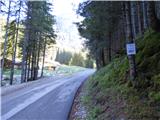
Access from Gorenjska: Through the Karawanks Tunnel, we drive to Austria, and then we continue driving towards Spittal and forward towards Lienz (a little after Spittal highway ends). Further, we drive on a relatively nice and wide road through Drau valley, which brings us in Italy. The road further leads past Dobbiaco / Toblach and Brunico / Bruneck. Only a little after the last-mentioned town, past which leads a bypass road, we turn left into a valley Val Badia. Further, we drive through the mentioned valley past settlements La Vila and Corvara. Next follows an ascent over the mountain pass Passo Campolongo and Passo Pordoi. From the mountain pass Passo Pordoi we then descend on the west side into a valley Val di Fassa. In the settlement Pozza di Fassa then at the roundabout, we continue left in the direction of Val San Nicolo. We follow this road to the mountain pasture Malga Crocifisso. From the mountain pasture, we can continue a little less than a kilometer on the road and then we turn left (marked with the caption Ferrata) over a small bridge where we park.
From Primorska side: From Nova Gorica, we drive to Italy and drive forward on the highway towards Venice / Venezia. At town Portogruaro we leave the highway towards Venice and continue right on the highway towards Pordenone. At the next highway junction near Conegliano, we continue right towards Belluno. We follow the highway to exit for Belluno. When we leave the highway we come to bigger roundabout, which we leave at exit for Belluno and settlement Feltre. In smaller roundabout in the settlement Belluno we then continue right towards the settlement Agordo. This road we then follow all the way to the settlement Pozza di Fassa into a valley Val di Fassa. In the settlement Pozza di Fassa then at the roundabout, we continue right in the direction of Val San Nicolo. We follow this road to the mountain pasture Malga Crocifisso. From the mountain pasture, we can continue a little less than a kilometer on the road and then we turn left (marked with the caption Ferrata) over a small bridge where we park.
Path description:
From the starting point, we continue right by the stream where signs »Ferrata I Magnifici 4« point us to. The path leads through the forest and at first runs by the stream and then turns left and starts ascending a little steeper. At crossings we all the time follow the signs »Ferrata«. The path then brings us to a smaller clearing on which we soon reach gully in which starts secured climbing path.
In front of the entry into a climbing part of the path, we must equip ourselves with a self-belay set and a helmet, it is also highly recommended to use climbing gloves and additional short rope for resting.
The secured path already at the beginning few times almost vertically ascends (difficulty D), then turns a little to the left and it ascends diagonally over a wall (difficulty C). After that, the path again turns to the right and difficulty slightly decreases and brings us in front of hardest part of the path. Before the most difficult part of the path there is also enough space for a rest.
The path here at first steeply ascends (difficulty D) and then follows a short very demanding ascent through overhang (difficulty E). Above the overhang we then continue to the right and we cross overhung wall. The crossing is mainly first few meters still very demanding (difficulty E). In further crossing is a mountain wall still overhanging and we get help from additional steel cable on which we can walk (difficulty D). After the crossing follows also steep ascent left upwards (difficulty D, C/D). First part of a secured path then ends and the path from deep gully surrounded by vertical walls brings us on less steep slopes from which a nice view opens up through a valley Val di San Nicolo and surrounding peaks.
Further, we then for some time cross the slopes towards the east. Here the path mostly isn't demanding only on some spots at the crossing we get help from a steel cable (difficulty to B/C). By the path is here also a smaller cave, which in case of bad weather we use as emergency bivouac. Later, the path turns a little to the left and again starts ascending and brings us below a mighty wall. We go towards narrow gully or a crack in the wall where the path again becomes demanding. From the gully we continue left upwards and we at first vertically ascend (difficulty D). Further, we are for some time ascending steeply upwards (difficulty C), after that steepness slightly decreases and the path soon turns to the left and crosses a slope towards the west (difficulty B, A). After that, the path for a short time again becomes easy and it brings us to the last part of the climbing path. The last part of the climbing path we can also avoid by continuing straight on less steep slopes.
The last part of climbing path otherwise at first almost vertically ascends right upwards (difficulty C). Then follows a short crossing to the left and then also last demanding vertical ascent (difficulty D, C). Climbing path then ends and brings us on a less steep grassy slopes. To the mountain hut Baita Cuz, which we already see in front of us follows only few minutes of easy walking.
We descend on an easy path which runs on a ski slope towards the mountain hut Rifugio Buffaure. At the mountain hut Rifugio Buffaure we then continue left downwards on a footpath following the signs Malga Crocifisso, which brings us back to the starting point. From the mountain hut, we can descend also on the road which runs on a ski slope.
The described path is extremely demanding and is graded with difficulty level E which ranks it among most difficult such paths. Many people rank it also as most difficult in the entire Dolomites. The path is appropriate only for climbers and experienced mountaineers with enough strength in arms.
Pictures:
 1
1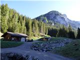 2
2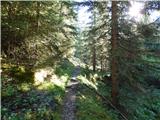 3
3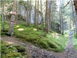 4
4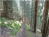 5
5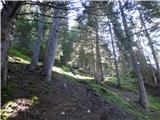 6
6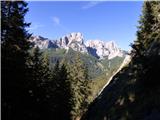 7
7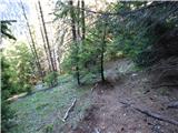 8
8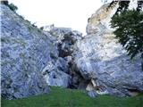 9
9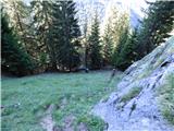 10
10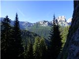 11
11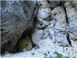 12
12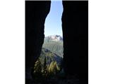 13
13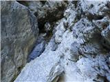 14
14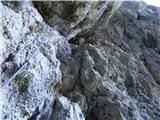 15
15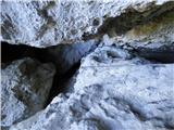 16
16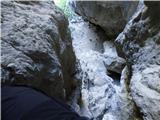 17
17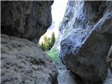 18
18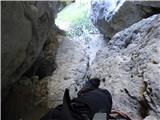 19
19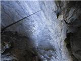 20
20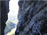 21
21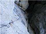 22
22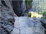 23
23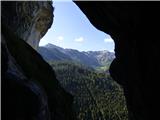 24
24 25
25 26
26 27
27 28
28 29
29 30
30 31
31 32
32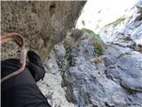 33
33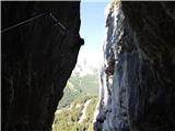 34
34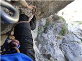 35
35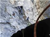 36
36 37
37 38
38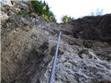 39
39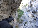 40
40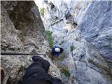 41
41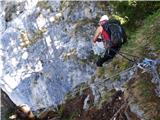 42
42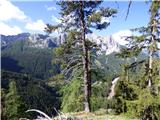 43
43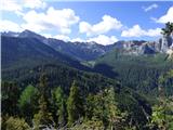 44
44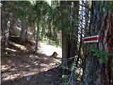 45
45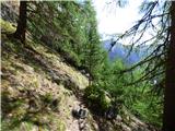 46
46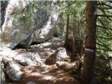 47
47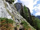 48
48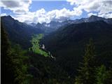 49
49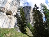 50
50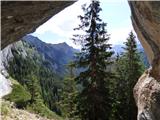 51
51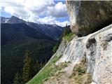 52
52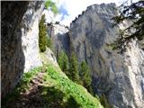 53
53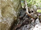 54
54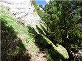 55
55 56
56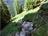 57
57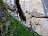 58
58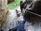 59
59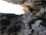 60
60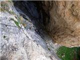 61
61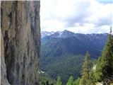 62
62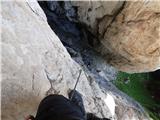 63
63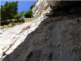 64
64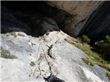 65
65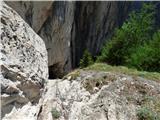 66
66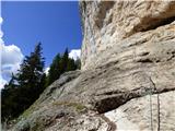 67
67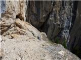 68
68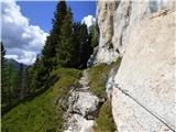 69
69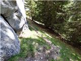 70
70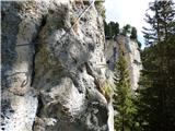 71
71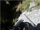 72
72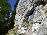 73
73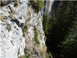 74
74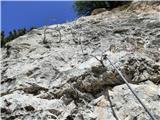 75
75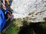 76
76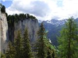 77
77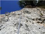 78
78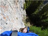 79
79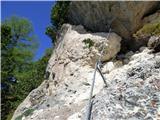 80
80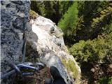 81
81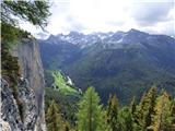 82
82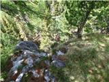 83
83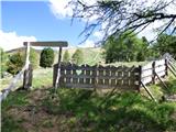 84
84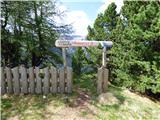 85
85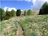 86
86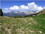 87
87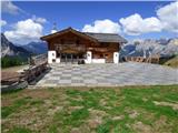 88
88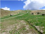 89
89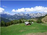 90
90