Medvodje - Planina Spodnja Dolga njiva
Starting point: Medvodje (854 m)
| Latitude/Longitude: | 46,40760°N 14,39150°E |
| |
Walking time: 2 h 15 min
Difficulty: easy marked way
Elevation gain: 546 m
Elevation difference along the route: 550 m
Map: Karavanke - osrednji del 1:50.000
Recommended equipment (summer):
Recommended equipment (winter): ice axe, crampons
Views: 16.880
 | 1 person like this post |
Access to starting point:
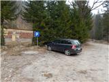
From highway Ljubljana - Jesenice we go to the exit Podnart (Ljubelj), and then we continue driving on the road towards Ljubelj and Tržič. When the fast road ends, we will notice a gas station on the right side, in front of which we turn right downwards towards Tržič. Further, we drive through Tržič, and we follow the narrower road towards the gorge Dovžanova soteska and then through the villages Dolina and Jelendol to Medvodje, where we park on a marked parking lot by the nearby crossroad.
Route description:
From the parking lot, we continue on the left road in the direction of Košutnikov turn, Dolga njiva and Košutnik (right - waterfall Stegovniški slap). We first walk on a marked road, by which the blazes are rare, and we are all the time ascending by the stream Košutnik. When the macadam road turns sharply right and crosses a stream, we leave it and we continue straight on a marked path, by which the blazes are more frequent. Few minutes we are still ascending by the stream and then the path turns left and steeply ascends to an older cart track which we follow to the right. On the cart track, we are mainly ascending diagonally, and then we go from the cart track even a little more to the right on a marked path, which at first crosses slopes above the stream and soon turns left and steeply ascends to a macadam road which we follow right to Košutnik, where there is a marked crossing.
We continue straight in the direction of Dolga njiva and Košutnikov turn (right on the road, we return to Medvodje) and we start moderately ascending. When the road turns left and goes away from the stream, we go slightly right on a marked path which continues on a cart track. At first, we still walk through the forest and then we again get closer to the torrent and we cross it (this part is in unfavorable conditions exposed to a mighty avalanche, which can be triggered from Košuta).
After the crossing of the torrent, we return on the road, we follow it to the right and there we get to a marked parking lot Pod Krnico, where in time when the road is drivable, the majority of the hikers start walking.
From the end of the parking lot, we continue slightly left on a cart track in the direction of Košutnikov turn, where we at first diagonally ascend, we cross a stream and a little ahead we cross also a torrent stream Košutnik. After the crossing of Košutnik, the path turns a little to the left and starts ascending steeper through the forest, and at the crossings we follow the blazes. When the path flattens, we step out of the forest, and on a cart track we get to a crossing, where a western path branches off to the left on Košutnikov turn and the path towards Kofce and other mountain pastures of Košuta.
We continue slightly right and on a cart track we quickly get to a mountain dairy on the mountain pasture Spodnja Dolga njiva.
Medvodje - Košutnik 1:05, Košutnik - Spodnja Dolga njiva 1:10.
Description refers to a condition in March 2020, and pictures are from various periods.

Along the route: Košutnik (1080m)
The trip can be extended to the following destinations: Tegoška planina,
Planina Pungrat,
Planina Ilovica,
Dom na Kofcah,
Zavetišče na planini Šija,
Planina Zgornja Dolga njiva,
Mala Košuta,
Plešivec,
Tolsta Košuta - western peak,
Tolsta Košuta - eastern peak,
Koschutnikturm (Košutnikov turn)
Photos:
 1
1 2
2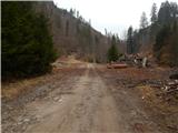 3
3 4
4 5
5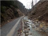 6
6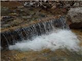 7
7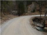 8
8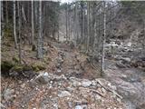 9
9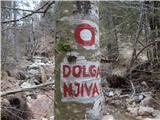 10
10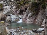 11
11 12
12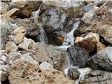 13
13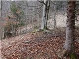 14
14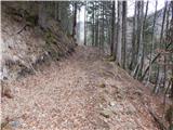 15
15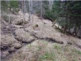 16
16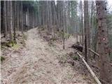 17
17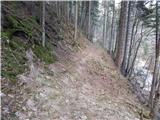 18
18 19
19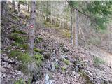 20
20 21
21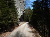 22
22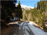 23
23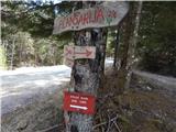 24
24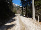 25
25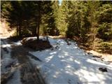 26
26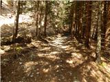 27
27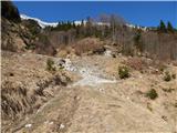 28
28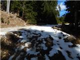 29
29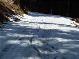 30
30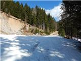 31
31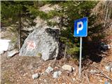 32
32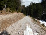 33
33 34
34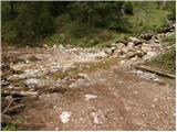 35
35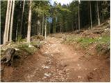 36
36 37
37 38
38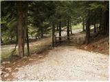 39
39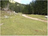 40
40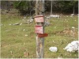 41
41 42
42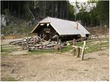 43
43
Discussion about the trip Medvodje - Planina Spodnja Dolga njiva
To post a comment you must log in:
If you do not yet have a username, you must first
register.