Medvodje - Planina Spodnja Dolga njiva (via planina Brsnina)
Starting point: Medvodje (854 m)
| Latitude/Longitude: | 46,40760°N 14,39150°E |
| |
Route name: via planina Brsnina
Walking time: 3 h 15 min
Difficulty: easy unmarked way, easy marked way
Elevation gain: 546 m
Elevation difference along the route: 650 m
Map: Karavanke - osrednji del 1:50.000
Recommended equipment (summer):
Recommended equipment (winter): ice axe, crampons
Views: 1.490
 | 1 person like this post |
Access to starting point:
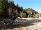
From the highway Ljubljana - Jesenice, take the exit Podnart (Ljubelj), then continue driving on the fast road towards Ljubelj and Tržič. When the fast road ends, we will notice a gas station on the right side, in front of which we turn right downhill towards Tržič. Further, we drive through Tržič, following the narrower road towards the gorge Dovžanova soteska and then through the villages Dolina and Jelendol to Medvodje, where we park on a marked parking lot by the nearby crossroads.
Route description:
From the parking lot, we continue on the right road in the direction of Storžič, Stegovnik and Stegovniški slap (left - Košutnik, Košutnikov turn and mountain pasture Dolga njiva on a marked path), after a few dozen steps we continue straight (right - Stegovniški slap). The path ahead leads us on a macadam road which continues along Tržiška Bistrica, and when we get to a crossroad at the confluence of Tržiška Bistrica and Fevča, we continue on the left road which continues along Tržiška Bistrica. Higher, the road turns sharply left and only a few steps further it brings us to a crossroad, where we go right (the left road leads towards Medvodnica 1202 m). Next follows an ascent in a few hairpin turns, and then a beautiful view opens up towards the west, and the road still follows the direction along Tržiška Bistrica, even though we occasionally go away from the riverbed. When higher we again pass to the right bank of Tržiška Bistrica, then we go on the first cart track right, and a few minutes ahead we join the cart track which continues from the end of the other forest road. Next follows a few minutes of ascent on a rough cart track, and then we choose the slightly left cart track (slightly right - mountain pasture Brsnina 3 minutes) to which a few steps further the blazes join. Next follows crossing of a torrent, and a little ahead the blazes from the cart track direct us to the left, so that we then cross the slopes towards the left. Next follows traversing with some shorter ascents and descents, and the path leads us below the towers Turen, where there is some danger of falling stones. Further, the footpath starts to vanish and we follow the blazes, which a little further bring us to a cart track, which we follow right upwards. Already quickly, still before an interesting cliff we go left, where we continue on a worse footpath which first crosses the slopes, then ascends diagonally across a steep slope. The slope, from which temporarily a little view opens up in the direction towards Storžič, gradually flattens, and the path brings us to a macadam road which gently descends. A few minutes we descend, then from the crossroad we go right in the direction of Dolga njiva (on the road left we would descend into the valley) and continue an easy descent. A little further the blazes direct us right onto an older cart track, on which we diagonally descend to a torrent, cross it, and then across the pasture we walk to a marked junction, where we go right and then in a minute of further walking we arrive at the mountain dairy on mountain pasture Spodnja Dolga njiva.
Medvodje - Planina Brsnina 1:30, Planina Brsnina - Planina Spodnja Dolga njiva 1:30.

Along the route: Planina Brsnina (1357m)
The trip can be extended to the following destinations: Tegoška planina,
Planina Pungrat,
Planina Ilovica,
Dom na Kofcah,
Zavetišče na planini Šija,
Planina Zgornja Dolga njiva,
Mala Košuta,
Plešivec,
Tolsta Košuta - western peak,
Tolsta Košuta - eastern peak,
Koschutnikturm (Košutnikov turn)
Photos:
 1
1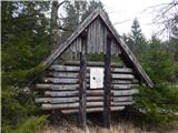 2
2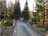 3
3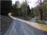 4
4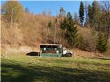 5
5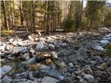 6
6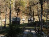 7
7 8
8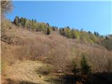 9
9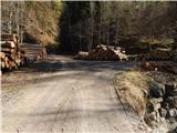 10
10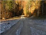 11
11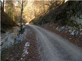 12
12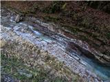 13
13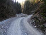 14
14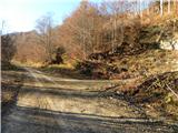 15
15 16
16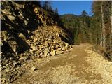 17
17 18
18 19
19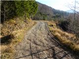 20
20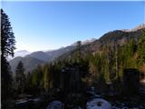 21
21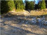 22
22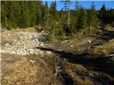 23
23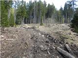 24
24 25
25 26
26 27
27 28
28 29
29 30
30 31
31 32
32 33
33 34
34 35
35 36
36 37
37 38
38 39
39 40
40 41
41 42
42 43
43 44
44 45
45 46
46 47
47 48
48 49
49 50
50 51
51 52
52 53
53
Discussion about the trip Medvodje - Planina Spodnja Dolga njiva (via planina Brsnina)
To post a comment you must log in:
If you do not yet have a username, you must first
register.