Mengeš - Mengeška koča on Gobavica
Starting point: Mengeš (320 m)
| Latitude/Longitude: | 46,16690°N 14,56810°E |
| |
Walking time: 20 min
Difficulty: easy marked way
Elevation gain: 113 m
Elevation difference along the route: 113 m
Map:
Recommended equipment (summer):
Recommended equipment (winter):
Views: 16.453
 | 5 people like this post |
Access to starting point:
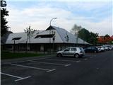
A) From the direction of Ljubljana: We drive on the bypass to Tomačevo roundabout, where we turn towards Črnuče and Trzin. On a four-lane road we drive past Črnuče and Trzin. At the crossroad right before Depala vas or just before the road narrows into a two-lane road we turn left in the direction of Mengeš (signpost). After driving through Trzin we get to Mengeš and to the roundabout of Mengeš bypass road. We leave the roundabout at the exit for the settlement Mengeš. We drive through the settlement over two traffic light crossroads (at first Tuš, at the second fire station). Just before the main crossroad towards Brnik we turn left. We drive past the kindergarten (picture 1 - only during the weekends is parking allowed) or we drive even a little further to the parking lot, which is situated on both sides just before the road turns uphill (picture 2).
B) From Domžale (from the direction of Štajerska highway exit): We drive to Rodica (direction Kamnik) and there just after the railway station at the crossroad at Toyota center we turn left, we cross the track and we drive about a kilometer or two to Mengeš. From the settlement sign, we drive a few hundred meters to the first traffic light. On the right we see the fire station. We turn right and further as per the description from the direction of Ljubljana.
C) From the direction of Kamnik: We drive to the roundabout on Šmarca, and there in the direction of Ljubljana or Mengeš. From the settlement sign for Mengeš after a few hundred meters we get to the traffic light crossroad towards Brnik (on the right we see inn Pavovec). There we go straight and then we turn into the first street right and further as per the description from the direction of Ljubljana.
D) From the direction of Kranj (Gorenjska): We leave Kranj in the direction of Šenčur and at the roundabout (on which we come also from the highway from Ljubljana direction or from Jesenice direction, if at the crossroad after getting from the highway we turn right and we drive below the highway) we turn towards Šenčur. We drive through Šenčur, Brnik, Lahovče, Moste all the time straight or following signposts for Mengeš. When we come to Mengeš after a few hundred meters of driving, we find ourselves at a traffic light crossroad where we turn right and then we turn again into the first street right and further as per the description from the direction of Ljubljana.
Route description:
From the second parking lot we go some tens of meters still on the road uphill and then we turn left onto a forest path, which branches off from the road (picture 3). The path is marked even though at the beginning the blazes are a little poorly visible. After the turn to the left it leads us past a big rock (picture 4) and then past the broken bench (picture 5). From here after about 10 minutes we come to a clearing with a (whole) bench and a chapel. From this clearing we have a nice view towards the Kamnik Alps with Kamniško sedlo saddle, Brana, Planjava,...
Further, we DO NOT continue on the obvious path past the bench and directly into the forest but we follow the poorly visible path behind the chapel as shown on picture 7. This path after some tens of meters again brings us into the forest (picture 9) where we again notice the blazes (picture 10). We continue straight and just before the peak we come to a crossroad (picture 12) where we again continue straight. After some tens of meters we reach the peak.

Photos:
 1
1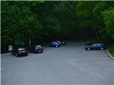 2
2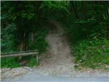 3
3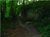 4
4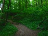 5
5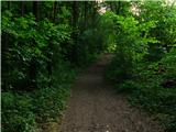 6
6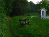 7
7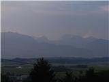 8
8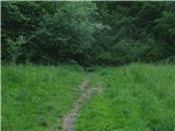 9
9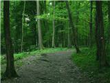 10
10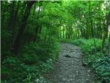 11
11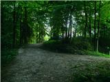 12
12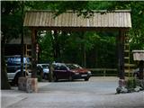 13
13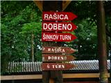 14
14
Discussion about the trip Mengeš - Mengeška koča on Gobavica
|
| pikec127. 06. 2011 |
Here I ride my bike and then to Rašica, wonderful forest path further. Just this path is really short 
|
|
|
|
| VanSims22. 09. 2023 07:44:26 |
No, the kindergarten in the first picture is the one that was flooded this year and from which children were rescued.
|
|
|
To post a comment you must log in:
If you do not yet have a username, you must first
register.