Mengeš - Mengeška koča on Gobavica (on trim trail)
Starting point: Mengeš (320 m)
| Latitude/Longitude: | 46,16690°N 14,56810°E |
| |
Route name: on trim trail
Walking time: 30 min
Difficulty: easy marked way
Elevation gain: 113 m
Elevation difference along the route: 113 m
Map:
Recommended equipment (summer):
Recommended equipment (winter):
Views: 31.056
 | 2 people like this post |
Access to starting point:
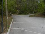
A) First, we drive to Trzin, then we continue driving towards Mengeš and Kamnik. When we arrive at the roundabout at the beginning of the settlement Mengeš, we take the Mengeš exit, then we continue driving through the center of the settlement. When we see the main crossroad, where slightly to the left a road branches off towards Brnik, and slightly to the right towards Kamnik, we turn sharply left onto a narrower road in the direction of Mengeška koča na Gobavici. Further, we drive past the kindergarten, and we follow the road to the beginning of the forest, where we park on a marked and asphalted parking lot.
B) From Kamnik or Komenda we drive to Mengeš, then immediately after the crossroad, where both roads join, we turn right onto a narrower road in the direction of Mengeška koča na Gobavici. Further, we drive past the kindergarten, and we follow the road to the beginning of the forest, where we park on a marked and asphalted parking lot.
Route description:
At the end of the parking lot, we arrive at a crossing of several paths, and we choose the left one (straight marked and shortest path to Mengeška koča, right Mengeška koča on the asphalt road), so the one by which there are also signs for trim trail. Initially a gently sloping path, which crosses slopes towards the right, leads us past trim trail exercises, then higher it joins another marked path from Mengeš. Here a few meters before the nearby residential house we turn right, and then we gently ascend across a smaller meadow. The path then returns into the forest and after a few minutes of additional walking brings us to Mengeška koča na Gobavici.
Photos:
 1
1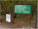 2
2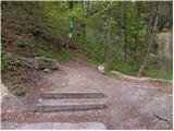 3
3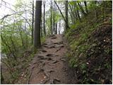 4
4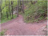 5
5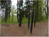 6
6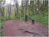 7
7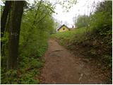 8
8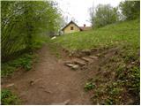 9
9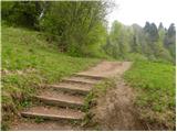 10
10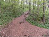 11
11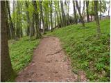 12
12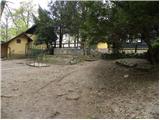 13
13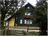 14
14
Discussion about the trip Mengeš - Mengeška koča on Gobavica (on trim trail)
|
| VanSims13. 05. 2012 |
The path is for the most part easy to follow due to the signs and equipment of the trim trail if nothing else, but I would add a bit to the somewhat incomplete description at the end:
When we turn right before that residential house (pictures 9 and 10), we continue for a while on the trim trail past the tenth and eleventh exercise. Then we reach the twelfth and instead of going right before this exercise we go straight where we reach a junction where we turn sharply left (we join the marked path in the first description Mengeš - Gobavica).
The path is marked with green-white markings on the trim trail, after joining the path in the first description with usual red-white markings.
And I would ask you to follow what is written on the sign in picture 3. There are many recreational athletes and trim users there.
|
|
|
To post a comment you must log in:
If you do not yet have a username, you must first
register.