Mönichkirchen - Hochwechsel (via Steinerne Stiege)
Starting point: Mönichkirchen (1006 m)
| Latitude/Longitude: | 47,51217°N 16,03173°E |
| |
Route name: via Steinerne Stiege
Walking time: 3 h 30 min
Difficulty: easy marked way
Elevation gain: 737 m
Elevation difference along the route: 840 m
Map:
Recommended equipment (summer):
Recommended equipment (winter): ice axe, crampons
Views: 295
 | 1 person like this post |
Access to starting point:
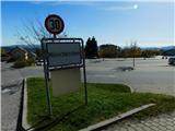
We leave the A2 Graz - Vienna / Wien motorway at the Pinggau, Friedberg exit, then from the nearby roundabout we take the exit in the direction of the mentioned places and Vienna and Graz. A few kilometres further at the intersection of regional roads we follow the signs for Vienna and Mönichkirchen. We then drive along Wechsel Straße, the aforementioned road which is mainly ascending, but leave it at the junction for Mönichkirchen. This is followed by driving through the settlement to a larger parking lot above the settlement, which is located at the foot of the ski slope.
Parking before 8 a.m. is prohibited, the parking lot is paid for hikers, free for cable car users.
Free parking is located below along the main road, which extends the route by approximately 15 minutes.
Route description:
On the right, eastern side of the parking lot, the asphalt road continues, along which there are still some parking lots, and we ascend along it beside the ski slope. After a few minutes we arrive at a marked junction, where the path towards Mönichkirchner-Schwaig splits into two parts.
We continue slightly left (straight: path along the road) and continue along the path on the right side of the ski slope (path across the ski slope leads past the Studentenkreuz cross). This is followed by an ascent along a trail that leads along the edge of the forest, all the time near the ski slope. Higher up, we carefully cross the macadam road, as during the summer season descents take place along it with vehicles adapted for use on dry ski slopes.
We ascend for a few more minutes along the edge of the ski slope, then return to the road, continue left and walk to Berggasthof Mönichkirchner-Schwaig.
We continue in the direction of the Hallerhaus and Vorauer Schwaig huts and ascend along the right side of another ski slope, accompanied by fairly rare markings. This is followed by a few minutes of steeper ascent along a cart track ascending the ski slope, then we join a cart track that continues further along the ski slope. Further on, beautiful views occasionally open up, and we follow the marked path to the Hallerhaus hut.
We bypass the hut on the left side and follow the signs for Hochwechsel. The path ahead leads through the forest, and at a few junctions we follow the markings. A little higher we leave the forest and arrive at the Kulinarik zur Stoa Alm hut, from which a nice view opens up mainly towards the northeast.
We bypass the hut and the upper cable car station on the left side and return to the forest, through which we steeply ascend for a few minutes. Higher up the forest thins out and some views open up, we continue a little further and arrive at the indistinct summit of Steinerne Stiege.
This is followed by some descent through the forest, then we arrive at a clearing, from which a view opens up of the Schneeberg mountain, which with its second-highest peak Kaiserstein is considered the northernmost and at the same time easternmost two-thousander in the Alps. The path ahead returns to the forest and splits.
We continue straight across the cart track onto the path towards the Hochwechsel and Niederwechsel summits (left along the cart track: Vorauer Schwaig hut). Further on we ascend diagonally, briefly still through the forest, then gradually along an increasingly panoramic grassy slope. Higher up we cross a pasture fence twice more, and we follow the marked path all the way to the junction near the Niederwechsel summit, where a path joins from the left that leads past the Vorauer Schwaig hut.
Here we go right and in a few steps ascend to the rocky and panoramic summit.
We continue northwest towards the Hochwechsel summit, first descending gently along panoramic grassy slopes. Lower down we reach an indistinct saddle between the two summits, and a few minutes further we arrive at a marked junction, where the path past the Vorauer Schwaig hut and some other starting points joins from the left.
We continue straight and begin first gently, then moderately to ascend. We then follow this path to the Wetterkoglerhaus am Hochwechsel hut, where we step onto the road. We cross the road at the start of the parking lot and walk to the summit a few steps away.
Starting point - Mönichkirchner-Schwaig 0:35, Mönichkirchner-Schwaig - Hallerhaus 0:30, Hallerhaus - Stoa Alm 0:15, Stoa Alm - Steinerne Stiege 0:15, Steinerne Stiege - Niederwechsel 0:50, Niederwechsel - Hochwechsel 1:05.
Description and pictures refer to the condition in October 2022.

Photos:
 1
1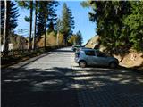 2
2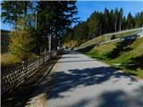 3
3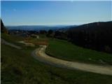 4
4 5
5 6
6 7
7 8
8 9
9 10
10 11
11 12
12 13
13 14
14 15
15 16
16 17
17 18
18 19
19 20
20 21
21 22
22 23
23 24
24 25
25 26
26 27
27 28
28 29
29 30
30 31
31 32
32 33
33 34
34 35
35 36
36 37
37 38
38 39
39 40
40 41
41 42
42 43
43 44
44 45
45 46
46 47
47 48
48 49
49 50
50 51
51 52
52 53
53 54
54 55
55 56
56 57
57 58
58 59
59 60
60 61
61 62
62 63
63 64
64 65
65 66
66 67
67 68
68 69
69 70
70 71
71 72
72 73
73 74
74 75
75 76
76 77
77 78
78 79
79 80
80 81
81 82
82 83
83 84
84
Discussion about the trip Mönichkirchen - Hochwechsel (via Steinerne Stiege)
To post a comment you must log in:
If you do not yet have a username, you must first
register.