Brezje / Montemaggiore - Punta di Montemaggiore
Starting point: Brezje / Montemaggiore (819 m)
| Latitude/Longitude: | 46,26810°N 13,37000°E |
| |
Walking time: 3 h
Difficulty: easy marked way
Elevation gain: 794 m
Elevation difference along the route: 820 m
Map: Julijske Alpe - zahodni del 1:50.000
Recommended equipment (summer):
Recommended equipment (winter): ice axe, crampons
Views: 12.111
 | 3 people like this post |
Access to starting point:
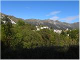
First, we drive to the center of Kobarid, and then we continue driving towards the border crossing Robič. Near the village Staro selo, we leave the main road which runs towards the border crossing Robič and we continue driving right in the direction of Breginj. Further, we follow a mainly ascending road to Breginj, where behind the church in the village we continue right in the direction of "Most na Nadiži". We follow the mentioned road to the mentioned bridge (bridge is a connection between Slovenia and Italy), and then on the other side of the bridge we continue right. A narrow and steep road then brings us to the village Plastišča / Platischis, and we follow it to the next hamlet Bona / Bonis. Here we continue right (direction Montemaggiore) and the road past the equestrian park brings us into the forest, where it starts ascending steeply. Higher, we come to a smaller crossroad, where we continue sharply right. The road then leads us through the village Brezje / Montemaggiore. In a sharp left turn a macadam road branches off to the right. At the crossroad, there are also signposts and blazes for path 742. We park at an appropriate place near the mentioned crossroad.
Route description:
In the village Brezje we turn right onto a macadam road following the signs “Pta di Montemaggiore“. The road soon starts slightly descending and brings us to a marked junction. Here we leave the forest road and go on a narrow footpath left upwards. The path starts ascending and runs through the beech forest. Further, the path turns slightly to the right, crosses some streams, and then brings us out of the forest. Here from the left joins another path from the village Brezje. At the junction, we continue right and cross a short scree below a rockfall. The path then brings us into the pine forest through which we ascend for quite some time. Out of the forest the path brings us onto grassy slopes from which nice views open up towards Breški Jalovec, Stol and Matajur. We can also clearly see the sea. Next follows an ascent on grassy slopes, which gradually become steeper. Later, the path turns to the right and crosses steep slopes below Jalovec. Still in ascent we cross steep grassy slopes, later the path also leads us through some very short sections of forest. Such a path then soon brings us to the main ridge, where there is also a marked junction.
At the junction, we continue left on the ridge, straight downwards leads the path towards the saddle Tanamea / Tam na meji, and right leads the path on the ridge towards the summit Gnjilica, Nad Ohojami and further towards Musc.
So we continue on a panoramic grassy ridge towards the west. The ridge in the last part becomes a little narrower and then follows only a short somewhat steeper ascent to the top of Breški Jalovec.

Photos:
 1
1 2
2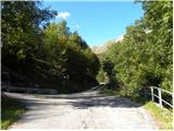 3
3 4
4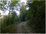 5
5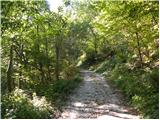 6
6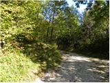 7
7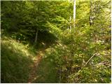 8
8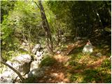 9
9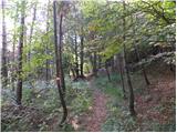 10
10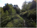 11
11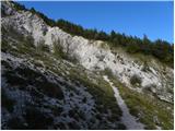 12
12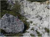 13
13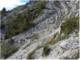 14
14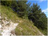 15
15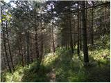 16
16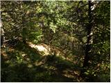 17
17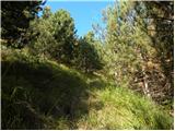 18
18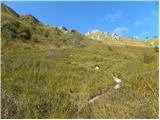 19
19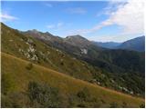 20
20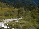 21
21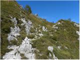 22
22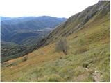 23
23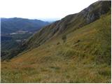 24
24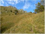 25
25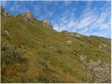 26
26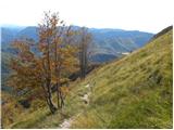 27
27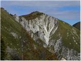 28
28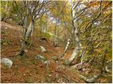 29
29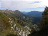 30
30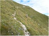 31
31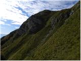 32
32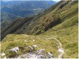 33
33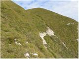 34
34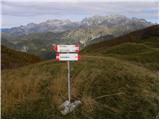 35
35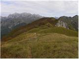 36
36 37
37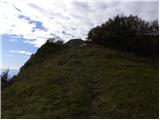 38
38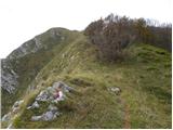 39
39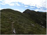 40
40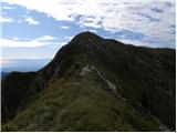 41
41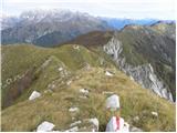 42
42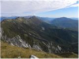 43
43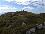 44
44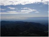 45
45 46
46
Discussion about the trip Brezje / Montemaggiore - Punta di Montemaggiore
To post a comment you must log in:
If you do not yet have a username, you must first
register.