Mrše - Sveti Socerb (Artviže)
Starting point: Mrše (749 m)
| Latitude/Longitude: | 45,59030°N 14,03890°E |
| |
Walking time: 1 h
Difficulty: easy marked way
Elevation gain: 68 m
Elevation difference along the route: 115 m
Map:
Recommended equipment (summer):
Recommended equipment (winter):
Views: 20.124
 | 1 person like this post |
Access to starting point:
From the highway Ljubljana - Koper, we take the exit Hrpelje-Kozina, and then we continue driving in the direction of Ilirska Bistrica. Just a little after the settlement Materija, we leave the main road and continue left on a local road in the direction of the villages Hotična, Mrše and Artviže. Further, we drive on a narrower ascending road, which soon brings us to a junction, where the road to Hotična branches off to the left, and here we continue right and drive to the next junction, in which we turn left towards Mrše and Artviže (right Markovščina). We continue the ascent and the road brings us to the next junction, where we go left again (right Orehek pri Materiji). Further, we drive through Mrše, and soon above the village we park in a suitable place by the road.
Route description:
From the starting point, we head onto the marked footpath in the direction of Artviže. The path, which initially runs along a cart track, goes immediately into the forest, through which it continues for a few minutes almost without changes in altitude. After a good 5 minutes of walking, the blazes direct us right onto a somewhat narrower cart track, which begins to ascend gently and takes us almost right up to the nearby asphalt road. We continue parallel to the road, carefully following the blazes, as due to the greater overgrowth we can quickly lose the correct path. Higher up, the path crosses a poorer cart track, after which it ascends moderately for a while, then levels out and takes us past a few clearings to a wider cart track, where we continue sharply left. We continue for a short time along the wide cart track, then at the point where it begins to descend noticeably, we continue sharply right (the junction is poorly marked) onto a somewhat narrower but marked cart track. From here we continue for a short time through the forest or a belt of scrub, then the path past a hunting observatory brings us to a larger meadow, from which a nice view opens up onto the village of Artviže and the church of St. Socerb above it. We walk for a few minutes across the panoramic meadow, then the path brings us to an asphalt road, along which we quickly ascend to a junction in the immediate vicinity of the village Artviže.
Here we continue left into the village and walk past the organic farm to the next junction, where we continue right (left 20 meters to the logbook box at Artviže).
From the centre of the village we continue along the asphalt road, which is not marked further on. At junctions we keep to the left directions (we overlook the turn-offs to courtyards), and the road quickly takes us above the village, where the asphalt ends. We continue the ascent along the panoramic grassy slope, along which we walk to the church of St. Socerb in a few minutes; it stands on the highest peak of the Brkini.

Along the route: Artviže (787m)
Photos:
 1
1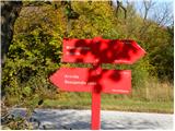 2
2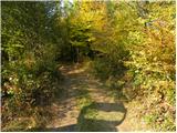 3
3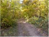 4
4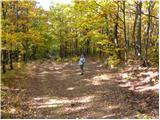 5
5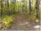 6
6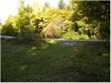 7
7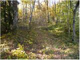 8
8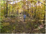 9
9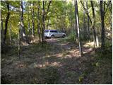 10
10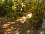 11
11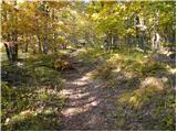 12
12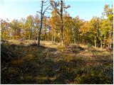 13
13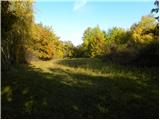 14
14 15
15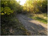 16
16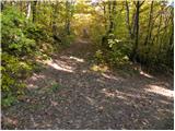 17
17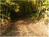 18
18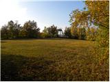 19
19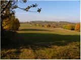 20
20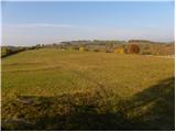 21
21 22
22 23
23 24
24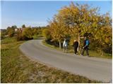 25
25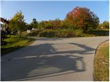 26
26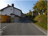 27
27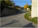 28
28 29
29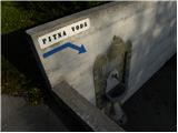 30
30 31
31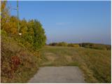 32
32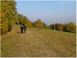 33
33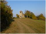 34
34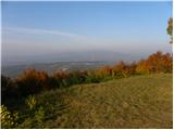 35
35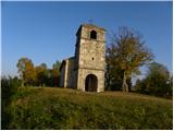 36
36
Discussion about the trip Mrše - Sveti Socerb (Artviže)
|
| B21. 11. 2011 |
The path is part of SPP, the new control point is also Artviže (logbook is inside, stamp is mounted on the box). PD Sežana takes care of the mentioned new CP and SPP section from Razdrto to Vremščica and further to Škocjan Caves (new SPP CP, stamp is in reception and also on the outdoor box, logbook is in the box) and to Podgrad pri Vremah, Artviže, Mrše and Markovščina.
|
|
|
|
| smatjaz4. 05. 2013 |
Does anyone perhaps know exactly where the stamp is located in Artviže? Thanks
|
|
|
|
| julius4. 05. 2013 |
In the box opposite the monument. Possible that they mounted it under the box.
|
|
|
|
| B25. 05. 2013 |
Above I wrote: "The logbook is in, the stamp is mounted on the box". - Already since we mounted it...
|
|
|
|
| Šuška24. 05. 2015 |
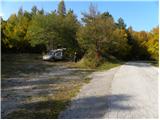
Today visited Artviže, started from the parking lot shown in the picture. Just to say that the signs are now poorly visible when overgrown with leaves, similarly some markings in the forest are poorly visible. Otherwise, the path is suitable for everyone and can be a really nice Sunday outing. The SPP stamp is at the owners in the house opposite the pillar, where the logbook box is. 
|
|
|
|
| balon8. 06. 2016 |
Hello,
I'm interested in how long the hike is if we extend the trail from Artviže to the Škocjan Caves? And where does this trail run?
Balončki
|
|
|
|
| pojoča travica8. 06. 2016 |
In the direction from the Škocjan Caves to Artviže it is marked 2 hours 30 min. In the opposite direction probably less, since you go downhill. The trail runs through forest, meadow, a bit also on road. From Mrše you go up, then down the other side, past the place Podgrad pri Vremah. It's nice.
|
|
|
|
| Kleemen23. 03. 2020 |
At the beginning of the path from Mrše to Artviže catastrophically marked path, many paths and almost no markings anywhere. Even in the middle of the village no sign/marking for the monument/stamp.
|
|
|
|
| padez24. 09. 2020 |
The SPP from Markovscina to Škocjan Caves is well maintained and excellently marked, both with signs and markings. Verified, walked the day before yesterday...
|
|
|
|
| NeH17. 04. 2021 10:28:14 |
The Mrše - Artviže path is well marked all the time. Really pleasant walk.
|
|
|
|
| rokeg29. 05. 2023 18:35:47 |
Today's hike from Markovščina. The path mostly follows the road indeed, so I went through Hotično and past sv. Pantaleja, also to a few mostly thorny peaks along the path (Majnik (not even accessible due to thorns), Tržič and Vrhe) and reached the road at picture 1. The road further towards Artviže is currently closed due to widening, the path that mostly runs along the road is well marked, just need to be careful at some junctions not to stray. The triangular stamp is in place at the monument in the box, the oval stamp for SPP is in the house opposite the stamping box.
What's happening with the church of sv. Socerb or around it??? The road to the top is dug up and everything around the church is excavated due to the road, the church is fenced and looks like a construction site, you can reach it only from the other (eastern) side or walk on the grass past the construction site.
I descended via Žernjavce into a really remote valley of the Padež stream. Along the valley itself the road dragged on quite a bit. The train in Gornjih Ležečah escaped me, despite serious "running", and it had no delay. Then the bus at the junction for the mentioned valley escaped too...
|
|
|
|
| Petmar5. 02. 2026 01:13:57 |
The stamp is in the village, by the road, on the light pole, under the box, next to the monument which is on the other side of the road. Coordinates: 45.6126°N, 14.0262°E.
|
|
|
To post a comment you must log in:
If you do not yet have a username, you must first
register.