Murova (Jesenice) - Chapel of St. Barbara on Pejce
Starting point: Murova (Jesenice) (590 m)
| Latitude/Longitude: | 46,43860°N 14,04950°E |
| |
Walking time: 25 min
Difficulty: easy unmarked way
Elevation gain: 160 m
Elevation difference along the route: 160 m
Map: Karavanke - osrednji del 1 : 50.000
Recommended equipment (summer):
Recommended equipment (winter): ice axe, crampons
Views: 3.165
 | 2 people like this post |
Access to starting point:
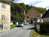
From the highway Ljubljana - Jesenice, we take the exit Lipce, where we drive right towards Jesenice. In the settlement Slovenski Javornik, at the first crossroad with traffic lights we turn left towards the center of the town. In the seventh traffic light crossroad in a row we turn sharply right and drive only a few tens of meters, after which we go left uphill towards the church on Murova. We park nearby.
Route description:
From the church, we continue left on the road which leads uphill among houses. We soon come to a crossroad, where we continue slightly right or straight uphill. The street (Kosova) narrows and we go along it all the way to its end past the last house on the left. After the small garden we step on a wide forest path which leads uphill towards the northwest. After only 15 minutes of walking from the starting point, we encounter a small chapel, and behind it a junction. We choose right (left Sp. Pejce) and continue on a slightly narrower path through the forest, and across the power line clearing to the next junction at the water intake, where we join the wider path coming from the left, or from Spodnje Pejce. We continue right uphill on a nice, wide rocky path, on which ore was once transported, of which there are still visible traces (glajžne). In a few minutes we arrive at another, larger chapel, which is located right below Zgornje Pejce. By the chapel there are benches where we can take a rest.

Photos:
 1
1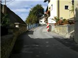 2
2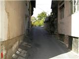 3
3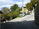 4
4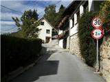 5
5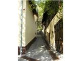 6
6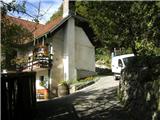 7
7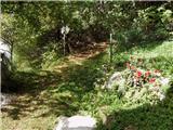 8
8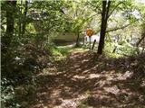 9
9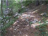 10
10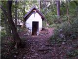 11
11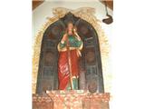 12
12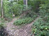 13
13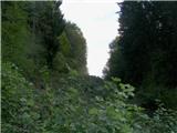 14
14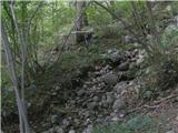 15
15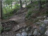 16
16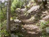 17
17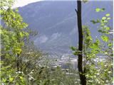 18
18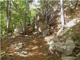 19
19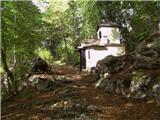 20
20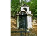 21
21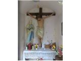 22
22
Discussion about the trip Murova (Jesenice) - Chapel of St. Barbara on Pejce
To post a comment you must log in:
If you do not yet have a username, you must first
register.