Na Sušeh - Ajdna (climbing way)
Starting point: Na Sušeh (1085 m)
| Latitude/Longitude: | 46,42470°N 14,13430°E |
| |
Route name: climbing way
Walking time: 15 min
Difficulty: difficult marked way
Elevation gain: -39 m
Elevation difference along the route: 40 m
Map: Karavanke - osrednji del 1:50.000
Recommended equipment (summer):
Recommended equipment (winter): ice axe, crampons
Views: 18.631
 | 7 people like this post |
Access to starting point:
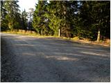
From the highway Ljubljana - Jesenice we go to the exit Vrba and follow the road ahead in the direction of Jesenice. Soon a road to the village Žirovnica branches off to the right. We go on this road and then follow it through the village, after which for a short time it steeply ascends and then at the spot where the asphalt ends brings us to a crossroads. We continue left in the direction of the mountain hut Valvasorjev dom and mountain pasture Potoška planina (straight Završnica). A relatively well maintained road then brings us to a crossroads, where we continue left in the direction of Potoška planina and Valvasorjev dom. At the next crossroads, we continue left on the lower road in the direction of the mountain pasture Potoška planina (right upward Valvasorjev dom). After some time we come to the next crossroads, where Ajdna is left downwards (marked), Potoška planina straight. Here we park on the parking lot by the road.
Route description:
From the parking lot, we go to the left lower path towards Ajdna. After a short descent on the road a signpost leads us left downwards on a cart track. We follow the cart track which is descending to a saddle between the on maps unnamed summit on the left (Mala Ajdna) and Ajdna on the right side. Here we are at the crossing, where we go straight upwards (right easy path). Already after a few meters of ascent we come to fixed safety gear (iron spikes), which lead us on a very steep slope straight upwards. After approximately 10 minutes of ascent on a steep and for slipping dangerous slope the path flattens and then a little below the summit joins the easy path. Here we go left and in a few steps we reach the peak.
I recommend descent on an easy path.
Photos:
 1
1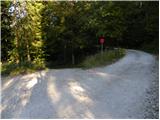 2
2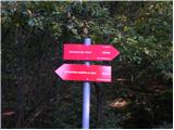 3
3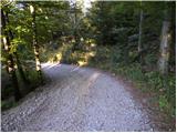 4
4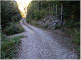 5
5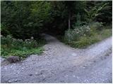 6
6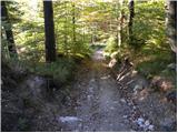 7
7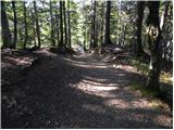 8
8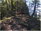 9
9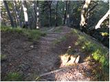 10
10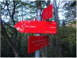 11
11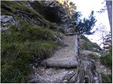 12
12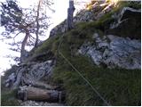 13
13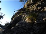 14
14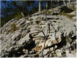 15
15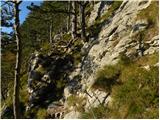 16
16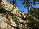 17
17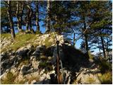 18
18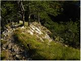 19
19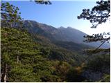 20
20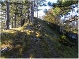 21
21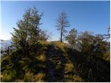 22
22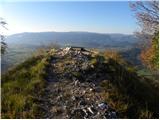 23
23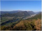 24
24
Discussion about the trip Na Sušeh - Ajdna (climbing way)
|
| Gost31. 10. 2007 |
Short and scenic climbing path. Recommended to all lovers of Slovenian history.
|
|
|
|
| Gost31. 10. 2007 |
The described path is ideal for a Sunday stroll. The easier path also nicely leads us to the right to the archaeological excavations and to the summit. The path was neglected, now it is superbly reworked and renovated. Kudos to whoever put in such great effort and enabled us unique views from Ajdna's summit.
|
|
|
|
| heinz20. 11. 2008 |
Yesterday I climbed this path.
Less than 5 minutes? Probably yes, if you are in a hurry, but you should not on such a more demanding section.
Why not write 10 min., as it is better e.g. to check twice where you placed your foot..
Otherwise pleasant short climbing, just some piton is somewhat loose.
Back I went via the easy path and later from the path observed a couple descending the climbing route. It took nearly half an hour...
|
|
|
|
| Tadej20. 11. 2008 |
Heinz, thanks for the warning. I corrected it to 10 minutes.
|
|
|
|
| dr. gumpi17. 09. 2010 |
The unnamed peak is Mala Ajdna.
|
|
|
|
| enes12. 10. 2010 |
We climbed this section without rope with a small dog up and down without trouble, not that demanding.
|
|
|
|
| heinz12. 10. 2010 |
What ropes? Regarding difficulty: if you're climbing, of course it's demanding. How much? To each their own.. Sure, you can drag a dog almost anywhere, but mine for example.. is quite scared, so I don't torment him too much with rocks.
|
|
|
|
| enes12. 10. 2010 |
you know well enough yourself how capable and skilled you are, I just wrote my experiences on this path... otherwise I recommend the trip, it's worth the view
|
|
|
|
| enes12. 10. 2010 |
does anyone come here to Ajdna to "climb" more often?
|
|
|
|
| JusAvgustin12. 10. 2010 |
What ropes? hahahahahahahahahaha good one heinz!
|
|
|
|
| jprim12. 10. 2010 |
And dear male world - this is normal conversation for you.
|
|
|
|
| JusAvgustin12. 10. 2010 |
yeah where a woman has no business looking...
|
|
|
|
| jprim13. 10. 2010 |
Geolog, where can one search for something  maybe in bed. maybe in bed.
|
|
|
|
| heinz24. 10. 2010 |
To Ajdna you now go along the cable all the way to the top. Praise to PD Radovljica for the work done! Steps, pegs, cables - everything is new. From now on, the descent also presents no special difficulties.
|
|
|
|
| klavdipo11. 12. 2011 |
Is there also a stamp at Ajdna?
|
|
|
|
| pohodnica5312. 12. 2011 |
klavdipo@ I found the logbook at the very top, but no stamp; lp
|
|
|
|
| pohodnica5312. 12. 2011 |
klavdipo@ I found the logbook at the very top, but no stamp; lp
|
|
|
|
| klavdipo15. 12. 2011 |
Pohodnica53@ thanks for the reply!
|
|
|
|
| zavratčan15. 04. 2016 |
WHAT ARE THE CONDITIONS LIKE?
ANY SNOW?
|
|
|
|
| Majdag15. 04. 2016 |
... Ajdna - depends on the direction, towards Potoška over Smolnik there is no snow.
|
|
|
To post a comment you must log in:
If you do not yet have a username, you must first
register.