Podkraj / Unterort - Končnikov vrh (Peca) (Walter Mory Klettersteig)
Starting point: Podkraj / Unterort (650 m)
| Latitude/Longitude: | 46,54260°N 14,77440°E |
| |
Route name: Walter Mory Klettersteig
Walking time: 4 h 5 min
Difficulty: very difficult marked way
Via ferrata: C
Elevation gain: 1459 m
Elevation difference along the route: 1480 m
Map: Koroška 1:50.000
Recommended equipment (summer): helmet, self belay set
Recommended equipment (winter): helmet, self belay set, ice axe, crampons
Views: 8.265
 | 2 people like this post |
Access to starting point:
A) Via the Jezerski vrh border crossing we drive into Austria, then after approximately 6 km past Železna Kapla / Bad Eisenkappel we turn right towards Velikovec / Völkermarkt. We follow the main road towards Velikovec for 2 km, then we turn right again, this time in the direction of the settlement Pliberk / Bleiburg. Further, we drive through the Podjuna valley, then at the next larger intersection we turn right towards Pliberk. The road leads through some roundabouts, and we continue following it in the direction of the ski area Peca / Petzen. Further, we drive through Bistrica pri Pliberku / Feistritz ob Bleiburg to the large parking lot at the lower station of the cable car to Peca. From the Jezerski vrh border crossing to the starting point it is approximately 40 km.
B) From Dravograd or Slovenj Gradec we drive to Ravne na Koroškem, then we continue driving in the direction of the Holmec border crossing. When we enter Austria we first drive towards Pliberk / Bleiburg, then we follow the signs for the ski area Peca / Petzen. Further, we drive through a few villages, and we follow the road to the large parking lot at the lower station of the cable car to Peca. From the Holmec border crossing to the starting point it is approximately 8 km.
Route description:
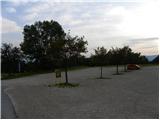
From the parking lot, we first walk to the lower station of the circular cabin cable car that goes to Peca, then we head to the path marked with nos. 3, 7 and 8. The path first leads along a wide cart track, along which we quickly arrive at the ski slope. We continue along the left edge of the ski area, then the path turns slightly to the right and brings us into a dense forest. Here it flattens and joins a cart track, along which we slightly descend to the nearby marked junction.
From the junction we continue along the left ascending road, where the signs for path nos. 3 and 7 also direct us. Just a few minutes higher, the road splits into two parts, where we continue left along path no. 3 (right initially slightly downhill path no. 7, which leads towards Veška planina). About 100 m higher, we join the marked path that comes from the village Rute / Ruttach, so further on we cross a poor forest road several times. Higher up, the road along which we occasionally continue the path for some time finally ends, and we continue between two rocks into the forest. The path ahead steeply ascends through the forest, which on hot days offers pleasant shade. Higher up the forest gradually thins, and nice views open up on Podjuna and the Golica range. A little further on, the trail turns quite to the left and brings us below the steep slopes of Mala Peca, where soon to the left branches the climbing path named Walter Mory Klettersteig.
At the junction we continue left in the direction of the climbing path and then we begin to ascend in zigzags towards the wall where the start of the climbing path is.
Before entering the climbing section of the path, we equip ourselves with a helmet and a self-belay kit.
The climbing path initially ascends traversely across the rocky slope, aided by a steel cable and a few pegs. The path then turns right and ascends a slippery slope, on which there is quite a lot of sand and earth. Follows a slightly less steep traverse to the left and then a steep ascent to the right upwards along a short gully. At the top of the gully the path becomes less demanding for a short time and brings us to a junction.
If the path seemed too demanding to us, we continue left along the easier path, otherwise we can continue right along the harder path. The harder path then after a shorter traverse and ascent over a crumbly slope brings us to the logbook box, which is located before the most demanding part of the path. Here the path ascends almost vertically, aided by numerous pegs. Follows a steep ascent along the steel cable on an indistinct rocky ridge. The climbing path then ends and after a short ascent we reach a viewpoint where there are quite a few benches.
We continue along a wide gentle path, which brings us to a macadam road where there is a marked junction. We continue straight along the steep road to the upper station of the cable car, which we already see ahead.
At the upper station of the cabin cable car where there is a junction, we continue straight following the signs »P12 Kordeschkopf«. Initially we walk along a gentle cart track, then the path turns right and begins to ascend along the ski area upwards. For a short time then the path leaves the ski area left into the forest, then ascends again along the edge of the ski area. When we reach the top of the ski area we continue left and then for some time ascend along the dwarf pines upwards. Later the dwarf pines become somewhat sparser and then follows a short ascent along the grassy slope to the junction on the border ridge (Knipsovo sedlo).
At the junction we continue right (left Kordeževa glava) and quickly ascend to Končnikov vrh.

Photos:
 1
1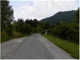 2
2 3
3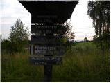 4
4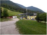 5
5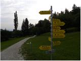 6
6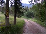 7
7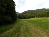 8
8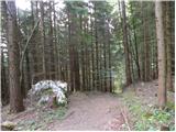 9
9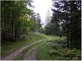 10
10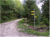 11
11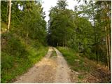 12
12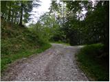 13
13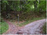 14
14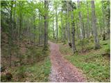 15
15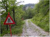 16
16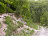 17
17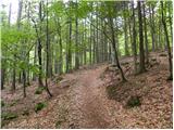 18
18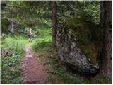 19
19 20
20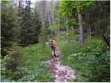 21
21 22
22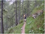 23
23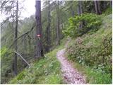 24
24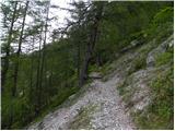 25
25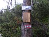 26
26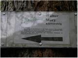 27
27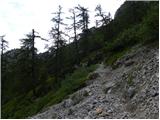 28
28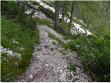 29
29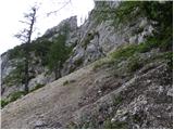 30
30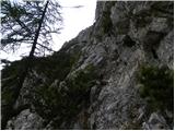 31
31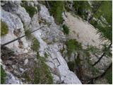 32
32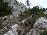 33
33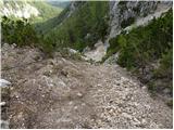 34
34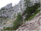 35
35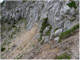 36
36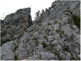 37
37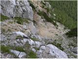 38
38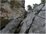 39
39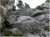 40
40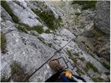 41
41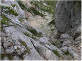 42
42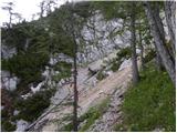 43
43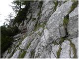 44
44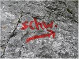 45
45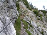 46
46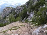 47
47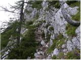 48
48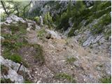 49
49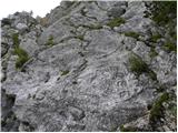 50
50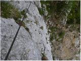 51
51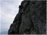 52
52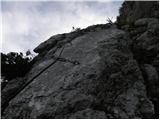 53
53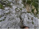 54
54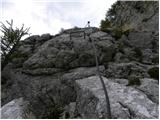 55
55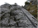 56
56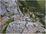 57
57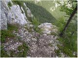 58
58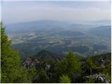 59
59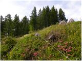 60
60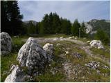 61
61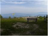 62
62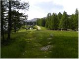 63
63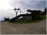 64
64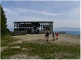 65
65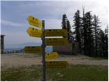 66
66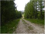 67
67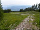 68
68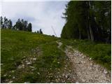 69
69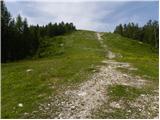 70
70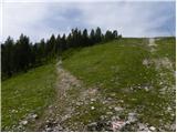 71
71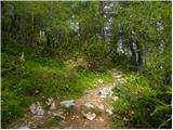 72
72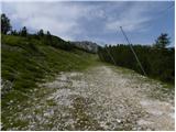 73
73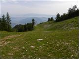 74
74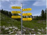 75
75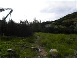 76
76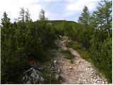 77
77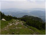 78
78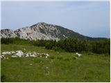 79
79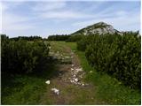 80
80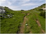 81
81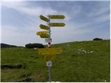 82
82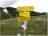 83
83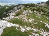 84
84 85
85
Discussion about the trip Podkraj / Unterort - Končnikov vrh (Peca) (Walter Mory Klettersteig)
|
| lepenatka2. 08. 2012 |
Hi, has anyone hiked this trail recently?
I'm interested in the condition of the fixed protection and the trail in general.
|
|
|
|
| katja8715. 07. 2013 |
On Sunday, 14.7.2013, we went via this path over Končnikov vrh to Bistriška špica.
We did a circular tour: Najberž (parking) - Končnikov vrh (via Walter Mory ferrata) - Bistriška špica - Najberž.
The tour took 8 hours. We had great weather and met a large group of Austrian hikers at the summit.
The ferrata itself is really super and I recommend it to all ferrata enthusiasts 
Pictures from the hike can be viewed on the website of the Matica Murska Sobota Mountaineering Association: http://www.mojalbum.com/pdmaticams/20130714-bistriska-spica-walter-mory-ferata/peca/20931627
|
|
|
|
| robson27. 07. 2014 |
Yesterday I did the same circular tour as described by katja87, and it's really beautiful. I completed it in five and a half hours, but mainly because the weather was chasing me...  Probably the weather was also the reason I met only three people on the trail all day... Probably the weather was also the reason I met only three people on the trail all day...
The via ferrata is fun and not overly demanding, but I was surprised at how short it is - you have to climb over 900m just to the start... From there you're quickly at the upper cable car station. Otherwise, the safety gear is in good condition.
|
|
|
To post a comment you must log in:
If you do not yet have a username, you must first
register.