Mokrine / Nassfeld - Creta di Aip / Trogkofel (Via Ferrata Crete Rosse)
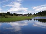
Starting point: Mokrine / Nassfeld (1540 m)
| Latitude/Longitude: | 46,56090°N 13,27580°E |
| |
Route name: Via Ferrata Crete Rosse
Walking time: 4 h 30 min
Difficulty: very difficult marked way
Elevation gain: 739 m
Elevation difference along the route: 810 m
Map: Tabacco 18
Recommended equipment (summer): helmet, self belay set
Recommended equipment (winter): helmet, self belay set, ice axe, crampons
Views: 10.553
 | 1 person like this post |
Access to starting point:
Through the border crossing in Rateče we drive through Trbiž / Tarvisio, Ukve / Ugovizzo to the place Tablja / Pontebba, where we turn right following the signs »Passo di Pramollo / Nassfeld« (Slovenian Mokrine). On the mountain pass, we drive past the lake on the Austrian side, where we park at a large parking lot.
Route description:
From the parking lot on the mountain pass Mokrine / Nassfeld we go on a macadam road following the signs Rosskofel and Trogkofel. After a few hundred meters, we leave the road and blazes lead left on a footpath which runs through meadows and past the artificial lake intended for snowmaking. After that, the path runs through a thin forest and several times crosses a ski slope and numerous streams. We soon come to a crossroad, where signs point us to the left on the path which runs by the ski slope, a little steeper ascends and in 15 minutes brings us to the road at the mountain hut on Tressdorfer Höhe.
At the crossroad, which is approximately a hundred meters from the mountain hut and from where there is a nice view towards our destination Veliki Koritnik / Creta di Aip / Trogkofel, we go on the right road which is descending a little. At the right turn, we leave the road and again go on a footpath. The path through a thin forest is still descending and over numerous streams we come to a crossing, where we go right following the signs Trogkofel (path 413). On a little overgrown path, which runs by streams we get to a smaller mountain pasture and we go left on the path which runs by the ski slope. The path ascends a little steeper and after half an hour of walking across the ski slope we get to the border ridge between Italy and Austria, from where there is a very nice view towards Veliki Koritnik, Konjski Špik / Monte Cavallo / Rosskofel and bivouac Lomasti, to which we have only a few minutes of descent on the Italian side. On the border ridge we go to the right and the path in gentle ascents and descents again brings us to a crossing.
We go left on the path 403 and already after a few minutes of walking, we come to the entrance to the climbing path. The path ahead runs in an almost vertical gully and is secured with a steel cable. On some spots, we also get help from a few pegs. In the upper part a big rock blocks the path, so we have to climb under it. From the rock, on which there is also the logbook we only have a few meters of climbing on pegs and the climbing part of the path is behind us. The path from here ahead is not demanding anymore and soon wonderful views also open up on the Austrian side. When the path from the right from the Austrian side (Uiberlacher Steig), which is a little less demanding, joins us, we have to the top only a few minutes of walking on a gentle footpath.

Photos:
 1
1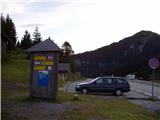 2
2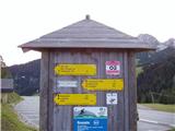 3
3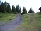 4
4 5
5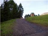 6
6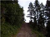 7
7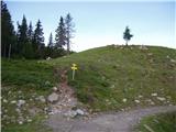 8
8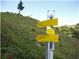 9
9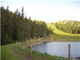 10
10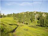 11
11 12
12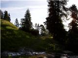 13
13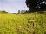 14
14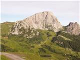 15
15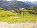 16
16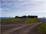 17
17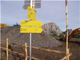 18
18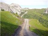 19
19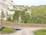 20
20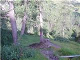 21
21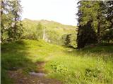 22
22 23
23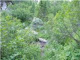 24
24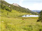 25
25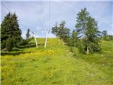 26
26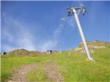 27
27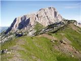 28
28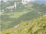 29
29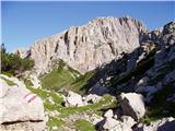 30
30 31
31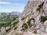 32
32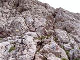 33
33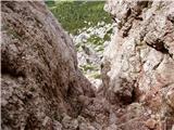 34
34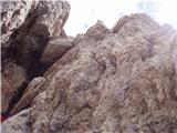 35
35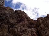 36
36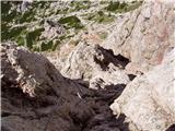 37
37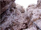 38
38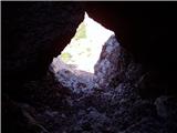 39
39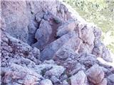 40
40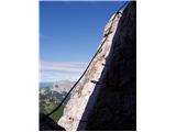 41
41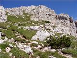 42
42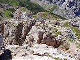 43
43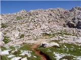 44
44 45
45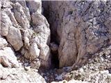 46
46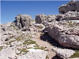 47
47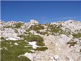 48
48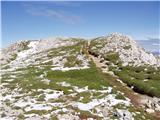 49
49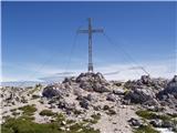 50
50
Discussion about the trip Mokrine / Nassfeld - Creta di Aip / Trogkofel (Via Ferrata Crete Rosse)
|
| trebez18. 11. 2014 |
Excellent tour, however I did it completely
from the Italian side. The views from the top are wonderful over almost the entire Carnic Alps.
The ferrata is not too demanding but a safety harness and of course a helmet are obligatory!
|
|
|
|
| Robie3. 09. 2023 11:16:15 |
Elevation gain on the path is about 1500m, ferrata in good condition, path to the summit a bit harder to follow. For descent I recommend the path - Uiberlacher Steig.
|
|
|
To post a comment you must log in:
If you do not yet have a username, you must first
register.