NC Planica - Zadnja Ponca / Ponza di Detro
Starting point: NC Planica (945 m)
| Latitude/Longitude: | 46,47600°N 13,72410°E |
| |
Walking time: 4 h 50 min
Difficulty: very difficult marked way
Elevation gain: 1297 m
Elevation difference along the route: 1415 m
Map: Julijske Alpe - zahodni del 1:50.000
Recommended equipment (summer): helmet, self belay set
Recommended equipment (winter): helmet, self belay set, ice axe, crampons
Views: 12.724
 | 2 people like this post |
Access to starting point:
a) First we drive to Kranjska Gora, then we continue driving towards Rateče. When we reach the roundabout near Rateče, we take the exit in the direction of Planica. There follows some more ascent and we arrive at the large parking lot next to the Nordic Centre Planica, where we park at the paid parking lot. The price for passenger vehicles is 2.5 euros / day (March 2019).
b) Through the Rateče border crossing we drive into Slovenia, then we turn right soon towards Planica. There follows some more ascent and we arrive at the large parking lot next to the Nordic Centre Planica, where we park at the paid parking lot. The price for passenger vehicles is 2.5 euros / day (March 2019).
Route description:
From Planica we continue along the macadam road towards the Dom v Tamarju, before the road enters the forest it splits into two parts. We continue along the slightly right road in the direction of the footpath towards Tamar (slightly left is the drivable road, which is closed to public traffic).
The path ahead leads us along the road, which passes the last parking lot of NC Planica, enters the forest and which in winter is converted into a cross-country ski trail. This is followed by an ascent along a gentle road that mostly runs through the forest. When the path leaves the forest, there are viewing boards along the path with inscriptions of what can be seen. Higher up, the forest thins out several times or we leave it for a while, so beautiful views open up of the mountains rising above Planica and Tamar. When we get quite close to the Dom v Tamarju a wonderful view of Jalovec opens up, the path splits.
We continue slightly left (slightly right is the spring of the Nadiža) and a few minutes later we join the drivable road, along it past the chapel we arrive at the Planinski dom v Tamarju.
We continue along the marked mountain path in the direction of Jalovec and Ponc (left Slemenova špica). The path ahead leads us through the forest, which quickly brings us to the next crossroads, where the path to Ponce branches off to the right. We continue in the mentioned direction (straight ahead Jalovec and Kotovo sedlo), or follow the signs for Srednja Ponca, Visoka Ponca.
The path ahead brings us out of the forest and begins to ascend to the right of a smaller stream. Higher up the path turns right again and begins to ascend through dwarf pine on a fairly steep slope. The path then turns somewhat left and takes us past a small cave back into the forest through which we ascend for quite some time. After several steep ascents through the forest the path brings us out of the forest and to the first steel cables on the route. Here the path turns right and ascends steeply. The steepness soon eases and a traverse of the slopes towards the north follows. Towards the end the slopes become quite steep and some steel cables help us as well. The path then turns left and begins to ascend somewhat more steeply again all the way to the main ridge of the Ponc. On the ridge we then turn right (left Zadnja Ponca) and only a few meters of ascent remain to the summit of Srednja Ponca.
From the summit of Srednja Ponca we return to the last crossroads and then continue along the ridge following the signs »Bivacco Tarvisio«. The ridge in the continuation becomes narrower and narrower and a descent into Rdeča škrbina follows. At the notch the path turns to the Italian side and after a short exposed traverse ascends almost vertically along a narrow exposed path. The protections on this part of the path are destroyed and unusable so quite a lot of caution is required. The path then traverses steep slopes on the Italian side of the ridge and then ascends towards the ridge. This is followed by a short ascent along a slightly exposed ridge to the summit of Zadnja Ponca.
Planica - Dom v Tamarju 0:45, Dom v Tamarju - Srednja Ponca 3:15, Srednja Ponca - Rdeča škrbina 0:25, Rdeča škrbina - Zadnja Ponca 0:25.

Photos:
 1
1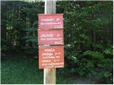 2
2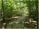 3
3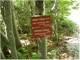 4
4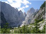 5
5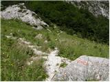 6
6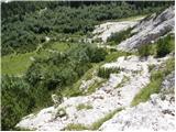 7
7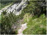 8
8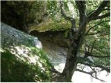 9
9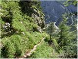 10
10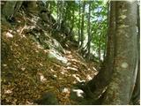 11
11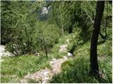 12
12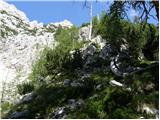 13
13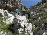 14
14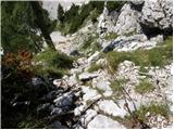 15
15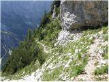 16
16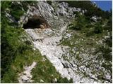 17
17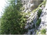 18
18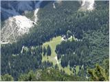 19
19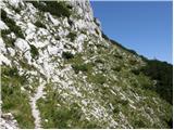 20
20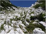 21
21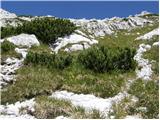 22
22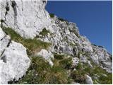 23
23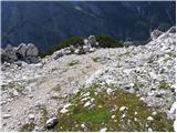 24
24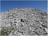 25
25 26
26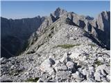 27
27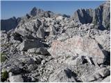 28
28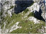 29
29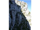 30
30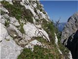 31
31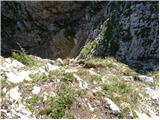 32
32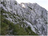 33
33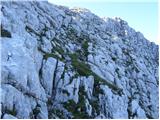 34
34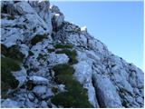 35
35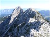 36
36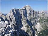 37
37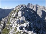 38
38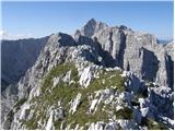 39
39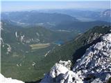 40
40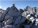 41
41
Discussion about the trip NC Planica - Zadnja Ponca / Ponza di Detro
|
| hike_mare2. 07. 2025 10:45:11 |
I was there on 14.6.. From Srednja Ponca to Rdeča škrbina nothing special, then we reach an exposed section where the safety gear is destroyed. Careful on the crossing of the steep slope, where there is a lot of loose rock.
The path really isn't for those afraid of heights!!!
The views are even better than on Srednja Ponca 
|
|
|
To post a comment you must log in:
If you do not yet have a username, you must first
register.