Obermoos - Wiener Neustädter Hütte
Starting point: Obermoos (1220 m)
| Latitude/Longitude: | 47,42653°N 10,94211°E |
| |
Walking time: 2 h 30 min
Difficulty: partly demanding marked way
Elevation gain: 993 m
Elevation difference along the route: 993 m
Map:
Recommended equipment (summer):
Recommended equipment (winter): ice axe, crampons
Views: 1.664
 | 2 people like this post |
Access to starting point:
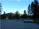
Through the Karawanks Tunnel, we drive to Austria, and then we continue driving towards Spittal and further towards Lienz (a little after Spittal the highway ends). Further, we drive on a relatively nice and wide road through the Drau valley, which brings us into Italy. The road further leads past Dobbiaco / Toblach and Brunico / Bruneck. We continue further on the main road and then join the highway towards Austria (direction Brenner, Innsbruck). In Innsbruck we continue on the highway which runs towards the west along the river Inn (at the highway junction direction Innsbruck-West). We leave the highway at the exit for the Fernpaß pass. We continue driving over the mentioned pass and when the road starts descending we continue right towards the town of Ehrwald (at the turn-off there are also signs for Zugspitze). When we drive through the town of Ehrwald, first the road towards the cableway Ehrwalder Almbahn branches off to the right. At the mentioned crossroad, we continue straight, and then we soon come to a crossroad where we turn right towards the cableway Tiroler Zugspitzbahn. We park on the parking lot at the bottom station of the gondola cableway.
Route description:
From the parking lot, we continue past the bottom station of the cableway following the signs »Zugspitze / Wiener Neustädter Hütte«. At the beginning, the path turns a little to the right and then we go left onto a cart track which runs by the forest on a grassy slope. For some time we ascend like this, and then we come to a junction where signposts direct us left into the dwarf pines. On the path through the dwarf pines there is more and more torrent sand and soon a sign on the rock directs us slightly to the right onto a somewhat nicer path on grassy terrain. From the path we have a nice view of the mountains west of the town of Ehrwald, and the view of the nearby precipitous walls of the peak Schneefernerkopf becomes increasingly beautiful.
The path then soon brings us onto scree and starts to ascend somewhat more steeply. Further on, the path turns a little to the left and for a short time ascends again on a somewhat more vegetated slope. Higher up we come again onto scree, on which we ascend in zigzags for some time. To the left from the path we will here also notice some structures of the old cableway.
Further on, the path brings us to the slopes below the cableway where there is also a marked junction. At the junction we continue straight ahead, while to the left downward leads the path to Lake Eibsee. The path, which is occasionally secured with a steel cable, then crosses somewhat steeper northern slopes. Later the path turns right and only a short ascent to the hut Wiener Neustädter Hütte follows.

Photos:
 1
1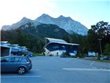 2
2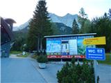 3
3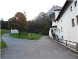 4
4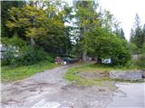 5
5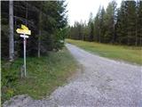 6
6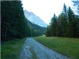 7
7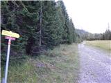 8
8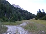 9
9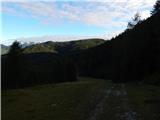 10
10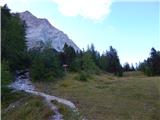 11
11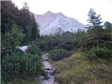 12
12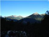 13
13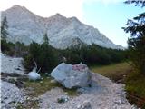 14
14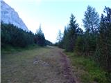 15
15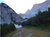 16
16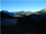 17
17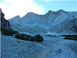 18
18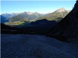 19
19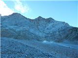 20
20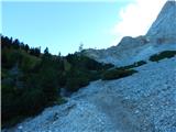 21
21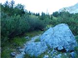 22
22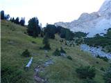 23
23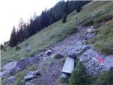 24
24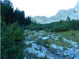 25
25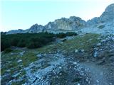 26
26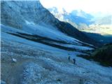 27
27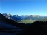 28
28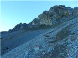 29
29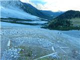 30
30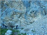 31
31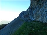 32
32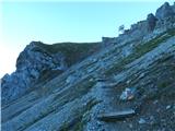 33
33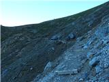 34
34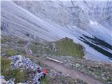 35
35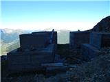 36
36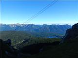 37
37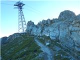 38
38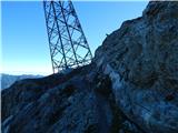 39
39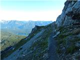 40
40 41
41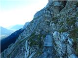 42
42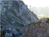 43
43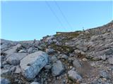 44
44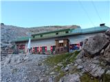 45
45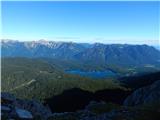 46
46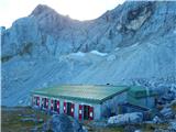 47
47
Discussion about the trip Obermoos - Wiener Neustädter Hütte
To post a comment you must log in:
If you do not yet have a username, you must first
register.