Obermoos - Zugspitze (Stopselziehersteig)
Starting point: Obermoos (1220 m)
| Latitude/Longitude: | 47,42653°N 10,94211°E |
| |
Route name: Stopselziehersteig
Walking time: 5 h
Difficulty: very difficult marked way
Via ferrata: A/B
Elevation gain: 1742 m
Elevation difference along the route: 1750 m
Map:
Recommended equipment (summer): helmet, self belay set
Recommended equipment (winter): helmet, self belay set, ice axe, crampons
Views: 11.613
 | 3 people like this post |
Access to starting point:
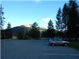
Through the Karawanks Tunnel, we drive into Austria, then continue driving towards Spittal and further towards Lienz (somewhat after Spittal the motorway ends). Further, we drive on a relatively nice and wide road through the Drava Valley, which brings us into Italy. The road further leads past Dobbiaco / Toblach and Brunico / Bruneck. We continue on the main road and then join the motorway towards Austria (direction Brenner, Innsbruck). In Innsbruck, we continue on the motorway which runs west along the river Inn (at the motorway junction direction Innsbruck-West). We leave the motorway at the exit for the Fernpaß pass. We continue driving over the mentioned pass and when the road starts descending, we continue right towards Ehrwald (at the exit there are also signs for Zugspitze). When driving through Ehrwald, first the road towards the Ehrwalder Almbahn cableway branches off to the right. At the mentioned junction, we continue straight ahead, then soon come to a junction where we turn right towards the Tiroler Zugspitzbahn cableway. We park on the parking lot at the lower station of the gondola cableway.
Route description:
From the parking lot, we continue past the lower station of the cableway following the signs »Zugspitze / Wiener Neustädter Hütte«. At the beginning, the path turns slightly to the right, then we head left onto a cart track that runs along the forest on a grassy slope. For some time we ascend like this, then we come to a junction where the signposts direct us left into the dwarf pines. On the path through the dwarf pines there is increasingly more torrent debris and soon a sign on the rock directs us slightly right onto a somewhat nicer path on grassy terrain. From the path we have a nice view of the mountains west of Ehrwald, and the view of the nearby precipitous walls of the peak Schneefernerkopf becomes increasingly beautiful.
The path then soon brings us to scree and starts to ascend somewhat more steeply. Further on, the path turns slightly left and for a short time ascends again on a somewhat more vegetated slope. Higher up, we reach scree again, on which we ascend in zigzags for some time. To the left from the path we will also notice some remnants of the old cableway here.
Further, the path brings us to the slopes below the cableway where there is also a marked junction. At the junction, we continue straight ahead, while to the left downward leads the path to Lake Eibsee. The path, occasionally secured with a steel cable, then crosses somewhat steeper northern slopes. Later, the path turns right and only a short ascent follows to the hut Wiener Neustädter Hütte.
At the hut, we continue left towards the east and then ascend on scree that brings us to the entry into the secured section of the path.
The secured path first ascends moderately along the steel cable, then follows an ascent through a natural tunnel. Further on, the path steeply ascends for some time with the aid of numerous brackets. Higher up, the slope becomes somewhat less steep but mostly still secured with a steel cable. In between there are also some unsecured sections, which are not overly demanding. Such a path then continues all the way to the ridge, alongside which there is also the abandoned structure of the old gondola cableway. At the ridge where there is a junction, a slightly easier path from the Zugspitze ski area joins us from the right. The ski area is otherwise connected to the summit by a gondola cableway, and a train also runs to the ski area.
At the junction, we continue left and then ascend on a well-maintained secured path along the ridge. From the path, which runs on the eastern side of the ridge, we have a nice view of the ski area and the nearby peaks above it all the time. For some time we ascend along the ridge, then follows an ascent on steps to the upper stations of the gondola cableways.
If we want to go to the summit where the cross stands, we continue on the German side past the hut Münchener Haus and head onto a short secured path towards the summit. Here the path first descends slightly, then ascends on a ladder to the ridge where more demanding secured paths from the German side join. Only a short ascent along the ridge to the summit follows, from which a view opens towards the glacier Höllentalferner and the ridge towards the summit Alpspitze.

Photos:
 1
1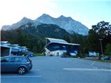 2
2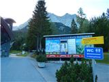 3
3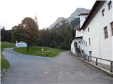 4
4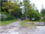 5
5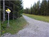 6
6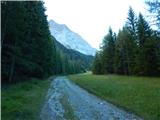 7
7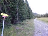 8
8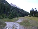 9
9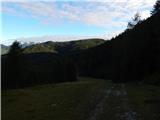 10
10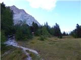 11
11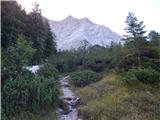 12
12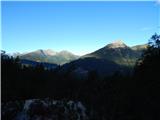 13
13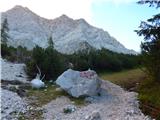 14
14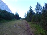 15
15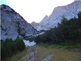 16
16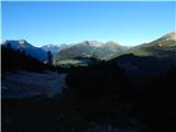 17
17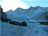 18
18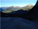 19
19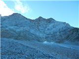 20
20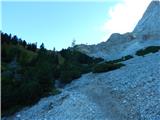 21
21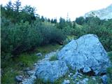 22
22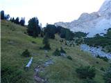 23
23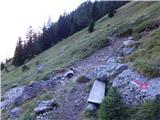 24
24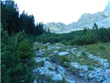 25
25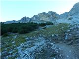 26
26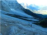 27
27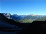 28
28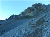 29
29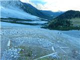 30
30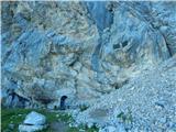 31
31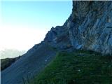 32
32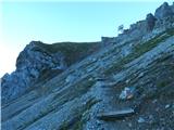 33
33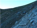 34
34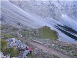 35
35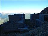 36
36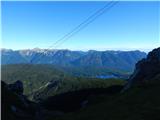 37
37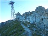 38
38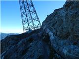 39
39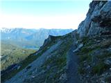 40
40 41
41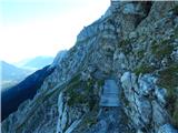 42
42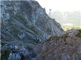 43
43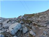 44
44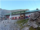 45
45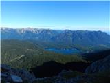 46
46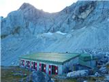 47
47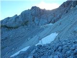 48
48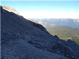 49
49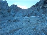 50
50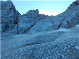 51
51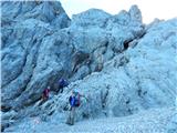 52
52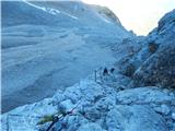 53
53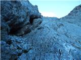 54
54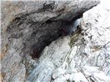 55
55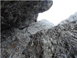 56
56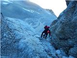 57
57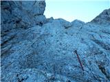 58
58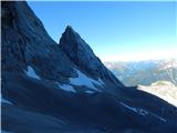 59
59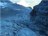 60
60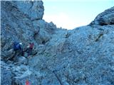 61
61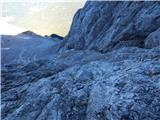 62
62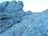 63
63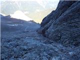 64
64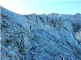 65
65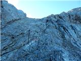 66
66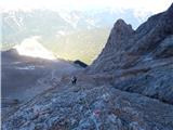 67
67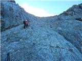 68
68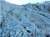 69
69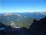 70
70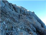 71
71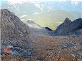 72
72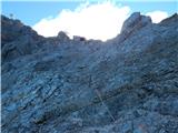 73
73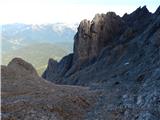 74
74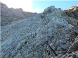 75
75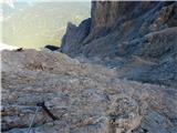 76
76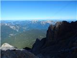 77
77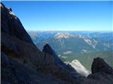 78
78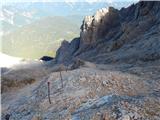 79
79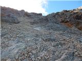 80
80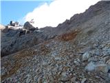 81
81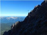 82
82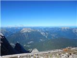 83
83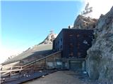 84
84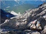 85
85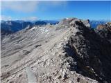 86
86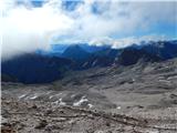 87
87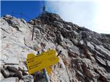 88
88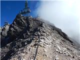 89
89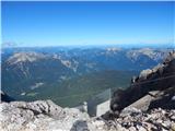 90
90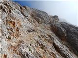 91
91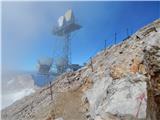 92
92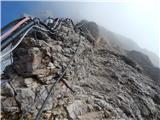 93
93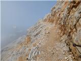 94
94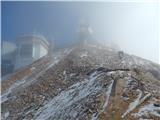 95
95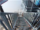 96
96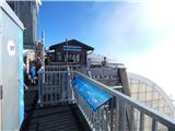 97
97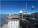 98
98 99
99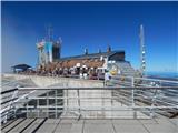 100
100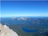 101
101 102
102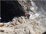 103
103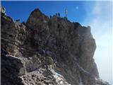 104
104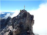 105
105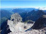 106
106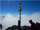 107
107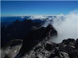 108
108 109
109
Discussion about the trip Obermoos - Zugspitze (Stopselziehersteig)
|
| VanSims12. 09. 2013 |
The path is well described, the pictures are clear, I would only correct the path name: "Stopselziehersteig".
Did the path as part of this year's holiday. It's 'very demanding' but technically I think it belongs to the lower class of such paths, the exposure isn't that extreme either. But it shouldn't be underestimated in terms of fitness, it's a serious mountaineering achievement on the level of say Triglav.
Descent possible by cable car to the Tyrolean side if we left the car there. There should also be some hiking path but I'm not exactly sure where it goes, as far as I remember it doesn't lead directly to the lower station.
More experienced can of course combine with some more demanding paths (Höllentalsteig - through beautiful gorge) or the extremely demanding Jubileumsgrat (D, -III), which leads to the neighboring Alpenspitz.
|
|
|
|
| Rok12. 09. 2013 |
I corrected it to Stopselziehersteig.
Otherwise I was on Zugspitze on 3.9.2013. I descended via the path you mention. This path is a bit easier but somewhat longer. From the top I first went down to the ski area and then to the hut Knorrhütte. From there towards the town Ehrwald. A bit below the summit of Zugspitze there's a sign "Ehrwald - übers Gatterl - 6h".
Down you arrive at the parking lot by the Ehrwalder Almbahn cable car. Back to the car is then about an hour and a half walk.
|
|
|
|
| cvetonmk6. 08. 2021 12:00:31 |
I went from Eibsee to the summit, past Wiener Neustädter Hütte. The path is physically demanding as you do 2000 m elevation gain. The path joins the one from Ehrwald just before Wiener Neustädter Hütte and continues along the path described above.
|
|
|
To post a comment you must log in:
If you do not yet have a username, you must first
register.