Olimje - Sveti Andrej above Olimje
Starting point: Olimje (264 m)
| Latitude/Longitude: | 46,14960°N 15,56280°E |
| |
Walking time: 15 min
Difficulty: easy marked way
Elevation gain: 87 m
Elevation difference along the route: 87 m
Map: Posavsko hribovje Boč - Bohor 1:50.000
Recommended equipment (summer):
Recommended equipment (winter):
Views: 3.036
 | 2 people like this post |
Access to starting point:
Starting point is definitely Podčetrtek, today in the Slovenian area already an important tourist/excursion destination, excellently accessible from several directions...
a) From the direction of Celje or Maribor, in the settlement Mestinje we head towards Podčetrtek. Through Pristava pri Mestinju and Sodna vas we soon reach Podčetrtek, where at the roundabout we follow the signs for Olimje. After three or four kilometers we reach the settlement Olimje and safely park next to the church/monastery complex.
b) From the direction of Brežice or Bistrica ob Sotli we reach Podčetrtek, where at the roundabout we follow the signs for Olimje. After three or four kilometers we reach the settlement Olimje and safely park next to the church/monastery complex.
Route description:
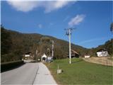
From the center of the settlement Olimje we continue left upwards along the monastery complex on an asphalt connection and follow the signs for Sv. Andrej. Somewhere after a hundred meters the path or road turns left, straight ahead is Koča pri čarovnicah. We continue and after a good hundred meters we reach another junction. We continue right steeply upwards, left is the entrance to Jelenov greben. The path upwards or rather the road winds steeply along the fence of Jelenov greben and this is also the southern area of Rudnica. Along the path there is also the Olimje water reservoir. Soon continuing, after a few turns left, right... we reach the end of the path, the church of Sv. Andrej above Olimje.
The length of the path is around 800 meters, 90 positive elevation meters and zero negative elevation meters. The path for the description was completed on 12.10.2014.
Photos:
 1
1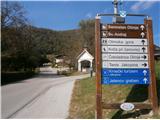 2
2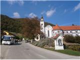 3
3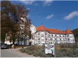 4
4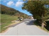 5
5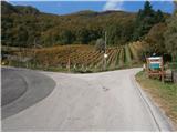 6
6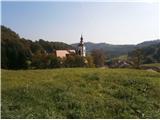 7
7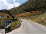 8
8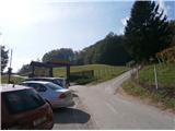 9
9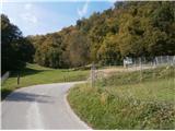 10
10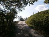 11
11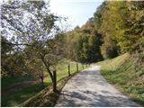 12
12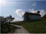 13
13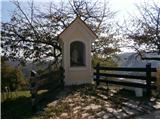 14
14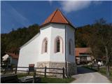 15
15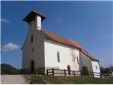 16
16
Discussion about the trip Olimje - Sveti Andrej above Olimje
|
| bruny16. 10. 2014 |
Yes, Olimje with the immediate surroundings is interesting. The path is orientationally undemanding. Up to and including picture no. 9 it is of course also quite touristy. Further on and higher up somewhat less visited and impresses mainly with the Mediterranean flair of the subsidiary church. The question is whether with its construction they wanted to please the Aquileian church or secular lords centuries ago, perhaps the builders were from there or maybe returnees, local boys from Mediterranean battlefields who built such a bell tower in thanks for safe return, as a memorial, reminder... Who would know, it is not important today. Pleasant, somewhat calm spot certainly today in this quite tourist-recognizable area of Kozjansko.
GPS track:Sv. Andrej nad Olimjem from the center of Olimje settlement,12.10.2014. Nice regards
|
|
|
To post a comment you must log in:
If you do not yet have a username, you must first
register.