Olševek - Štefanja gora (via Apnišče)
Starting point: Olševek (471 m)
| Latitude/Longitude: | 46,27910°N 14,44230°E |
| |
Route name: via Apnišče
Walking time: 1 h 15 min
Difficulty: easy unmarked way
Elevation gain: 277 m
Elevation difference along the route: 335 m
Map:
Recommended equipment (summer):
Recommended equipment (winter):
Views: 2.371
 | 1 person like this post |
Access to starting point:
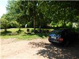
A) From the highway Ljubljana - Jesenice, we take the Brnik exit. When we reach the road Mengeš - Kranj, we continue left towards Kranj. On the main road towards Kranj, we drive to the first roundabout, from where we take the first exit right in the direction of Šenčur. Through Šenčur, we continue on the main road, then, when we reach the road Kranj - Zgornje Jezersko, we continue right in the direction of Jezersko. In the settlement Hotemaže, we leave the main road and continue driving straight (right from the main road) in the direction of the settlement Olševek. When we arrive in Olševek, we first follow the main road, from the crossroad of several roads we continue left onto the road in the direction of the sports club. Before the children's playground and sports field, we continue slightly left and then park behind the NOB memorial.
B) First, we drive to Kranj, then we continue driving in the direction of Zgornje Jezersko. In the settlement Hotemaže, we leave the main road and continue driving straight (right from the main road) in the direction of the settlement Olševek. When we arrive in Olševek, we first follow the main road, from the crossroad of several roads we continue left onto the road in the direction of the sports club. Before the children's playground and sports field, we continue slightly left and then park behind the NOB memorial.
C) b) From the highway Jesenice - Ljubljana, we take the exit Kranj west, then we continue driving towards Kokrica, later Britof. Still in Kokrica, at the unmarked intersection with the priority road, we continue left, then when we arrive in Britof, we follow the signs for Zgornje Jezersko. In the settlement Hotemaže, we leave the main road and continue driving straight (right from the main road) in the direction of the settlement Olševek. When we arrive in Olševek, we first follow the main road, from the crossroad of several roads we continue left onto the road in the direction of the sports club. Before the children's playground and sports field, we continue slightly left and then park behind the NOB memorial.
Route description:
From the starting point, we continue on the road alongside which we parked, alongside which the educational trail Olševek initially runs, so along the path we notice some educational panels. The educational trail turns left at the next crossroad, but we continue on the lower road, which continues straight ahead, from which the blazes soon direct us left into the forest. We continue the ascent through dense forest, where the path partly leads us along forest cart tracks, partly along forest footpaths; at junctions we follow the blazes. Higher up, the path brings us to a wider cart track, which we follow to the right, from which some views open up temporarily. After the panoramic section, the cart track ascends steeply for a while, then we join the marked path from Adergas.
We continue left, where the path leads past the "šterna", then a little further ahead the path levels out on a small saddle, where there is a junction with signposts for Olševek, Adergas and Možjanca.
We continue along the left cart track (the far-right path leads to the church of St. Stefan on Štefanja gora), from which we soon turn left onto a well-trodden but unmarked footpath. A little further, the path brings us from the forest onto a meadow, from which a nice view opens towards Kalški greben and Krvavec. When the path returns to the forest, only a short ascent follows, and the path brings us to the top of Apnišče.
From the top, we continue straight along the path, which begins to descend towards the saddle between Apnišče and Štefanja gora. Initially, we descend through the forest, then temporarily across a panoramic meadow, then again through the forest. Once in the forest, we join a cart track, which we follow to the right, and after a few more steps we arrive at a marked junction.
From the junction, we continue slightly right onto the path, which none of the nearby signs indicate (slightly left to the settlement Štefanja Gora, sharply right to Olševek and Adergas), and it begins to ascend.
Ahead, the path ascends moderately along an indistinct ridge, from which it almost imperceptibly transitions to a fairly gentle slope. A little further, the path forks, and we choose the right path (the straight path leads past the farm tourism and is slightly longer), along which after a few minutes of further walking we ascend to the church of St. Stefan on the top of Štefanja gora.
Description and pictures refer to the condition in 2017 (May).

Photos:
 1
1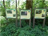 2
2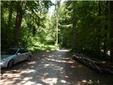 3
3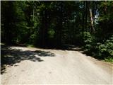 4
4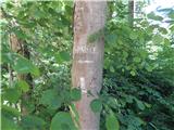 5
5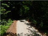 6
6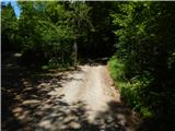 7
7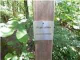 8
8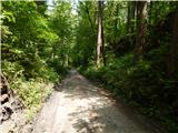 9
9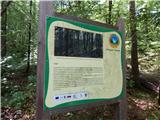 10
10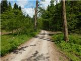 11
11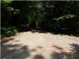 12
12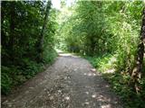 13
13 14
14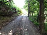 15
15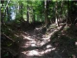 16
16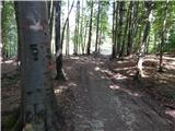 17
17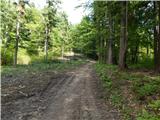 18
18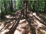 19
19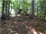 20
20 21
21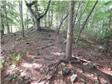 22
22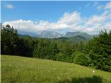 23
23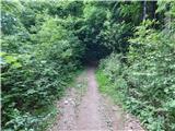 24
24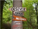 25
25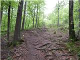 26
26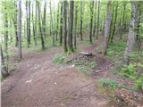 27
27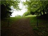 28
28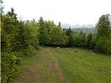 29
29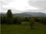 30
30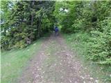 31
31 32
32
Discussion about the trip Olševek - Štefanja gora (via Apnišče)
|
| baloncek0518. 04. 2021 06:43:56 |
 top path...nicely marked top path...nicely marked
|
|
|
|
| ŠIMETA21. 04. 2021 11:35:58 |
Hello,
I would like to point out that the path description does not match the pictures. The first part of the path follows as published in the description Olševek-Apnišče (western path), the description from the top onwards is correct
|
|
|
To post a comment you must log in:
If you do not yet have a username, you must first
register.