Panoramska restavracija Oben - Feistritzer Spitze
Starting point: Panoramska restavracija Oben (1708 m)
| Latitude/Longitude: | 46,54260°N 14,77440°E |
| |
Walking time: 2 h 5 min
Difficulty: easy marked way
Elevation gain: 405 m
Elevation difference along the route: 515 m
Map: Koroška 1:50.000
Recommended equipment (summer):
Recommended equipment (winter): ice axe, crampons
Views: 6.492
 | 1 person like this post |
Access to starting point:
A) Via the Jezerski vrh border crossing we drive into Austria, then after approximately 6 km past Železno Kaplo / Bad Eisenkappel we turn right towards Velikovec / Völkermarkt. We follow the main road towards Velikovec for 2 km, then we turn right again, this time in the direction of Pliberk / Bleiburg. Further on, we drive through the Podjuna valley, then at the next major intersection we turn right towards Pliberk. The road leads through some roundabouts, and we continue following it in the direction of the Peca / Petzen ski area. Further on, we drive through Bistrica pri Pliberku / Feistritz ob Bleiburg to the large parking lot at the lower station of the cable car to Peca. From the parking lot we walk to the lower station of the circular cabin cable car, buy a ticket there and take the cable car to its upper station. From the Jezerski vrh border crossing to the starting point it is approximately 40 km.
B) From Dravograd or Slovenj Gradec we drive to Ravne na Koroškem, then continue driving towards the Holmec border crossing. Once in Austria we first drive towards Pliberk / Bleiburg, then follow the signs for the Peca / Petzen ski area. Further on, we drive through a few villages, following the road to the large parking lot at the lower station of the cable car to Peca. From the parking lot we walk to the lower station of the circular cabin cable car, buy a ticket there and take the cable car to its upper station. From the Holmec border crossing to the starting point it is approximately 8 km.
Route description:
From the upper station of the cable car we continue following the signs »P12 Kordeschkopf«. At first we walk on a gentle cart track, then the path turns right and starts ascending alongside the ski slope upwards. For a short time the path leaves the ski slope to the left into the forest, then ascends again along the edge of the ski slope. When we reach the top of the ski slope we continue left and then ascend for some time alongside the dwarf pines. Later the dwarf pines become somewhat sparser and then follows a short ascent on the grassy slope to a junction on the border ridge (near Knipsovo sedlo).
At the junction we continue right (left to Kordeževa glava) and quickly ascend to Končnikov vrh.
From Končnikov vrh a short descent follows on a grassy path, then we cross again to the purely Austrian side of the mountain. There follow some shorter ascents and descents and a panoramic path from which beautiful views open up onto Raduha and the central Kamniško Savinjske Alpe, bringing us to Bistriška špica.

Photos:
 1
1 2
2 3
3 4
4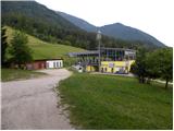 5
5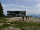 6
6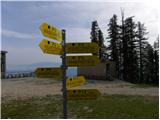 7
7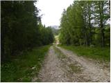 8
8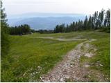 9
9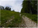 10
10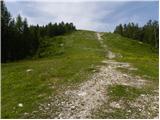 11
11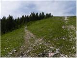 12
12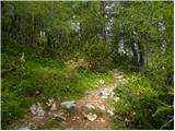 13
13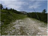 14
14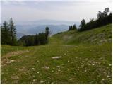 15
15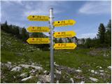 16
16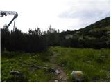 17
17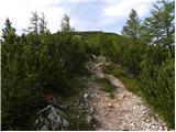 18
18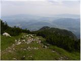 19
19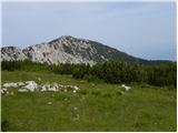 20
20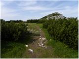 21
21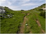 22
22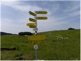 23
23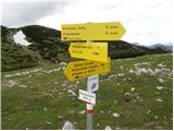 24
24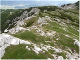 25
25 26
26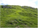 27
27 28
28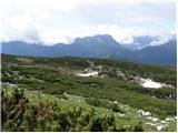 29
29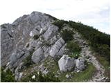 30
30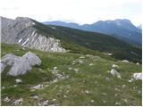 31
31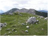 32
32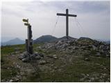 33
33 34
34
Discussion about the trip Panoramska restavracija Oben - Feistritzer Spitze
|
| klavdipo27. 08. 2011 |
Is there a stamp at Bistriška špica too?
|
|
|
To post a comment you must log in:
If you do not yet have a username, you must first
register.