Partizanski dom Kope - Grmovškov dom pod Veliko Kopo
Starting point: Partizanski dom Kope (1445 m)
| Latitude/Longitude: | 46,51376°N 15,18291°E |
| |
Walking time: 50 min
Difficulty: easy marked way
Elevation gain: -74 m
Elevation difference along the route: 100 m
Map: Pohorje 1:50.000
Recommended equipment (summer):
Recommended equipment (winter): ice axe, crampons
Views: 440
 | 1 person like this post |
Access to starting point:
We drive to Slovenj Gradec, then follow the signs to Kope. We continue ascending towards the Kope ski resort for quite some time, then turn left towards the Kaštivnik ski slope and Partizanski dom Kope. A traverse to the left follows, and we follow the road to the parking lot in front of Partizanski dom Kope.
Route description:
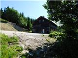
From the parking lot, we walk to the other side of Partizanski dom Kope, then turn right onto the gravel road, which forks immediately.
We continue along the right road, which leads past holiday homes. The path then enters the forest and ascends moderately. Upon leaving the forest, we reach a gravel road and continue along it without major elevation changes, or descend slightly temporarily.
At the pass below Velika Kopa, the marked path to Grmovškov dom turns slightly right and ascends traversely along the right side of Velika Kope; it does not lead to the summit itself, but the summit is only a few minutes from the path. From the highest point of the path, we begin to descend gradually, accompanied by educational trail signs along the way. Lower down, the path runs along the ski slope, and we follow the markers at several junctions.
At the Pungart saddle, where Gostilna pri Zajcu also stands, we go right and we are at Grmovškov dom pod Veliko Kopo.
Photos:
 1
1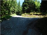 2
2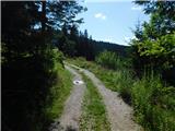 3
3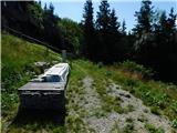 4
4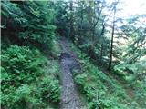 5
5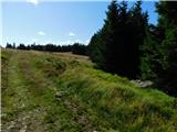 6
6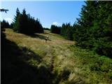 7
7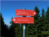 8
8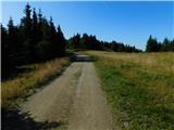 9
9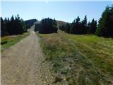 10
10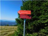 11
11 12
12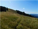 13
13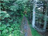 14
14 15
15 16
16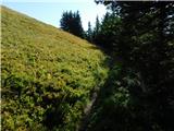 17
17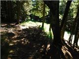 18
18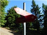 19
19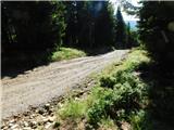 20
20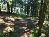 21
21 22
22 23
23 24
24
Discussion about the trip Partizanski dom Kope - Grmovškov dom pod Veliko Kopo
|
| felix13. 11. 2025 11:46:33 |
Unfortunately, only the name remains of Grmovšek's hut. I was there about 3 weeks ago to have a coffee or tea, everything was open, but no living soul anywhere. Where are the times when this hut was still a mountaineer's hut, now it's just business during the ski season.
|
|
|
|
| bbugari114. 11. 2025 14:13:50 |
I wrote about this on 22.7.2019 under the topic about crossing Pohorje... 
|
|
|
To post a comment you must log in:
If you do not yet have a username, you must first
register.