Passo Campolongo - Rifugio Punta Trieste
Starting point: Passo Campolongo (1860 m)
| Latitude/Longitude: | 46,51930°N 11,87393°E |
| |
Walking time: 1 h 10 min
Difficulty: easy unmarked way
Elevation gain: 168 m
Elevation difference along the route: 240 m
Map: Tabacco 07 1:25.000
Recommended equipment (summer):
Recommended equipment (winter):
Views: 399
 | 3 people like this post |
Access to starting point:
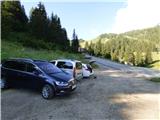
Through the Karawanks Tunnel, we drive to Austria, and then we continue driving towards Spittal and further towards Lienz (a little after Spittal the highway ends). Further, we drive on a relatively nice and wide road through the Drau Valley, which brings us to Italy. The road further leads past Dobbiaco / Toblach and Brunico / Bruneck. Only a little after the last-mentioned town, past which a bypass runs, we turn left into the Val Badia valley. Further, we drive through the mentioned valley past the places La Vila and Corvara. Next follows an ascent towards the pass Passo Campolongo. A few hundred meters before the pass, we will notice on the left side a macadam parking lot on which we park. The parking lot is located behind the hotel Laguscei opposite the bus station. By the road is also the lower station of the chairlift. A smaller parking lot is also on the right side of the road before the bus station.
Route description:
From the parking lot at the hotel Laguscei we ascend on a cart track which runs right below the cableway and after some tens of meters we get to a marked junction.
We go left on a worse cart track, where signs for »Inzija, Pralongia« direct us. To the right leads the cart track towards the summit Cherz. Our path then crosses the ski slope to the left side of the cableway and the cart track quickly turns into a footpath. The path then brings us into the forest and left downwards a path branches off towards the parking lot Planac and further towards the place Corvara. We continue straight and the path quickly brings us out of the forest onto the ski slope. Here the path for a short time steeply ascends on the ski slope and then from the ski slope turns to the left and again passes into the forest. Further, the path runs through the forest from which occasionally views open up towards the mountain group Puez. Such a path soon brings us to a junction, where from the right joins another slightly longer path from the pass Passo Campolongo.
At the junction we continue left and then through the forest we cross slopes mostly towards the east. The path then brings us out of the forest onto a clearing or ski slope where there is a bench and another junction.
Left downwards leads another path towards the place Corvara, to the right leads the path towards the summit Cherz, and we continue straight ahead and follow the signs »Inzija, Pralongia«. A gently sloping path, which occasionally also descends slightly, continues through the forest towards the east. Here we will also notice quite a few benches and springs along the path. When we come out of the forest then only a short descent follows and the path brings us to the saddle Passo Incisa, where we join the macadam road. Here on the left side there is also a nicely maintained mountain hut La Marmotta.
Signposts for the mountain hut Rifugio Punta Trieste direct us ahead on the macadam road. But we do not continue on the road but head for a somewhat shorter but unmarked path. At the hut Rifugio La Marmotta we first go behind the hut past the playground and head for a poorly visible path along the ski slope. Here we ascend right on the ski slope upwards parallel to the mountain bike downhill track. The downhill track then turns somewhat to the right, and we continue on the ski slope with beautiful views mainly on the mountain group Sella. Somewhat higher we then join the cart track.
Only a short ascent follows on the cart track to the hut, which we already see in front of us.

Along the route: Passo Incisa (1938m), Rifugio La Marmotta (1938m)
Photos:
 1
1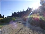 2
2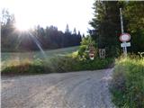 3
3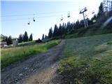 4
4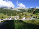 5
5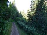 6
6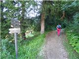 7
7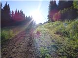 8
8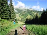 9
9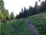 10
10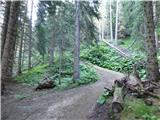 11
11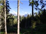 12
12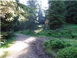 13
13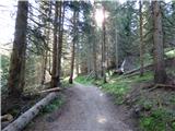 14
14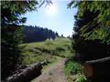 15
15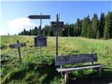 16
16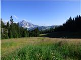 17
17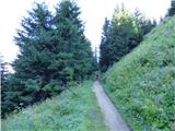 18
18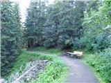 19
19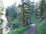 20
20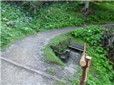 21
21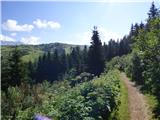 22
22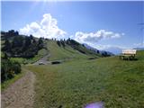 23
23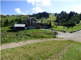 24
24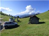 25
25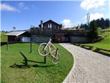 26
26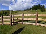 27
27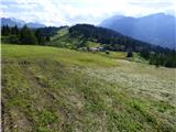 28
28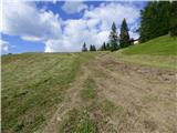 29
29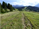 30
30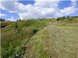 31
31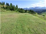 32
32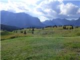 33
33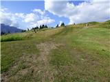 34
34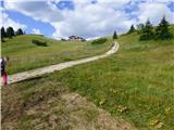 35
35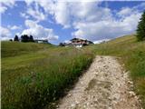 36
36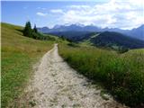 37
37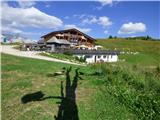 38
38 39
39 40
40
Discussion about the trip Passo Campolongo - Rifugio Punta Trieste
To post a comment you must log in:
If you do not yet have a username, you must first
register.