Passo Falzarego - Lagazuoi Piccolo (normal way)
Starting point: Passo Falzarego (2105 m)
| Latitude/Longitude: | 46,51950°N 12,00850°E |
| |
Route name: normal way
Walking time: 2 h 15 min
Difficulty: easy marked way
Elevation gain: 673 m
Elevation difference along the route: 673 m
Map: Tabacco 03 1:25.000
Recommended equipment (summer): helmet
Recommended equipment (winter): helmet, ice axe, crampons
Views: 11.635
 | 2 people like this post |
Access to starting point:
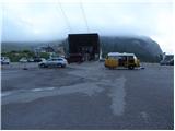
First, we drive to Cortina d'Ampezzo (you can get here via the border crossing at Rateče or Predel to Trbiž / Tarvisio and then on the highway in the direction of Vidma / Udine to the Tolmezzo exit. From Tolmezzo, we follow the road in the direction of the village Ampezzo and the mountain pass Passo della Mauria. The road then descends and brings us to an intersection, where we continue left (also possible right) in the direction of Cortina d'Ampezzo. At all following intersections, we follow the signs for Cortina d'Ampezzo. Or from the Primorska side, where we drive on the highway in the direction of Trst / Trieste. Further, we drive on the Italian highway in the direction of Padova, but only to the highway junction, where we continue in the direction of the region Veneto and Belluno. Near Belluno, the highway ends, and at the next intersections we continue in the direction of Cortina d'Ampezzo and then follow the signs for the alpine pass Passo di Falzarego. We then follow this ascending road to the large parking lot on the mentioned pass.
Route description:
Just a few dozen meters away from the parking lot at the lower station of the cable car on Lagazuoi Piccolo, we will notice signs for the Lagazuoi gallery. The path initially leads along a gravel road closed to traffic and in poor condition (road for ski area needs), which after a short ascent brings us to the point where the signs for the gallery direct us slightly left. We continue the ascent on a wide mountain path that ascends parallel to the road we just left. The moderately steep path then brings us from the belt of dwarf pines onto the scree slopes, from which beautiful views open up, mainly towards the south. The well-maintained path brings us, after less than an hour of walking, to a junction, where we continue right on the normal mountain path (left is the path through the gallery).
The path ahead crosses the slopes below the steep walls of Lagazuoi Piccolo (danger of falling rocks) and somewhat further, across a torrent gully, passes onto the scree between the aforementioned peak and the neighboring summit named Cima Falzarego. Here the path turns slightly left and ascends a moderately steep slope to the panoramic saddle Forcella Travenanzes, where there is a junction.
We continue left in the direction of the Lagazuoi hut on a slightly ascending path that crosses steep slopes protected against avalanches. A short descent follows, and the path brings us to the next saddle Forcella Lagazuoi, where we continue straight uphill (right are paths 20a and 20b). The path ahead begins to ascend moderately in zigzags on a relatively steep slope, along which we notice numerous remains from the First World War. Higher up, the path brings us to the upper cable car station and just a few meters beyond to the Lagazuoi mountain hut.
From the hut, we continue on a well-trodden path that along the summit ridge soon brings us to the spacious and panoramic summit.

Photos:
 1
1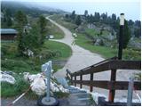 2
2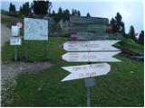 3
3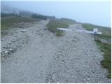 4
4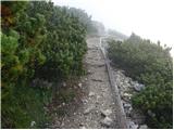 5
5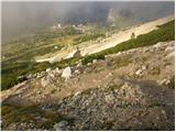 6
6 7
7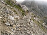 8
8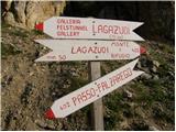 9
9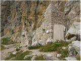 10
10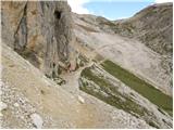 11
11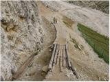 12
12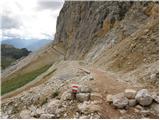 13
13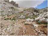 14
14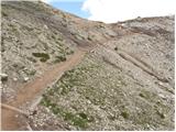 15
15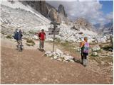 16
16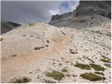 17
17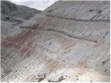 18
18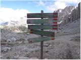 19
19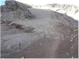 20
20 21
21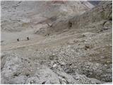 22
22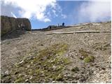 23
23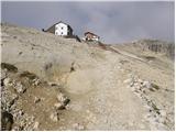 24
24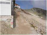 25
25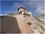 26
26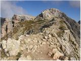 27
27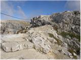 28
28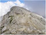 29
29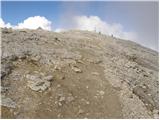 30
30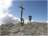 31
31
Discussion about the trip Passo Falzarego - Lagazuoi Piccolo (normal way)
|
| mirank22. 05. 2022 07:39:54 |
I recommend ascent through the gallery-cavern, definitely not down there, as the wet high steps and rocks are slippery for descent. For descent, instead of the tourist trail from the top, use the old military path of the imperial hunters (kaiserjager Weg). This path is somewhat more demanding but also interesting, as it runs along the precipitous south wall, but is well secured with cables. After a short traverse under the wall to the left, it brings us exactly back to the starting point.
|
|
|
To post a comment you must log in:
If you do not yet have a username, you must first
register.