Passo Falzarego - Punta Fanes Sud (Via Ferrata Tomaselli)
Starting point: Passo Falzarego (2105 m)
| Latitude/Longitude: | 46,51950°N 12,00850°E |
| |
Route name: Via Ferrata Tomaselli
Walking time: 4 h
Difficulty: extremely difficult marked way
Via ferrata: D
Elevation gain: 875 m
Elevation difference along the route: 975 m
Map: Tabacco 03 1:25.000
Recommended equipment (summer): helmet, self belay set
Recommended equipment (winter): helmet, self belay set, ice axe, crampons
Views: 8.951
 | 2 people like this post |
Access to starting point:
First, we drive to Cortina d'Ampezzo (you can get here via the border crossing at Rateče or Predel to Trbiž / Tarvisio and then on the highway in the direction of Vidma / Udine to the exit Tolmezzo. From Tolmezzo we follow the road in the direction of the village Ampezzo and mountain pass Passo della Mauria. The road then descends and brings us to a crossroad, where we continue left (possible also right) in the direction of Cortina d'Ampezzo. At all next crossroads, we follow the signs for Cortina d'Ampezzo.
Or from the Primorska side, where we drive on the highway in the direction of Trst / Trieste. Further, we drive on the Italian highway in the direction of Padova, but only to the highway junction, where we continue in the direction of the region Veneto and Belluno. Near Belluno the highway ends, and at the next crossroads we continue in the direction of Cortina d'Ampezzo and then we follow the signs for the alpine pass Passo di Falzarego. We then follow this ascending road to the large parking lot on the mentioned pass.
To Cortina d'Ampezzo we can also come from the direction of Austria (direction Karawanks Tunnel, Spittal, Lienz, Sillian, Dobbiacho / Toblach, Cortina d'Ampezzo, Passo Falzarego).
Route description:
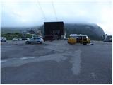
Just a few dozen meters away from the parking lot at the bottom station of the cable car on Lagazuoi Piccolo we will notice signs for the Lagazuoi gallery. The path first leads along a worse, traffic-closed macadam road (road for ski slope needs), which after a short ascent brings us to the spot where the signs for the gallery direct us slightly left. We continue the ascent on a wide mountain path that ascends parallel to the road we just left. The moderately steep path then brings us from the dwarf pine belt to the scree fields, from which beautiful views open up mainly towards the south. The well-maintained path then brings us after less than an hour of walking to a junction, where we continue right on the normal mountain path (left the path through the gallery).
The path further crosses slopes below the steep walls of Lagazuoi Piccolo (danger of falling rocks) and somewhat further across a torrent gully passes to the scree fields between the mentioned peak and the neighboring peak named Cima Falzarego. Here the path turns somewhat to the left and ascends on a moderately steep slope to the panoramic saddle forcella Travenanzes, where there is a junction.
We continue straight in the direction of "bivacco della Chiesa" on the path that crosses scree fields on the right (eastern) side of the Lagazuoi Grande ridge. After a few minutes of crossing, the path brings us below the walls of the mentioned ridge (danger of falling rocks) and then ascends to a smaller pass, where we notice numerous underground tunnels. We continue further in the direction of bivouac Chiesa on the path that occasionally ascends somewhat more. The increasingly panoramic traverse path then brings us higher to the saddle forcella Grande, from which with a few descent steps we reach bivouac Chiesa.
From the bivouac we follow the signs »Via Ferrata Tomaselli« and already after a few dozen meters we enter the southwest wall of the peak Punta Fanes Sud (2980 m). In the initial part we ascend steeply along the cable upwards. Above us we will notice old wooden ladders that are still here from the times of the First World War. The path runs somewhat left of the ladders and begins to cross the vertical wall to the left. Here it is also necessary to have some arm strength since there are not many footholds at the crossing. After a short crossing, the path ascends again along the cable almost vertically upwards all the way to the narrow ledge along which we continue left. Follows a somewhat less steep but unsecured ascent right upwards, which brings us to yet another ledge on which we continue left again. The ledge becomes narrower and the cable also helps us. From the ledge we then continue almost vertically upwards again. On the next narrow ledge we continue right. This time considerable caution is needed since the narrow ledge that crosses the precipitous slopes towards the south is not secured. When the view towards the south opens up for us, the path turns left along the cable steeply upwards. In the continuation, the path becomes even steeper and ascends vertically several times, on a short section it is even slightly overhanging. In the last part, the path brings us for a moment to a narrow precipitous ridge from which a wonderful view opens up towards the south. We continue left and a steep ascent follows on the smooth rocky slope, which brings us to the less demanding summit part of the mountain. On the ridge we continue left and only a few meters of ascent to the very panoramic summit remain.
The Via Ferrata Tomaselli path on Punta Fanes Sud is extremely demanding and is suitable only for the most experienced mountaineers with sufficient arm strength and mandatory self-belaying. The described path is indeed one of the most demanding secured paths in the entire Dolomites.
We descend along the secured path to the northeast side. Although this path is somewhat easier than the ascent path, it is still an extremely demanding path that is not to be underestimated. From the summit we first descend steeply downwards along the cable. The path then slowly turns towards the south and continues to descend steeply. A vertical descent follows with the help of a few pegs, after which the path soon brings us to the notch Forcella dei Quaire below the summit Travenanzes. From the notch we continue towards the south and descend down the gully. During the descent through the gully we take care not to dislodge rocks. After the descent through the gully we then join path 20b a little below the notch Forcella Granda.
If we continue right across the notch, we have about 10 minutes of walking to bivouac Chiesa. Left downwards, however, we can descend across the notch Forcella Travenanzes to the Falzarego pass.

Photos:
 1
1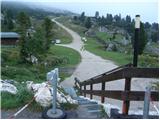 2
2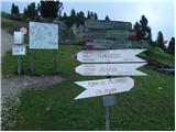 3
3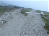 4
4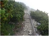 5
5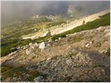 6
6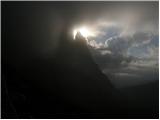 7
7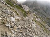 8
8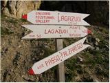 9
9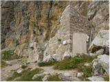 10
10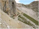 11
11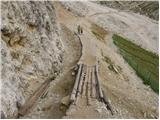 12
12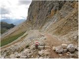 13
13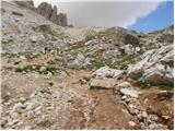 14
14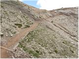 15
15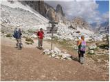 16
16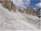 17
17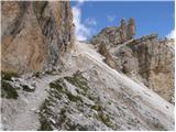 18
18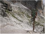 19
19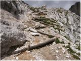 20
20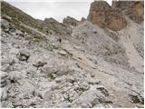 21
21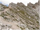 22
22 23
23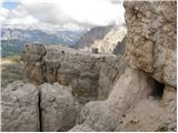 24
24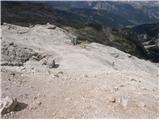 25
25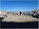 26
26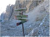 27
27 28
28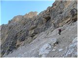 29
29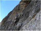 30
30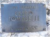 31
31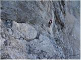 32
32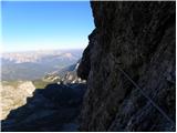 33
33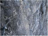 34
34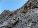 35
35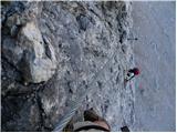 36
36 37
37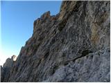 38
38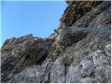 39
39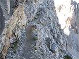 40
40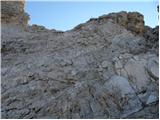 41
41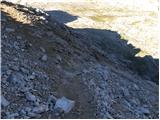 42
42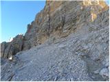 43
43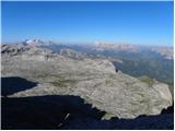 44
44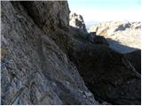 45
45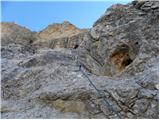 46
46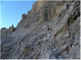 47
47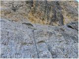 48
48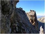 49
49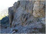 50
50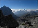 51
51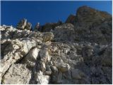 52
52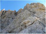 53
53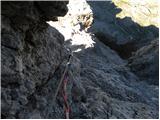 54
54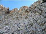 55
55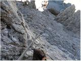 56
56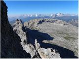 57
57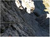 58
58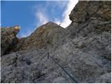 59
59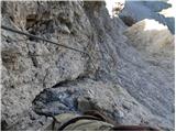 60
60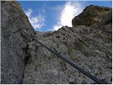 61
61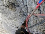 62
62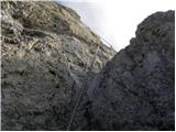 63
63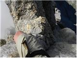 64
64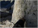 65
65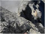 66
66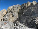 67
67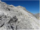 68
68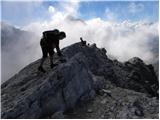 69
69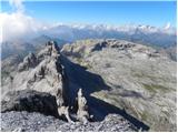 70
70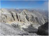 71
71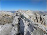 72
72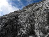 73
73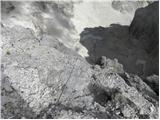 74
74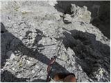 75
75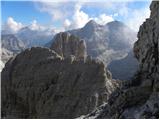 76
76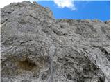 77
77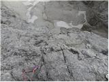 78
78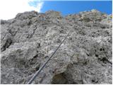 79
79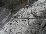 80
80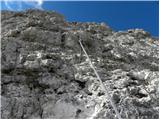 81
81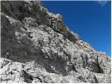 82
82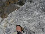 83
83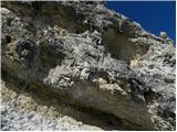 84
84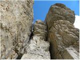 85
85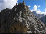 86
86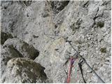 87
87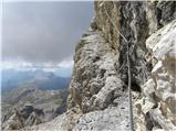 88
88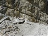 89
89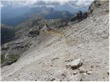 90
90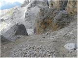 91
91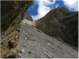 92
92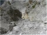 93
93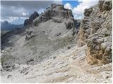 94
94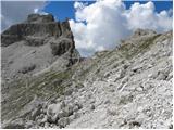 95
95
Discussion about the trip Passo Falzarego - Punta Fanes Sud (Via Ferrata Tomaselli)
|
| bpatrik30. 12. 2010 |
My most demanding ferrata so far. But the views are absolutely insane, beautiful like in a fairy tale. Be well physically and mentally prepared!
|
|
|
|
| andrejp1. 09. 2015 |
nice ferrata, which we did on Wednesday. The only thing we did differently from the description, we went first through the gallery (1100m long tunnel - high steps) to the top of the gondola and then descended to the described path towards the ferrata. And you'll search for the bivouac in vain, because it has been removed.
|
|
|
To post a comment you must log in:
If you do not yet have a username, you must first
register.