Passo Staulanza - Monte Pelmo
Starting point: Passo Staulanza (1766 m)
| Latitude/Longitude: | 46,42060°N 12,10467°E |
| |
Walking time: 6 h 30 min
Difficulty: very difficult unmarked way
Elevation gain: 1402 m
Elevation difference along the route: 1530 m
Map: Tabacco 15 1:25.000
Recommended equipment (summer): helmet
Recommended equipment (winter): helmet, ice axe, crampons
Views: 7.396
 | 2 people like this post |
Access to starting point:
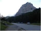
Via the Rateče border crossing we drive to Trbiž / Tarvisio, where we take the highway in the direction of Videm / Udine. We leave the highway at the Tolmezzo exit and follow the road to the mentioned settlement. From Tolmezzo we continue in the direction of the settlement Ampezzo and mountain pass Passo della Mauria. The road then starts descending and brings us into the Cadore valley, where we continue left towards Cortina d'Ampezzo. Further, we follow the signs for Cortina d'Ampezzo to the settlement Venas di Cadore. A little before the end of the mentioned settlement we turn left towards the settlement Forno di Zoldo. The road then via the Cibiana pass brings us into the Val di Zoldo valley, where we continue right towards the Staulanza pass. We then follow the ascending road all the way to the Staulanza pass.
Route description:
On the pass Passo Staulanza we head southeast following the signs »Rif. Venezia, Orme di Dinosauro«. After a short ascent through the forest we come to a junction, where we continue right, while left leads the path that runs along the northern side of Monte Pelmo towards the Forada notch.
The path further continues through the forest and crosses the slopes on the west side of Monte Pelmo. The path here slightly ascends and descends, and occasionally runs over swampy terrain and is often quite muddy. From the right, the path from the Pala Favera camp joins us, and we continue crossing the slopes towards the southeast. Further on, the path mostly runs through dwarf pines and brings us to a marked junction.
Left upwards leads the path below the walls of the Pelmetto summit, where dinosaur tracks are visible on a larger boulder; we continue straight ahead following the signs for Rifugio Venezia. From the right, another path from Pala Favera joins us, then our path slowly turns left and brings us to the southern slopes below the Monte Pelmo summit. In the last part towards the hut, the path brings us to grassy slopes and soon we will see the hut ahead. A little before the hut there is a junction, where the path to Monte Pena branches off to the right. From the junction, only a short ascent to the hut follows.
At the hut we continue left along the marked path following the signs »Monte Pelmo, Via Normale«. Initially we ascend briefly through dwarf pines, then follows an ascent over scree that brings us below the east walls of the Spalla Est summit.
Here the marked path turns right, and we head left towards Ballo's ledge. The entry into the wall is marked with the inscription »Attacco«. From here on, the path becomes very demanding and is suitable only for experienced mountaineers. Less experienced ones will necessarily need additional belaying with a rope. The path further is no longer marked with official blazes. Nevertheless, orientation is not overly difficult as the path is marked with numerous cairns. After a short easier climb we reach the aforementioned Ballo's ledge. The ledge is relatively long and crossing it will take us about one hour. The ledge is mostly very exposed, so concentration is required throughout the crossing. There are also a few short more difficult spots on the ledge where some climbing is needed. The most difficult part is in the last section of the ledge, where we must cross a very narrow passage called Passo del Gatto (cat's passage). Usually a rope is fixed over this section, which somewhat eases the crossing.
The ledge soon ends and brings us into the cirque between the summits Spalla Sud and Spalla Est. At the end of the ledge we continue sharply right and after a short ascent we reach the scree. Further on we ascend on the scree for quite some time, all the while accompanied by wonderful views of the walls of the aforementioned Spalla Sud and Spalla Est. Higher up the path becomes steeper and ascends the rocky slope via a few ledges. Here at some points very easy climbing is required. Such a path then brings us to gentler slopes from which a view opens towards the Monte Pelmo summit. Here the path turns left towards the west and then ascends towards the ridge between the summits Spalla Sud and Monte Pelmo. On this section there may also be some snowfields on the path, which are relatively gentle and cause no problems. Not so long ago there was also a glacier here.
When we reach the ridge, which drops off steeply to the west, a view opens up towards Monte Civetta and the nearby Pelmetto. We continue right along the ridge and the path becomes slightly more demanding again. At some points light climbing is needed, and occasionally the ridge is somewhat exposed. In the final part the ridge turns right and only a short ascent follows to the very panoramic summit.

Photos:
 1
1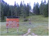 2
2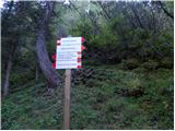 3
3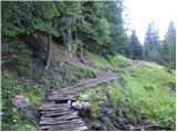 4
4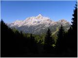 5
5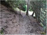 6
6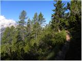 7
7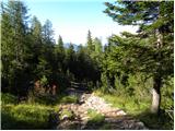 8
8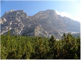 9
9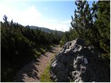 10
10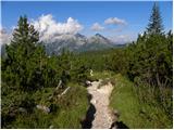 11
11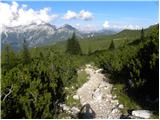 12
12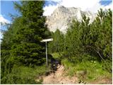 13
13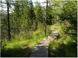 14
14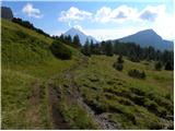 15
15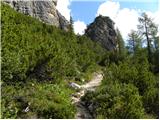 16
16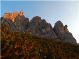 17
17 18
18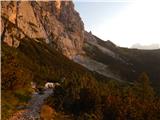 19
19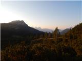 20
20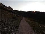 21
21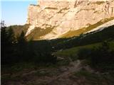 22
22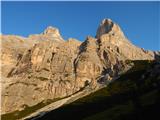 23
23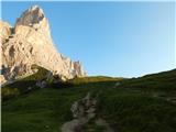 24
24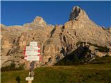 25
25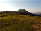 26
26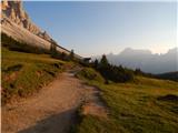 27
27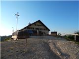 28
28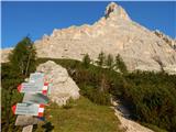 29
29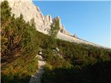 30
30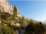 31
31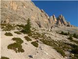 32
32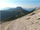 33
33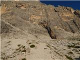 34
34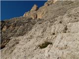 35
35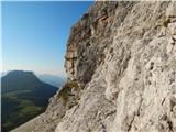 36
36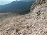 37
37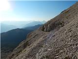 38
38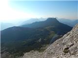 39
39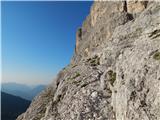 40
40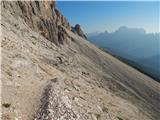 41
41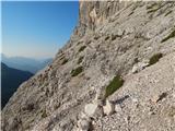 42
42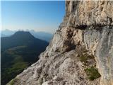 43
43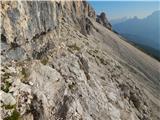 44
44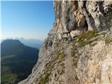 45
45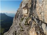 46
46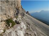 47
47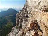 48
48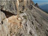 49
49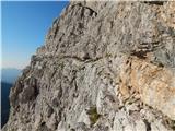 50
50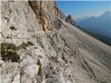 51
51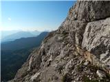 52
52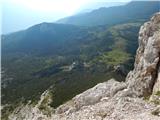 53
53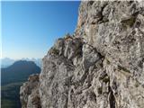 54
54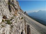 55
55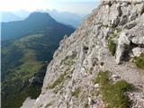 56
56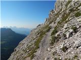 57
57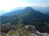 58
58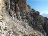 59
59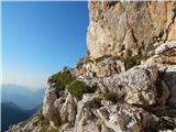 60
60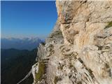 61
61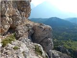 62
62 63
63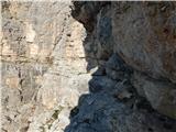 64
64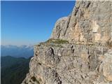 65
65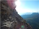 66
66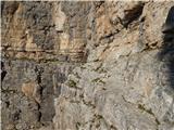 67
67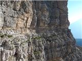 68
68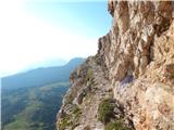 69
69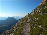 70
70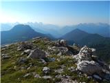 71
71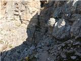 72
72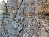 73
73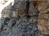 74
74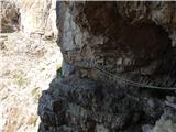 75
75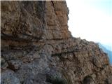 76
76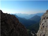 77
77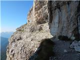 78
78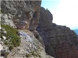 79
79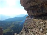 80
80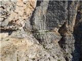 81
81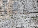 82
82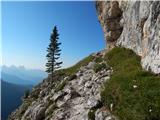 83
83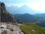 84
84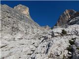 85
85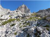 86
86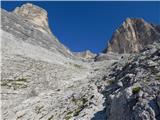 87
87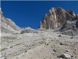 88
88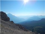 89
89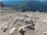 90
90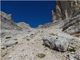 91
91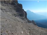 92
92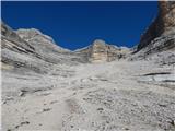 93
93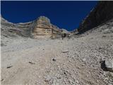 94
94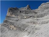 95
95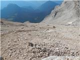 96
96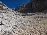 97
97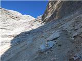 98
98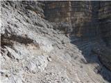 99
99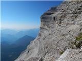 100
100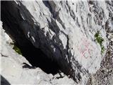 101
101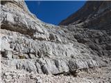 102
102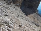 103
103 104
104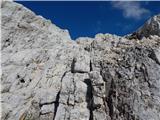 105
105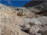 106
106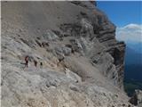 107
107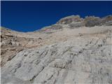 108
108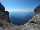 109
109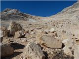 110
110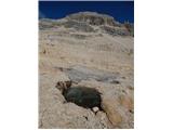 111
111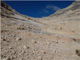 112
112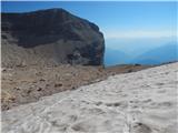 113
113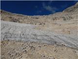 114
114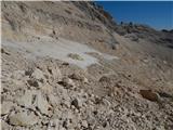 115
115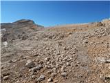 116
116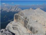 117
117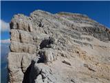 118
118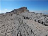 119
119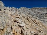 120
120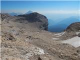 121
121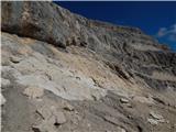 122
122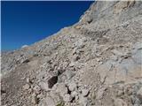 123
123 124
124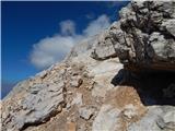 125
125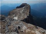 126
126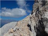 127
127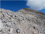 128
128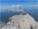 129
129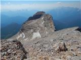 130
130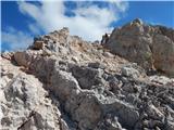 131
131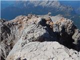 132
132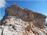 133
133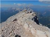 134
134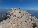 135
135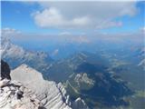 136
136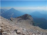 137
137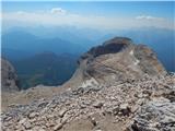 138
138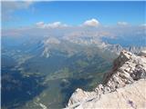 139
139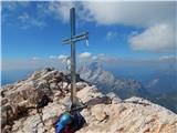 140
140
Discussion about the trip Passo Staulanza - Monte Pelmo
|
| VanSims7. 09. 2020 |
The shortest access to Rifugio Venezia is from Malga Ciauta. We drive to Vodo di Cadore and from there follow the signs for Rifugio Venezia and park at the parking lot on the alpine pasture, with Antelao right across the valley in front of our nose 
I, being of a more moderate pace, took just over an hour to reach Rifugio Venezia.
Ball's ledge is of course not suitable for those afraid of heights, but otherwise (except for the approach to it) no excessive climbing is required, just experience with exposed paths and a clear head. I could compare it to some sections of Mira Debelak's path along the Kanjavec ledges. Whoever managed that will also handle Ball's ledge) as it seemed to me (except for the 'Cat's crossing') almost easier.
Just below the summit, one must climb a short (1-2 m) grade II pitch, which with the proper approach (slightly to the right) poses no problems, but descending it is somewhat psychologically demanding due to the proximity of the abyss. 
|
|
|
To post a comment you must log in:
If you do not yet have a username, you must first
register.