Passo Valparola - Lagazuoi Piccolo
Starting point: Passo Valparola (2131 m)
| Latitude/Longitude: | 46,53420°N 11,98960°E |
| |
Walking time: 2 h 45 min
Difficulty: easy marked way
Elevation gain: 647 m
Elevation difference along the route: 700 m
Map: Tabacco 03 1:25.000
Recommended equipment (summer):
Recommended equipment (winter): ice axe, crampons
Views: 4.715
 | 2 people like this post |
Access to starting point:
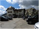
First, we drive to Cortina d'Ampezzo (you can get there via the border crossing Rateče or Predel to Trbiž / Tarvisio and then on the highway in the direction of Vidma / Udine to the exit Tolmezzo. From Tolmezzo we follow the road in the direction of the settlement Ampezzo and mountain pass Passo della Mauria. The road then descends and brings us to a junction, where we continue left (also possible right) in the direction of Cortina d'Ampezzo. At all following junctions, we follow the signs for Cortina d'Ampezzo. Or from the Primorska side, where we drive on the highway in the direction of Trst / Trieste. Further, we drive on the Italian highway in the direction of Padova, but only to the highway junction, where we continue in the direction of the region Veneto and Belluno. Near Belluno the highway ends, and at the following junctions we continue in the direction of Cortina d'Ampezzo and then follow the signs for the alpine pass Passo di Falzarego. We then follow this ascending road to the mentioned pass, and then continue right towards the pass Passo Valparola. From the pass Passo Valparola we then descend to the first left bend where the old road branches off to the right, which is closed to traffic. Here there is also a smaller parking lot where we park.
Route description:
From the parking lot, we continue on the old road following the signs for path 20a and start slightly descending. Soon we come to signposts which direct us from the road to the right upwards. Further, in gentle ascents and descents we cross the slopes towards the north. Such a path, which runs mostly along sparse dwarf pines, then brings us to a marked junction. We continue straight on path 20a following the signs »Salares – Lagazuoi«, while left the path leads downwards towards the settlement San Ciascian. Along the path we will also notice a sign marking the entrance to the nature park Fanes Sennes Braies. The path then starts to ascend in zig-zags up the steep slope all the way to the notch Forcella de Salares.
At the notch where there is a junction, we continue right on path 20a following the signs Lagazuoi. Further on, we ascend gently for a long time towards the southeast below the slopes of the peak Spinarac (2532 m). Soon beautiful views also open up towards the east where the ridge Cresta di Fanes stands out. The path continues towards the southeast and leaves the nature park Fanes Sennes Braies and later brings us to a marked junction.
Left the path leads towards bivouac Chiesa, while we continue straight following the signs »Rif. Lagazuoi« and start ascending towards the notch Forcella Lagazuoi. At the notch we then continue right in the direction of hut Lagazuoi. Ahead, the path starts to ascend moderately in zig-zags on a relatively steep slope along which we notice numerous remains from the First World War. Higher up the path brings us to the upper station of the cable car and just a few meters behind it to the mountain hut Lagazuoi.
From the hut we continue on a well-trodden path which along the summit ridge soon brings us to a spacious and panoramic summit.

Photos:
 1
1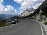 2
2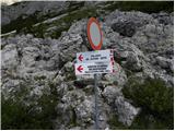 3
3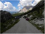 4
4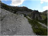 5
5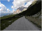 6
6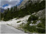 7
7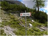 8
8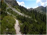 9
9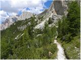 10
10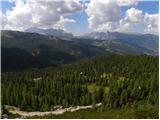 11
11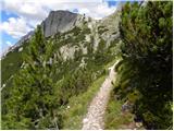 12
12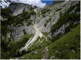 13
13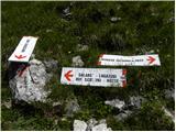 14
14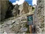 15
15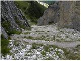 16
16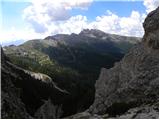 17
17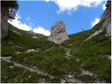 18
18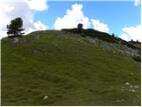 19
19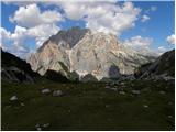 20
20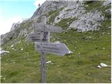 21
21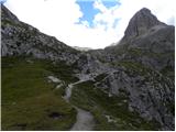 22
22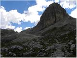 23
23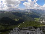 24
24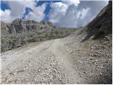 25
25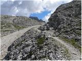 26
26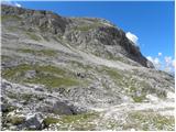 27
27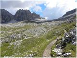 28
28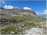 29
29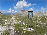 30
30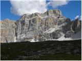 31
31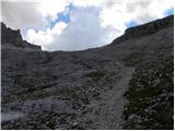 32
32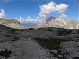 33
33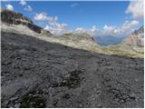 34
34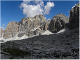 35
35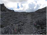 36
36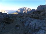 37
37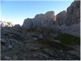 38
38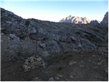 39
39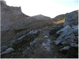 40
40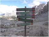 41
41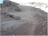 42
42 43
43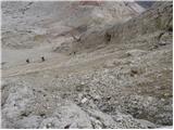 44
44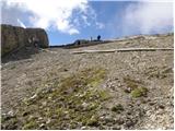 45
45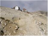 46
46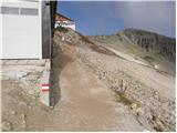 47
47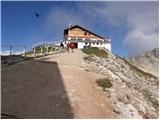 48
48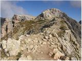 49
49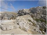 50
50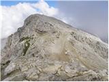 51
51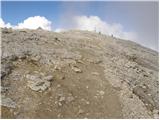 52
52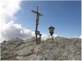 53
53
Discussion about the trip Passo Valparola - Lagazuoi Piccolo
|
| chazhmy23. 08. 2018 |
A few days ago I hiked the path in the opposite direction. There were quite a few people at the summit, but no excessive crowds, as the path is wide (there was even someone with a wheelchair at the top). From Forcella Lagazuoi to Forcella de Salares the path is really enjoyable, fairly uncrowded and very well marked.
If someone wants to extend the hike, from F. de Salares (or F. Lagazuoi if going in the opposite direction) past Rif. Scotoni hut and Lagazuoi lake, which adds another approx. 200 elevation meters.
|
|
|
|
| Robie30. 06. 2025 08:50:05 |
I recommend the "ferrata" Kaiserjager for ascent and return through the gallery. This way you avoid the crowds and partly the heat.
|
|
|
|
| mirank30. 06. 2025 11:34:11 |
Well, I strongly recommend ascent through the gallery and descent via the Kaiserjager path, which is not so demanding. It is a nicely secured path, and if you start early enough, due to the southwest exposure there will also be some shade. Descending the gallery with a helmet over those half-meter smoothed steps is no pleasure, especially with a crowd pushing towards you. Recommend starting the tour no later than 8am.
|
|
|
To post a comment you must log in:
If you do not yet have a username, you must first
register.