Pico do Areeiro - Pico Ruivo (Vereda do Areeiro)
Starting point: Pico do Areeiro (1817 m)
| Latitude/Longitude: | 32,73470°N -16,92860°E |
| |
Route name: Vereda do Areeiro
Walking time: 3 h
Difficulty: easy marked way
Elevation gain: 45 m
Elevation difference along the route: 320 m
Map:
Recommended equipment (summer): helmet, lamp
Recommended equipment (winter): helmet, lamp
Views: 6.340
 | 4 people like this post |
Access to starting point:
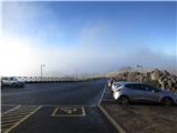
The trailhead is the parking lot right below Madeira's second highest peak, Pico do Areeiro. Access to the trailhead is possible from several directions: 1. Funchal (38 min / 19.2 km): from Funchal center, follow the road to Monte, then ER103 to Poiso pass, where we turn left onto the road to Pico do Areeiro. 2. Aeroporto da Madeira (35 min / 23.8 km): from the airport, follow the VR1 highway to Santa Cruz, where we join ER202 to Poiso pass and continue towards Pico do Areeiro. 3. Faial (35 min / 23.6 km): follow ER103 towards Funchal to Poiso pass, where we turn right to Pico do Areeiro.
Route description:
The trailhead is right below the Pico do Areeiro summit, near the parking lot, restaurant, and souvenir shop. The trail is well-marked and also well-secured.
From the Pico do Areeiro summit, we begin descending towards the Pico dos Torres summit. The trail is at least paved and stepped in the initial section. After 15 minutes of walking, we descend to the first viewpoint (Ninho da Manta) and then another 10 minutes to the second viewpoint (Mirador de Pedra Rija), where there is also a stone table. The trail then descends steeply and leads us under a stone arch. Immediately after, we encounter the first tunnel under the Pico do Gato summit (Tunel do Pico do Gato). In the tunnel, which is also paved, we can use a light. After exiting the tunnel, a descent follows to the grassy slope, where the trail forks (2.1 km walked). The left (western) variant is shorter, less demanding, and leads us through several tunnels. The right (eastern) variant is longer (4.8 km) and physically more demanding due to greater elevation change. Description of the eastern trail: the trail descends to the lowest point (1542 m), where we see lush vegetation. The trail then begins a steep ascent. Carved steps into the ground help us. The trail climbs to 1720 m and descends again. After crossing a short tunnel, we reach the junction with the western trail. Description of the western trail: this variant is shorter (3.4 km) and physically less strenuous. It leads us along a fairly exposed but secured trail. After crossing 3 tunnels, we arrive at the junction with the eastern trail. Here the trail ascends again until we reach the hut (Casa de Abrigo do Ruivo) at 1769 m. Then the last 90 elevation meters to the Pico Ruivo summit, where there are 3 viewpoints. The middle platform is also the highest point of the mountain. We return to the trailhead of course via the other route. The eastern trail takes from three to three and a half hours, the western trail takes just under three hours of walking.

Along the route: Pico do Areeiro (1817m), Tunel do Pico do Gato (1680m), Casa de Abrigo do Ruivo (1769m),
Pico Ruivo (1862m)
Photos:
 1
1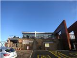 2
2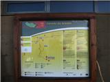 3
3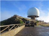 4
4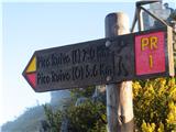 5
5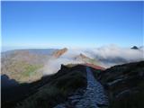 6
6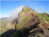 7
7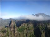 8
8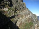 9
9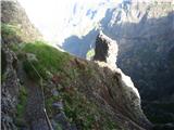 10
10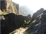 11
11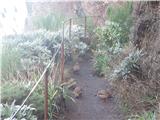 12
12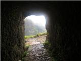 13
13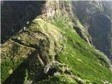 14
14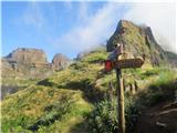 15
15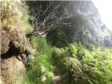 16
16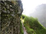 17
17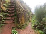 18
18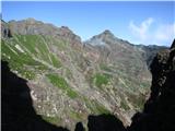 19
19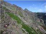 20
20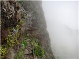 21
21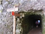 22
22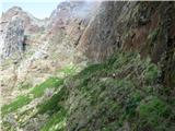 23
23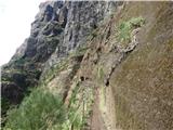 24
24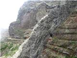 25
25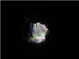 26
26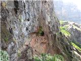 27
27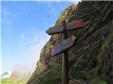 28
28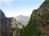 29
29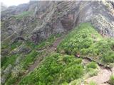 30
30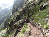 31
31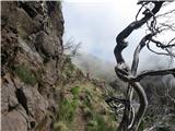 32
32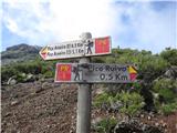 33
33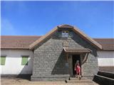 34
34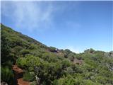 35
35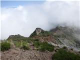 36
36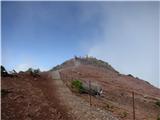 37
37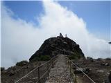 38
38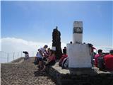 39
39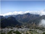 40
40
Discussion about the trip Pico do Areeiro - Pico Ruivo (Vereda do Areeiro)
To post a comment you must log in:
If you do not yet have a username, you must first
register.