Starting point: Pišnica (850 m)
| Latitude/Longitude: | 46,46880°N 13,78330°E |
| |
Walking time: 1 h 25 min
Difficulty: easy marked way
Elevation gain: 263 m
Elevation difference along the route: 275 m
Map: Kranjska Gora 1:30.000
Recommended equipment (summer):
Recommended equipment (winter):
Views: 126.563
 | 1 person like this post |
Access to starting point:
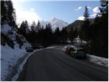
a) First we drive to Kranjska Gora, then we continue driving towards the Vršič pass. When Kranjska Gora ends, the road leads us past Lake Jasna, after the lake we arrive at the bridge over Velika Pišnica, where the described path begins. We park at the smaller parking lot at the crossroads, or already a little earlier, at the larger parking lot before the start of TNP, or after the bridge near the former Hotel Erika.
b) We drive to Trento, then over the Vršič pass we begin to descend towards Kranjska Gora. After crossing the bridge over Velika Pišnica, the described path begins. We park at the smaller parking lot at the crossroads, or already a little earlier near the former Hotel Erika, or a little after the bridge, at the somewhat larger parking lot opposite the TNP board.
Route description:
From the bridge over Velika Pišnica we continue in the direction of Koča v Krnici, where the path leads us along a gravel road, which then runs through the valley of Velika Pišnica. The fairly gentle road, which runs along the mountain stream, first crosses several torrents, then after the dam, which is quite photogenic due to the high mountains in the background, it takes us a little further to a marked junction, where to the left the path through Kačji graben branches off to Špik.
We continue straight on the still gentle road, which then takes us across the gravel bed to a marked junction, where at the edge of Planina v Klinu, the path from Ruski križ joins us from the right.
We continue left in the direction of Krnica, then immediately after crossing the torrent right onto the forest footpath. A moderate ascent through the forest follows, and after about 20 minutes of further walking we arrive at Koča v Krnici.
Starting point - junction for Kačji graben 0:40, junction for Kačji graben - Planina v Klinu 0:25, Planina v Klinu - Koča v Krnici 0:20.

Along the route: Eriški most (852m), Rušev graben (899m), Odcep za Kačji graben (916m), Planina v Klinu (980m)
The trip can be extended to the following destinations: Pogačnikov dom na Kriških podih (4 h 25 min),
Gubno (4 h 15 min),
Križ (4 h),
Planja,
Špik (4 h 10 min),
Stenar (5 h 30 min),
Dolkova špica (5 h),
Razor,
Velika Martuljška Ponca,
Veliki Oltar,
Škrlatica (6 h 45 min)
Photos:
 1
1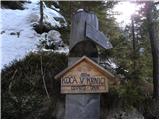 2
2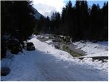 3
3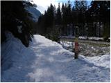 4
4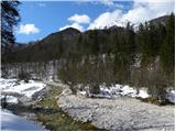 5
5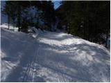 6
6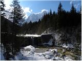 7
7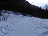 8
8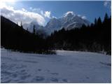 9
9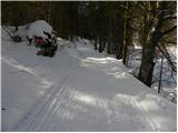 10
10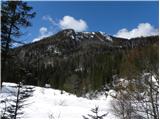 11
11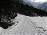 12
12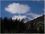 13
13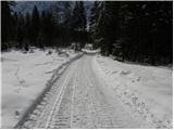 14
14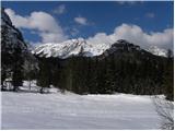 15
15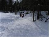 16
16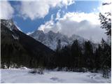 17
17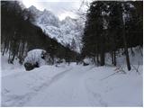 18
18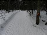 19
19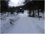 20
20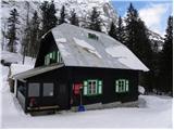 21
21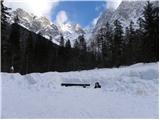 22
22
Discussion about the trip Pišnica - Koča v Krnici
|
| tnt00717. 08. 2010 |
Beautiful walking tour, suitable for all ages, beautiful nature along the path. Path also suitable for cyclists who enjoy nature.
|
|
|
|
| Pavlina18. 11. 2012 |
Super trip. However due to recent floods the road is destroyed at one place and need to cross steep slope for 100 m length. Deroca Pišnica prevented going along the bed. Don't know how it is when the flow decreases.
|
|
|
|
| potpodnoge28. 08. 2015 |
Pleasant path. Length about 1:15 hours or so, depending on pace. No problems on the path in summer. There is a nice path a bit further from the junction towards Mihov dom, when it turns right into the forest. No markings or signs otherwise, but the path is very well trodden, so you can turn onto it without worry. A little before the koča it comes out of the forest, when the koča is practically already visible, the length from the junction to the koča is approximately the same as via the gravel road to the koča. The path is blocked at two places with an electric shepherd tape, but there is a nice passage made at both barriers. In hot weather, the cool shade is pleasant, though unfortunately it doesn't allow walking all the way to the koča. The koča is open all year round, there are always quite a few people. Also cyclists, as the wide gravel path allows unobstructed meeting or overtaking of hikers by bikes. Usually, especially at weekends, the small parking before the bridge is fully occupied, so it pays to park at the larger parking about 150 m before the bridge, if coming from the Kranjska Gora direction. Suitable for all children who can walk, but not for strollers. Small children many carry in special backpack seats.
|
|
|
|
| potka6. 03. 2016 |
Real winter towards Krnica. The path is nice and despite unfavorable weather quite a few hikers
|
|
|
|
| Majdag29. 03. 2025 14:20:12 |
27.3....Koča v Krnici..
The road is mostly dry. Through the forest there's a bit more snow, but it can be bypassed. The mountains were foggy, little snow at the hut, it's open on weekends. Before the bridge of Vel. Pišnica there's a crowd, piles of sand needed for the construction site. Short but fun.
https://jelenkamenmajdag.blogspot.com/2025/03/dolina-krnica.html
|
|
|
To post a comment you must log in:
If you do not yet have a username, you must first
register.