Pišnica - Špik (via Koča v Krnici)
Starting point: Pišnica (850 m)
| Latitude/Longitude: | 46,46880°N 13,78330°E |
| |
Route name: via Koča v Krnici
Walking time: 5 h 30 min
Difficulty: very difficult marked way
Elevation gain: 1622 m
Elevation difference along the route: 1700 m
Map: TNP 1:50.000
Recommended equipment (summer): helmet
Recommended equipment (winter): helmet, ice axe, crampons
Views: 37.988
 | 3 people like this post |
Access to starting point:
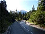
First we drive to Kranjska Gora, then continue driving towards Bovec. Just a little after the Jasna guesthouse, we reach the bridge over the Pišnica river, next to which we park at a smaller parking lot. We can also park a few 10 m back at the larger parking lot next to the TNP sign or near the former Hotel Erika.
Route description:
From the bridge over Velika Pišnica we continue towards Koča v Krnici, where the path leads us along a macadam road through the valley of Velika Pišnica. The fairly gentle road that runs along the mountain stream first crosses several torrents, then after the dam, which is quite photogenic due to the high mountains in the background, it brings us a little further to a marked junction, where the path through Kačji graben to Špik branches off to the left.
We continue straight on the still gentle road, which then takes us across the gravel bed to a marked junction, where at the edge of Planina v Klinu the path from Ruski križ joins us from the right.
We continue left towards Krnica, then immediately after crossing the torrent turn right onto the forest footpath. A moderate ascent through the forest follows and after about 20 minutes of further walking we arrive at Koča v Krnici.
From the hut we head left towards Špik (straight ahead to Kriška stena) and for a short time we continue on a flat path through the forest. The path then crosses two smaller torrent beds; at the next wider bed the path turns slightly right and then ascends for quite some time along the bed. Here we mostly climb through dwarf pine, with nice views from the path especially towards Prisank and Razor. Higher up the path crosses the bed to the left side and climbs a steeper slope. When the dwarf pine becomes somewhat sparser, the marked path turns left, and along the way we notice a large rock with the inscription „Špik 3h“.
The path ahead traverses slopes that are still partially covered with dwarf pine; higher up, the PP path (Planica - Pokljuka path) branches off quite unnoticeably to the left, and we then ascend to the upper part of Tarmanova žlefa, the slope that steeply descends towards Krnica.
Here the path climbs steeply and turns increasingly to the right, so we gradually reach the northern slopes of Gamsova špica (1931 m), and a little further we reach an indistinct saddle, where the path turns left and after a shorter ascent brings us to the more demanding part of the trail, where with the help of fixed protections we begin to climb towards Lipnica (marked as Liprtica on some maps). Below the summit of Lipnica the steepness decreases and we reach the summit of Lipnica without major difficulties.
From Lipnica we continue along the ridge, where the path soon becomes technically demanding. First we descend a little, then with the help of protections we traverse steep slopes that connect the Lipnica ridge with Špik.
When a little further we reach or approach some kind of saddle or notch, the path through Kačji graben joins us from the left (possibility to return to the valley).
We continue straight towards Špik, where the last very steep section is ahead of us. We ascend the quite steep slope with a great danger of falling rocks over quite crumbly fragmented rock; the path on this section is not protected.
After 15 minutes the steepness eases and in a few steps we reach the mighty and panoramic summit of Špik.
Starting point - turnoff for Kačji graben 0:40, turnoff for Kačji graben - Planina v Klinu 0:25, Planina v Klinu - Koča v Krnici 0:20, Koča v Krnici - turnoff to Velika Dnina 0:50, turnoff to Velika Dnina - Lipnica 2:40, Lipnica - junction below the summit of Špik 0:20, junction below the summit of Špik - Špik 0:15.

Along the route: Eriški most (852m), Rušev graben (899m), Odcep za Kačji graben (916m), Planina v Klinu (980m),
Koča v Krnici (1113m), Odcep v Veliko Dnino (1425m),
Lipnica (2418m), Razpotje pod vrhom Špika (2401m)
Photos:
 1
1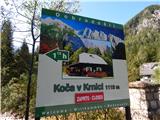 2
2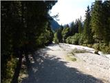 3
3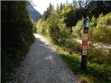 4
4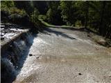 5
5 6
6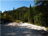 7
7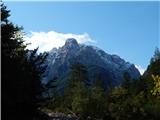 8
8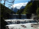 9
9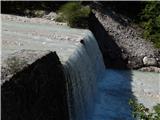 10
10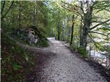 11
11 12
12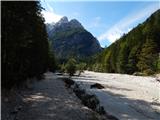 13
13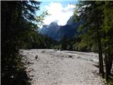 14
14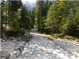 15
15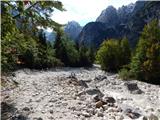 16
16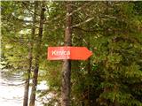 17
17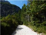 18
18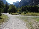 19
19 20
20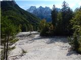 21
21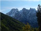 22
22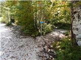 23
23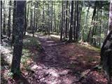 24
24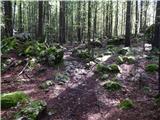 25
25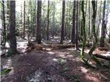 26
26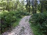 27
27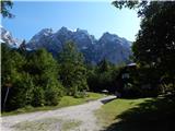 28
28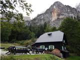 29
29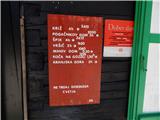 30
30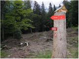 31
31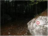 32
32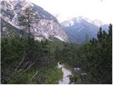 33
33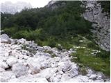 34
34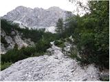 35
35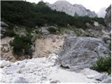 36
36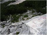 37
37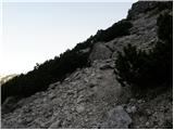 38
38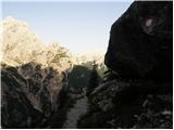 39
39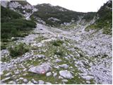 40
40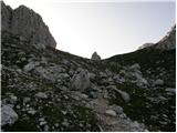 41
41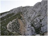 42
42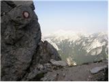 43
43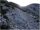 44
44 45
45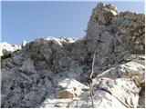 46
46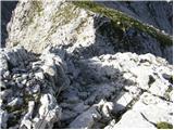 47
47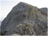 48
48 49
49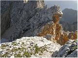 50
50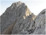 51
51 52
52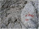 53
53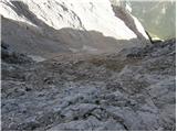 54
54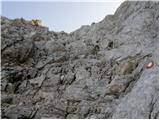 55
55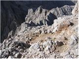 56
56 57
57
Discussion about the trip Pišnica - Špik (via Koča v Krnici)
|
| maks5711. 04. 2019 |
I was looking for any data about Lipnica, but I can't find any. Strange!
|
|
|
|
| Janez Seliškar12. 04. 2019 |
The ascent to Špik from Koča v Krnici goes via Lipnica, so everything is written in those posts.
|
|
|
|
| malihodec7. 07. 2021 23:16:11 |
Has anyone been to Špik this month? Is there still snow, where and how much, and what gear is needed???Thanks for info!!
|
|
|
To post a comment you must log in:
If you do not yet have a username, you must first
register.