Planina Jezerca - Kompotela
Starting point: Planina Jezerca (1410 m)
| Latitude/Longitude: | 46,28550°N 14,53140°E |
| |
Walking time: 2 h 30 min
Difficulty: easy marked way
Elevation gain: 579 m
Elevation difference along the route: 660 m
Map: Kamniške in Savinjske Alpe 1:50.000
Recommended equipment (summer):
Recommended equipment (winter): ice axe, crampons
Views: 64.333
 | 2 people like this post |
Access to starting point:
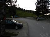
A) From the Ljubljana–Jesenice highway, take the Vodice exit, then continue driving to the first traffic-light intersection in Vodice, where you continue left in the direction of Cerklje na Gorenjskem and Brnik. When you arrive at the main roundabout in Spodnji Brnik, continue driving in the direction of Cerklje and the Krvavec ski center. At the end of the settlement of Cerklje na Gorenjskem, leave the main road, which continues towards Velesovo and Visoko, and continue slightly right onto the road towards the Krvavec ski center. Further on, you arrive at the village of Grad, where signs for the settlement Ambrož pod Krvavcem direct you right onto a steep asphalt road (straight ahead: lower station of the monocable gondola to Krvavec and Štefanja Gora). When the gradient on the steep road eases somewhat, you will arrive at an intersection, where you continue left in the direction of the settlement Ambrož pod Krvavcem (straight ahead: settlements Ravne, Apno and Šenturška Gora). A little further on, the road temporarily descends a bit, then ascends through occasionally quite scenic slopes. Higher up, you arrive at Ambrož pod Krvavcem, where you pass the church of St. Ambrož and the tourist farm Pr Ambružarju on the left side. From the tourist farm onwards, the road enters the forest and ascends through it all the way to Planina Jezerca, where there is a large arranged parking lot.
B) From the Jesenice–Ljubljana highway, take the Kranj–East exit, then continue driving towards Brnik, Komenda and Mengeš. When you arrive at the main roundabout in Spodnji Brnik, continue driving in the direction of Cerklje and the Krvavec ski center. At the end of the settlement of Cerklje na Gorenjskem, leave the main road, which continues towards Velesovo and Visoko, and continue slightly right onto the road towards the Krvavec ski center. Further on, you arrive at the village of Grad, where signs for the settlement Ambrož pod Krvavcem direct you right onto a steep asphalt road (straight ahead: lower station of the monocable gondola to Krvavec and Štefanja Gora). When the gradient on the steep road eases somewhat, you will arrive at an intersection, where you continue left in the direction of the settlement Ambrož pod Krvavcem (straight ahead: settlements Ravne, Apno and Šenturška Gora). A little further on, the road temporarily descends a bit, then ascends through occasionally quite scenic slopes. Higher up, you arrive at Ambrož pod Krvavcem, where you pass the church of St. Ambrož and the tourist farm Pr Ambružarju on the left side. From the tourist farm onwards, the road enters the forest and ascends through it all the way to Planina Jezerca, where there is a large arranged parking lot.
Route description:
At the end of the parking lot, where the road turns left and a road branches off to the right towards the nearby Planina Jezerca, we will notice red hiking signposts that direct us straight onto a marked footpath in the direction of Kriška planina, Vrh Korena, Košutna, Kompotela and Mokrica, which ascends through the pastures of the aforementioned mountain pasture. After a short ascent we reach a cart track, which we follow to the left, crossing the slopes of Kržišče (1658 m). The cart track on which we are walking quickly splits into two parts, and we continue straight on the lower one. Temporarily a nice view opens towards Kranj, Škofjeloško hribovje and Storžič, then the path begins to descend gently. A few more minutes of walking follow, then we arrive at the parking lot at the lower part of Kriška planina.
From the parking lot we continue in the direction of Planina Koren and continue along a poorer macadam road that passes through the underpass under the ski slope. After the underpass, the marked path veers slightly left from the road, continuing parallel to the road along a sort of spruce avenue. When, after a few minutes of gentle ascent, we reach the eastern edge of Kriška planina, where there is a small watering place for animals, we continue slightly left across the grazing fence (right: Planina Osredek and Kamniški vrh), but continue the gentle ascent in roughly the same direction. The path then transitions from the mountain pasture to somewhat steeper slopes of Krvavec, across which we traverse upwards to a vantage point from which a nice view opens towards Kržišče (Pokovše), the ridge of Kamniški vrh, the Korošica valley, Velika planina and towards the nearby Košutna and Veliki Zvoh.
From the vantage point, which is a few steps to the right off the path, we begin to descend more steeply towards the hunting cabin above the Korošica valley. When the descent ends and the path continues without major changes in elevation, we arrive at a visible but poorly marked junction, where a path branches off to the right to the aforementioned hunting cabin and further towards the Korošica valley and Kamniška Bistrica valley. At this junction we continue slightly left and begin to ascend gently through the forest. The path quickly leaves the forest into bushes and dwarf pines, then gradually leads us across a grazing fence to the next unmarked junction, which is situated right in the middle of a sharp right-hand bend.
From this hairpin bend, an unmarked path continues straight towards the Razor saddle (saddle between Krvavec and Veliki Zvoh), while we continue right on the still-marked path. A short traverse ascent follows and the path brings us to the southern part of Planina Koren, from where a nice view opens over the central part of the mountain pasture and surrounding peaks. From the southern part of the mountain pasture a short descent follows to the nearby shepherd hut, which is located in the central part of Planina Koren.
Here our path continues slightly left (slightly right: Planina Košutna) across meadows at the valley bottom (the path is initially poorly visible). The path then becomes steeper and after less than 30 minutes of walking brings us to a small pond, where there is a poorly marked junction. We continue straight (right: Košutna) and follow the gentle path to the next junction, where we take the right path in the direction of Kompotela (left: Vrh Korena). From here orientation is somewhat more difficult, and in fog very challenging. The path ahead slowly begins to ascend gently up the grassy slope overgrown with dwarf pines. The footpath then brings us, with fine views, to the summit of Kompotela.

Photos:
 1
1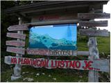 2
2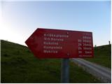 3
3 4
4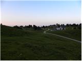 5
5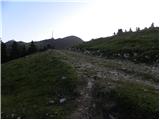 6
6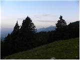 7
7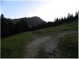 8
8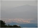 9
9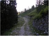 10
10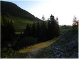 11
11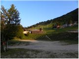 12
12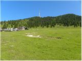 13
13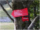 14
14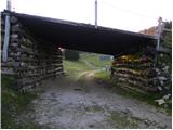 15
15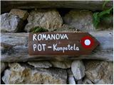 16
16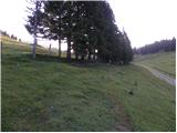 17
17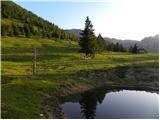 18
18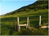 19
19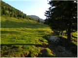 20
20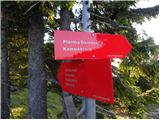 21
21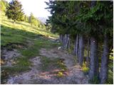 22
22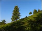 23
23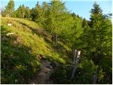 24
24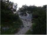 25
25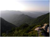 26
26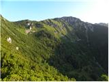 27
27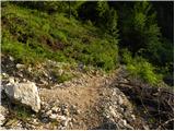 28
28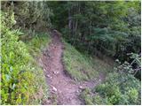 29
29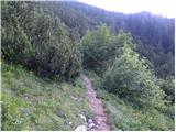 30
30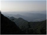 31
31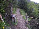 32
32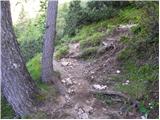 33
33 34
34 35
35 36
36 37
37 38
38 39
39 40
40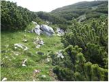 41
41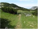 42
42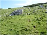 43
43 44
44
Discussion about the trip Planina Jezerca - Kompotela
|
| velkavrh16. 08. 2013 |
On top of Kompotela there is a new logbook box for entries and I think a stamp too. Also new directional signs under Vrh Korena that direct us to Kompotela and further to Mokrica. This year this tour via planina Koren, planina Košutna, vrh Košutna, Kompotela and Mokrica is still waiting for me. From Mokrica we can also descend to Medvedova jama, where we can still find some bones of cave bears. Recommended - pleasant, non-strenuous tour.
|
|
|
|
| pohodnik0117. 08. 2013 |
At the beginning of the month, my wife and I were in those parts. Everything is as described by "velkavrh". The stamp is there too, which sometimes wasn't. The only pity is that the logbook box is missing its lid. Maybe someone (unlikely?) stole it.
Lots of enjoyment on the trail 
|
|
|
|
| valerija11211. 10. 2014 |
Such fog we've never seen! Today besides Kompotela
we also visited Vrh korena and Košutna. All morning we were surrounded by thick fog, only after 1pm did the sun on Košutna give us some views. Still, the day was full of nice experiences, we met many pleasant hikers. Maybe you'll have more luck with views tomorrow. Trails are well signposted and marked. Thanks to the path maintainers.
|
|
|
|
| gofra2. 01. 2016 |
Perhaps just a note - Picture 8 shows the junction where one should continue straight. In winter conditions this junction is not visible, which doesn't hinder much (continue straight towards Kriska planina) but still worth mentioning.
Further, I recommend crossing the pasture fence (start at picture 17) as soon as possible (if in doubt) and the path continues along the left side of the avenue from the start. The fence is barbed wire and crossing it later can be problematic.
|
|
|
|
| Lisica2. 01. 2016 |
Yesterday visited Košutna, Kompotela and Vrh Korena. The first two have no logbooks, but Vrh Korena's is already full. PD Komenda could take care of new ones...
|
|
|
|
| sh14. 04. 2016 |
Please provide information on the snow conditions on this trail.
|
|
|
|
| viharnik15. 04. 2016 |
There is still snow ahead from Pl. Koren.
|
|
|
|
| sh15. 04. 2016 |
Is there a lot of snow, does it sink in deeply?
|
|
|
|
| grega_z_brega15. 04. 2016 |
On Sunday there was about 25 cm, where it was drifted it went up to the butt.
But a lot of it melted during the week.
|
|
|
|
| grega_z_brega15. 04. 2016 |
If you're going tomorrow, I recommend a photo there under Kalski greben
|
|
|
|
| marko hribinet9. 11. 2016 |
Hello. Can someone who knows this area well please tell me how dangerous this trail is for avalanches. I was planning to go this Saturday (crampons and ice axe of course with me). Thanks!
|
|
|
|
| velkavrh10. 11. 2016 |
marko hribinet-on Saturday better weather is expected. I think there will be little snow-maybe around 20cm there. But you might sink up to 40cm where it's wind-packed. Probably nothing will be trodden so orientation will be harder. If there's a track it won't be difficult. We must not go on this trail in fog. We must strictly follow the described path. Currently there is no avalanche danger because there is also too little snow. Just take crampons with you, you won't need the ice axe. Otherwise it's nice to return via Vrh Korena and Ježa to Veliki Zvoh, but this path is not recommended for the inexperienced. We safely return along the approach path.
|
|
|
|
| velkavrh10. 11. 2016 |
Check the conditions from yesterday on the Forum under Vrh Korena. It looks like there is more snow than I predicted. Be careful!
|
|
|
|
| ljubitelj gora10. 11. 2016 |
Avalanches possible in many places, so when there's a bit more snow in the mountains, one must be extremely careful. Choose those ascents that we know in dry conditions.
|
|
|
|
| marko hribinet10. 11. 2016 |
Thank you very much for the information. I've already hiked this trail twice in dry conditions, but I have no experience with it in winter conditions.
|
|
|
|
| sirt110. 11. 2016 |
Better not go to those areas on Saturday. ARSO forecast for Zvoh is snowfall and wind near 80 km/h. On Sunday sun, little wind, how much snow ??
|
|
|
|
| Gost11. 11. 2016 |
There is already a lot of new snow and the first avalanche lurks just a few minutes after entering the forest, but there must really be a lot of it, the others much larger ones come from Zvoh at the end of the first descent when the path flattens. Further on there are no major dangers yet. In winter when the debris is covered, it can also avalanche from Košutne.
|
|
|
|
| mito300013. 11. 2016 |
Today I made a track to the top of Korena from Planina Jezerca. There is about half a meter of snow at the top, in places it sinks quite deep. As "miro_krivec" mentioned, the most dangerous part is when an avalanche comes from Zvoh, which I experienced last year. The avalanche went just a couple of meters away and you can't believe how quickly it all happens.
|
|
|
|
| Keki4. 12. 2017 |
Has anyone been to Kompotela and Vrh Korena in the last few days... is the path trodden?
|
|
|
|
| Bandzo4. 12. 2017 |
@Keki, check the comment under Vrh Korena
LP,
Ben
|
|
|
|
| Keki6. 12. 2017 |
Since I'm stubborn, I went to check the conditions anyway. Since there were two fairly nice days in between, I hoped the track would already be well trodden... Well, it's not... up to pl. Koren it's locally blown over, from pl. Koren onwards everything is blown over and crusty snow up to the knees and over, so I turned back a bit below the marker on the rock at the end of the meadow....Pics on FB
|
|
|
|
| Bandzo7. 12. 2017 |
Well, nothing to do. As if no one had walked there before In the previous description I was wrong: 45 min to Kompotela not to Mokrica. We'll go trample it again
LP,
Ben
|
|
|
|
| michael661. 04. 2018 |
How is the path these days, is it trodden...? Can one go on foot...?
|
|
|
|
| radovednež15. 02. 2026 15:40:22 |
Has anyone been to Kompotela over the weekend from Planina Jezerca? I'm mainly interested in safety in winter conditions... is the terrain dangerous for snow avalanches?
And has a track been made in the snow?
|
|
|
To post a comment you must log in:
If you do not yet have a username, you must first
register.