Planina Kuhinja - Krn (via jezero v Lužnici)
Starting point: Planina Kuhinja (991 m)
| Latitude/Longitude: | 46,24130°N 13,66300°E |
| |
Route name: via jezero v Lužnici
Walking time: 4 h 45 min
Difficulty: partly demanding marked way
Elevation gain: 1253 m
Elevation difference along the route: 1400 m
Map: Julijske Alpe - zahodni del 1:50.000
Recommended equipment (summer): helmet
Recommended equipment (winter): helmet, ice axe, crampons
Views: 58.772
 | 2 people like this post |
Access to starting point:
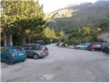
a) We drive to Kobarid, then follow the signs for Drežnica. After crossing the Soča River via Napoleon's Bridge, turn right towards Tolmin and Vrsno (Drežnica is slightly to the left) and gradually start ascending. We continue driving past the settlements of Ladra, Smast and Libušnje to the settlement of Vrsno, where the birth house of Simon Gregorčič is located. Here the road from the settlement of Kamno joins from the right, while we continue following the signs towards the village of Krn and the mountain pasture Kuhinja. There is still quite a long drive along a relatively narrow road; at junctions we always follow the direction for the mountain pasture Kuhinja. Just a short distance before the mountain pasture, turn left where the barrier for paying the parking fee is located. Beyond the barrier, a few parking spaces are already available along the road, with many more on a small flat area. It is also possible to park a little further ahead, in front of the Koča na planini Kuhinja.
b) We drive to Tolmin, then follow the signs for Kobarid. On the flat section of the road, turn right towards the settlement of Kamno, which we reach via a narrow bridge over the Soča River, then follow the signs for the village of Vrsno. In Vrsno we join the road coming from Kobarid and continue following the signs towards the village of Krn and the mountain pasture Kuhinja. There is still quite a long drive along a relatively narrow road; at junctions we always follow the direction for the mountain pasture Kuhinja. Just a short distance before the mountain pasture, turn left where the barrier for paying the parking fee is located. Beyond the barrier, a few parking spaces are already available along the road, with many more on a small flat area. It is also possible to park a little further ahead, in front of the Koča na planini Kuhinja.
Route description:
From the parking lot at the smaller quarry we continue on the right upper road in the direction of the mountain pasture Kašina (left mountain pasture Kuhinja 3 minutes). The road, which further moderately ascends, already after a few steps of additional walking brings us to the next junction, where we continue right again (left mountain pasture Zaslap). The relatively gentle road, which gradually changes into a cart track, soon brings us to expansive grassy slopes, where we step onto the pastures of the mountain pasture Kašina.
Here the road or cart track turns even more to the right, then makes a sharp left turn, and then continues crossing the slopes to the right. After approximately 45 minutes (from the starting point) of moderate ascent, the relatively panoramic path brings us to the mountain pasture Leskovca, overgrown with nettles.
From the mentioned mountain pasture, we continue slightly left on a marked and initially quite gentle mountain path. The path, which passes onto the western and increasingly steep grassy slopes, higher up joins from the right a somewhat less trodden path from the mountain pasture Sleme. We continue left on the already very steep path, which ascends at the foot of the steep walls of Maselnik (1906 m). A little higher, to the path, which due to its considerable steepness is exposed to falling rocks, another path from the mountain pasture Sleme joins. We continue straight on the path, which a little higher flattens, then turns quite to the left, where it passes into a smaller valley. A short somewhat steeper ascent follows and left somewhat below us we spot the lake in Lužnica (1801 m).
The marked path bypasses the mentioned lake on the right side and continues ascending at the foot of the scree of the ridge Mali Peski. Higher, the path turns slightly to the left and ascends over the grassy slopes of Srednji vrh (2032 m) to the saddle named Prag (2068 m).
On Prag, where there is a marked junction, we continue left in the direction of Batognica (straight down Krnsko jezero, right Vrh nad Peski and Koča na planini Razor) on the path which moderately ascends along the summit slope of Batognica. We then follow this increasingly panoramic path to the summit, which we reach after 15 minutes of further walking.
From Batognica we continue on an initially somewhat less visible path, which continues along the left side of the peak. The path, which initially descends only slightly, soon brings us into steeper terrain, where we begin to descend more steeply. After a short descent, we reach relatively steep steps, on which we descend steeply. On this section, due to the scree on the path, there is a great risk of slipping. The path ahead gradually flattens and a little further brings us to Krnska škrbina (we can also reach the škrbina if on Prag we continue on the so-called Northern Path, which bypasses the peak Batognica; the latter is somewhat shorter, but also substantially less panoramic).
From the škrbina we continue straight (left mountain pasture Kuhinja, right Krnsko jezero) on the path which begins to ascend the grassy slope of the mountain. We then follow this increasingly panoramic path to the panoramic summit, which we reach after approximately 30 minutes of walking from Krnska škrbina.
From the summit we can descend in 5 minutes to Gomiščkovo zavetišče and then descend to the mountain pasture Kuhinja along the usual path.

Photos:
 1
1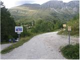 2
2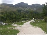 3
3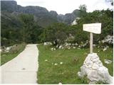 4
4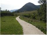 5
5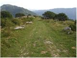 6
6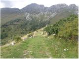 7
7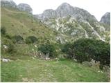 8
8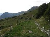 9
9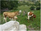 10
10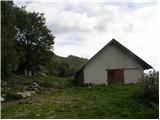 11
11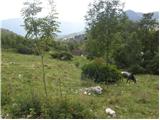 12
12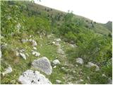 13
13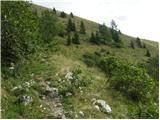 14
14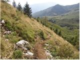 15
15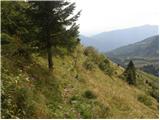 16
16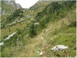 17
17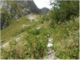 18
18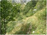 19
19 20
20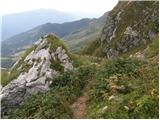 21
21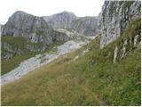 22
22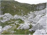 23
23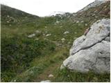 24
24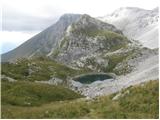 25
25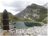 26
26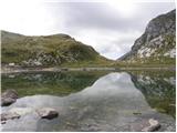 27
27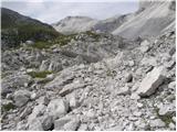 28
28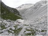 29
29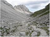 30
30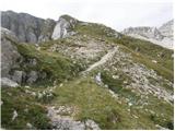 31
31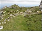 32
32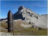 33
33 34
34 35
35 36
36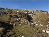 37
37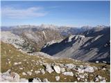 38
38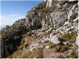 39
39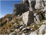 40
40 41
41 42
42 43
43 44
44 45
45 46
46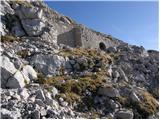 47
47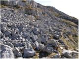 48
48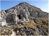 49
49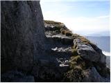 50
50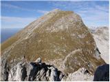 51
51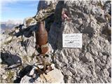 52
52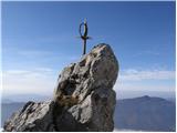 53
53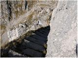 54
54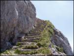 55
55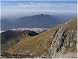 56
56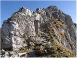 57
57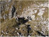 58
58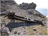 59
59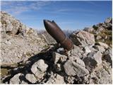 60
60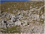 61
61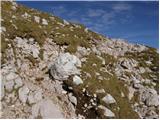 62
62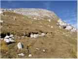 63
63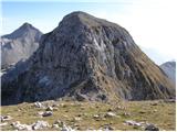 64
64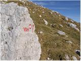 65
65 66
66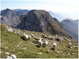 67
67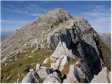 68
68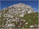 69
69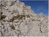 70
70 71
71
Discussion about the trip Planina Kuhinja - Krn (via jezero v Lužnici)
|
| SašaRegent22. 08. 2012 |
If we ignore the annoying flies at the start and the poorly maintained markers on Batognica .... a wonderful hiking experience!!
|
|
|
|
| miranm18. 06. 2013 |
Hello,
I'm wondering if the mentioned path from Planina Kuhinja to Krn (past the lake in Lužnica) is dry and if winter equipment is needed.
Thanks and happy hiking!
Miran
|
|
|
|
| Laščan11. 07. 2013 |
I'm interested in how much walking there is from the Prag saddle to the WWI remains below Mali Peski (monument and hut ruins)
Thanks!
|
|
|
|
| SuzanaM12. 07. 2013 |
To the monument it's 15-20 minutes. We see it right after crossing the southern slopes of Vrh nad Peski. But the views are so beautiful that the minutes to the monument pass quickly.
|
|
|
|
| megadave8. 09. 2014 |
Two days ago I returned from this wonderful tour (Pl.Kuhinja-Krn-Batognica-lake in Lužnica-Rdeči rob-Pl.Kuhinja). It does take about 9 hours altogether, but it's the most beautiful tour so far for me. Batognica, Lužnica, marmots, eagles, then the natural landmark-Rdeči rob. Wonderful!
|
|
|
|
| miri8. 09. 2014 |
Try it in the opposite direction! I'd bet it's even nicer. I don't know why.
|
|
|
|
| šnedrnca20. 11. 2015 |
.Hey, has anyone been to Batognica?
|
|
|
|
| Smetar20. 11. 2015 |
I was up there last weekend...
|
|
|
|
| StyLa11. 07. 2016 |
This weekend we did a circular tour from Planina Kuhinja - past the hut up to Krn and then via Batognica and past the lake back. This is really a nice tour, short but full of beautiful views. I warmly recommend it to everyone who will approach Krn from this starting point. I admit though, we probably wouldn't have found the path in the opposite direction, which goes through pastures and past barns, as it is quite poorly marked.
|
|
|
|
| darinka411. 07. 2016 |
From the parking lot to Planina Leskovca and then onwards, the path is solidly marked. I usually go past Lužniško jezero to Batognica and then along the southern valley. It’s much nicer for me that way.
|
|
|
|
| N3bULA23. 07. 2017 |
Via the upper path to Krn yesterday.
The path is well marked, despite Saturday I met only 5-6 hikers up to Batognica, but there was no shortage of cows and sheep from which the whole Batognica is "manured"  . .
The steps on the path from Batognica to Krnska škrbina are not that scary, especially since a wire rope is installed along their entire length.
Descent from Krn I did past the shelter and then along the usual path towards Planina Kuhinja, this usual path is very suitable for descent, for ascent it seems too monotonous to me.
Best regards
|
|
|
|
| haluzow23. 07. 2017 |
Yesterday my girlfriend and I went on this path. Extremely beautiful tour, great views. We descended on the southern side, which drags on a loooot. So for a circular tour I recommend ascent via Batognica.
|
|
|
|
| entrenous29. 07. 2020 |
Mountaineer's greeting!
In the coming days we plan with dog and small children to Krn via Pl. Kuhinja and do a loop via Batognica/Lužnica. We'd show children remains of the Great War.
Which direction do you recommend (dog, children) - Batognica on ascent or descent from Krn? Do we need safety rope for steps between Batognica and Krn?
Thanks!
|
|
|
|
| Enka29. 07. 2020 |
I think it's better to go directly to Krn, then across K.škrbina to Batognica (easier for ascent, now there's a chain on the steps, but they're slippery), then to Prag saddle and onwards past the lake back to Kuhinja. But the path is quite long and in the Lužnica valley it's terribly hot on sunny days.
|
|
|
|
| soraya200230. 07. 2020 |
On Tuesday, 28.7., I forgot my Leki hiking poles at the Planina Kuhinja parking lot. For any information - thank you.
|
|
|
|
| ljubitelj gora6. 08. 2021 21:16:11 |
Parking for the whole day at this parking lot is 10 euros. Valid from 6.8.2021.... 100m further at the hut there is free parking.
|
|
|
|
| 12a3bc12. 10. 2021 17:20:05 |
In the village Vrstno there is a sign for complete road closure because they often repair higher up but on Sunday it was possible to pass by. Don't know how it is during the week.
|
|
|
To post a comment you must log in:
If you do not yet have a username, you must first
register.