Planina Kuk - Tolminski Kuk
Starting point: Planina Kuk (1150 m)
| Latitude/Longitude: | 46,21120°N 13,78720°E |
| |
Walking time: 4 h 30 min
Difficulty: partly demanding marked way
Elevation gain: 935 m
Elevation difference along the route: 1100 m
Map: TNP 1:50.000
Recommended equipment (summer): helmet
Recommended equipment (winter): helmet, ice axe, crampons
Views: 44.120
 | 10 people like this post |
Access to starting point:
Between Most na Soči and Tolmin, the road branches off to Poljubinj. From Poljubinj we drive ahead towards the village Ljubinj, where behind the church we turn left towards the mountain pasture Razor and Stador. The road brings us to the parking lot on the mountain pasture Stador, where nearby there is a mountain hut. We drive further to the mountain pasture Lom and further along the road following the signs for Planina Razor. At an altitude of 1150 m we arrive at the mountain pasture Kuk, where there is a parking lot on which we park. Further driving is forbidden.
Route description:
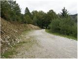
From the parking lot, we continue on the road closed to traffic, which after a few dozen steps brings us to the mountain pasture Planina Kuk, where in the summer time we can buy homemade milk products (sour milk, cheese, curd).
The road ahead starts gently ascending and eventually brings us to the next gate. After the gate, the path goes into the forest and ascends almost imperceptibly, occasionally even slightly descending. After one hour of walking, the path brings us to the mountain pasture Razor, where there is the mountain hut.
From the hut, we head on the path in the direction of Škrbina and Vogel. After a few minutes of gentle walking, the path brings us to the next junction, where we continue straight in the direction of Škrbina (right Vogel).
The path ahead turns slightly to the left and moderately ascends over slopes covered with dwarf pines. When the path brings us to the next junction at an altitude of approximately 1500 m, we continue left in the direction of Škrbina saddle (right Vrh nad Škrbino - south path). The path soon after that emerges from the dwarf pines onto interesting slopes, where on our right side we will notice steep rocky slabs that form an interesting wall for climbers, which is not overly steep. The path ahead ascends transversely over the scree to the Škrbina saddle, which is located at an altitude of 1910 m.
When we step onto Škrbina, a nice view opens up on the Gorenjska side, and at the junction we continue left in the direction of Kuka (right Vrh nad Škrbino, straight down Planina za Migovcem, Komna, Vogel and Ukanc). The path ahead begins to ascend transversely over steep slabs, then both the path and the slope level out somewhat. The path ahead passes below the short wall of Vrh Kont, then begins gently descending over occasionally steeper scree. The path ahead on the Primorska side also crosses Podrto gora and Mali vrh, then returns to the main ridge of Spodnje Bohinjske gore, which it reaches right on the saddle between Mali vrh and Zeleni vrh. From here we continue in the same direction, only that the path from the slopes passes onto a locally exposed ridge. We follow the marked path, which occasionally ascends quite steeply, then with ever better views, all the way to the grassy Zeleni vrh.
From Zeleni vrh we descend on the marked path, which begins descending more steeply to the west. The slope down which we descend quickly narrows and the path brings us to a narrow and slightly exposed ridge. Here the path flattens, and we quickly reach the saddle, from which we begin ascending towards Tolminski Kuk. Above the saddle awaits a short steep ascent, then the path passes onto the ridge, along and beside which we ascend to the highest peak of Spodnje Bohinjske gore.
Planina Kuk - planina Razor 1:00 planina Razor - Škrbina 2:00, Škrbina - Tolminski Kuk 1:30.

The trip can be extended to the following destinations: Podrta gora
Photos:
 1
1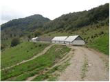 2
2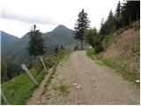 3
3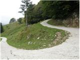 4
4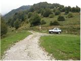 5
5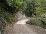 6
6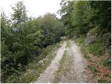 7
7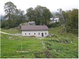 8
8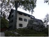 9
9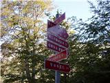 10
10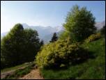 11
11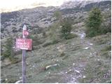 12
12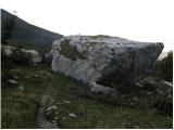 13
13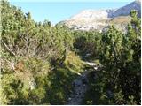 14
14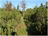 15
15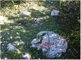 16
16 17
17 18
18 19
19 20
20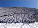 21
21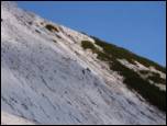 22
22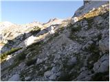 23
23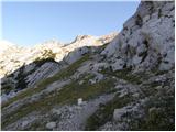 24
24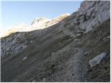 25
25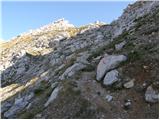 26
26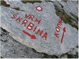 27
27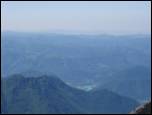 28
28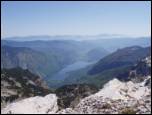 29
29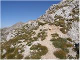 30
30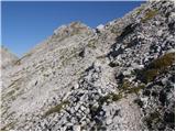 31
31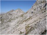 32
32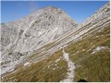 33
33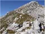 34
34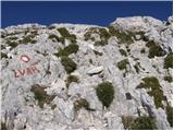 35
35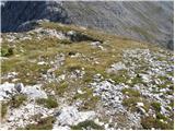 36
36 37
37 38
38 39
39 40
40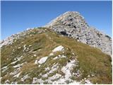 41
41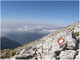 42
42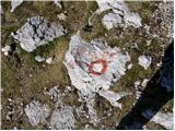 43
43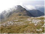 44
44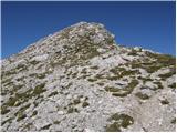 45
45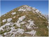 46
46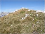 47
47
Discussion about the trip Planina Kuk - Tolminski Kuk
|
| Gost25. 02. 2007 |
This is an excellent hike that you can finish circularly. From Tol Kuk go back 300m then right to Migovec (path not marked, occasionally cairns). Then descend to pl. Kal and turn left on the marked path to pl. Razor to the starting point. Peaks around Tol Kuk are perfect for ski touring.
|
|
|
|
| Gost27. 04. 2007 |
Wonderful winter ascent. Bivouac on Planina Razor is exemplary equipped (blankets, pillows) 
|
|
|
|
| Gost26. 08. 2007 |
The tour described in the comments from 25.2.2007 is great also in dry conditions. Then the markings are visible besides the cairns, which may be a bit sparser, but you can't get lost. I did the route today and recommend it!
|
|
|
|
| antonija7. 05. 2011 |
Does anyone know what the current conditions are like now? Is there still any snow on the path?
|
|
|
|
| m.marmota7. 05. 2011 |
Path hiked today: Tol. Ravne, Planina na Kalu, Migovec, Tolm. Kuk and back. There are still some small snow patches on the path, but they pose no problem. Significantly more snow was visible below Zeleni Vrh and Škrbina. Probably until the second half of May.
|
|
|
|
| antonija12. 05. 2011 |
Thanks for the information.
|
|
|
|
| godovčan28. 05. 2011 |
Is it possible that someone is informed about the conditions on the path from Tolminski Kuk to the hut at Komna. Is there still a lot of snow? Thanks
|
|
|
|
| babim23. 09. 2011 |
These days my husband and I are heading to Tolminski Kuk, so I'm wondering which car access road is more suitable. A few years ago we went to Tolminske Ravne and to Studor and to planina Kuk. The first is really asphalted but very narrow, the second from Studor to pl.Kuk was terrible in one word. I'm interested if anything has changed recently, maybe at least passing places? Thanks for the answer
|
|
|
|
| ktbffh23. 09. 2011 |
I think nothing has changed on the road to Ravne. The road is as always, narrow and steep, I saw no passing places anywhere . My only advice is to go with a smaller car (if you have the option) and start earlier. I drove that road three times myself, but met only two cars. . My only advice is to go with a smaller car (if you have the option) and start earlier. I drove that road three times myself, but met only two cars.
Good luck and safe driving, the trip will surely be nice.
|
|
|
|
| babim23. 09. 2011 |
Sorry: Stador not Studor. Thanks for the answer.
|
|
|
|
| ktbffh23. 09. 2011 |
If I helped you a bit
|
|
|
|
| babim30. 09. 2011 |
I followed the advice and we drove to Planina Kuk instead and I must say this path is still better, since they nicely arranged it from my last visit a few years ago. The section without bypass is shorter, otherwise you can avoid it at the end. To Tolminski Raven you can't pass if you meet someone with a car. The trip was really wonderful, on the way up and down we met no hikers. The path to Škrbina is quite nasty, as on this steep scree it's quite dangerous to slip. On the way back the cheesemaker at Planina Kuk kindly served us cottage cheese and a shot of schnapps. We couldn't resist buying good Tolmin cheese.
|
|
|
|
| ales5030. 09. 2011 |
is there anything interesting to see up there,
|
|
|
|
| babim30. 09. 2011 |
I don't know what interesting thing you mean, but with such weather the view from Tolminski Kuk in all directions is wonderful and interesting
|
|
|
|
| babim1. 10. 2011 |
We didn't encounter anything like that
|
|
|
|
| matjazp6011. 01. 2013 |
Hello,
can someone tell me how long it is between Tolminski Kuk and Tolminski Migovec.
Thanks.
|
|
|
|
| miri11. 01. 2013 |
Yeah, yeah, that will be more accurate. I was with a young one.
|
|
|
|
| funnyboy11. 01. 2013 |
With a young one I would also take at least 2 hours
|
|
|
|
| ljubitelj gora15. 06. 2013 |
Today I headed to Tolminski kuk, starting at pl.Stador and all along the forest path (didn't go further by car, the road is narrow and in places quite exposed below the road) to pl.Razor then towards Škrbina then I crossed the snowfields and went to Tolm.kuk, then along a faintly visible path to Tolm.Migovca, a bit back then pl.Kal and DOLGA back to pl.Stador, about 25 km.
More photos:
https://picasaweb.google.com/114400986607884783562/TolminskiKukTolminskiMigovec
|
|
|
|
| link_26. 07. 2015 |
Already 4 days ago I set off for a trip via Migovec to Kuk. The marked path at two spots from the top of Kuk to the col is minimally harder to follow, it could be a problem if there's fog or low clouds. In clear weather the markings are visible. From the col onwards towards the hut on Planina Razor the path is well visible. Of course there's no snow anywhere anymore, the path is in good condition and poses no problems. I correctly judged that this would be the right choice if we want peace. On the way to Kuk I met no one, on the way to Planina Razor only one hiker. Good luck on the path.
|
|
|
|
| nevica17. 05. 2018 |
there was a wonderful view along the ridge from Tolminski Kuk to Vrh nad Škrbino clouds just right for getting soaked  alone, to Migovec you go, even if you're wet like a mouse alone, to Migovec you go, even if you're wet like a mouse
|
|
|
|
| J.P.12. 06. 2022 10:50:26 |
The road to Lom is now worse only in one section with some potholes, elsewhere... highway Otherwise still narrow... The hills in these parts are wonderful and it's definitely worth doing one of the circular tours. The circular Škrbina-Zel.vrh-Tolminski Kuk-Tol.Migovec is not demanding (in current dry conditions!), just a bit long. Recommended.
|
|
|
|
| jax12. 06. 2022 19:27:35 |
A bit more wild (and not for everyone), but I found the tour Kneške Ravne - Vrata - Vogel (preferably directly along the ridge) - Žabiški Kuk - road under planina Razor - Ljubinske stene - Kneške Ravne even more beautiful. Solitude and romance you could cut with a knife, views in good weather are insane.
|
|
|
|
| Darxta26. 08. 2024 10:23:34 |
The trail from Škrbina to the saddle between Zeleni and Mali vrh is very well and visibly marked. Beyond the saddle, however, the marks are not renewed and quite faded, so you need to look carefully at the rocks. Especially the junction in picture 35 can be easily missed.
|
|
|
|
| mirank26. 08. 2024 12:51:47 |
And then what? The vast majority cross from the top along the ridge, while the path is routed across the southern slope about 50m below the summit. The terrain is everywhere easily passable and clear so there really are no problems to expect here.
|
|
|
|
| Darxta26. 08. 2024 20:06:31 |
What kind of question is that??
Dear mirank, my post is intended for those who come to this page for information because they will be doing this tour for the first time. Unfortunately the above photos are already quite outdated (regarding the visibility of the markers) and that's what I wanted to highlight. If you believe it, fog/cloud can form on the ridge (as it did for me the day before yesterday, fortunately on the way back) and in that case this kind of information is probably welcome.
My post was not intended for you who obviously know the path by heart and could probably walk it at night during a new moon. Sorry I don't share your opinion that there really are no problems to expect here.
Good luck!
|
|
|
|
| mirank26. 08. 2024 21:19:14 |
About 15 years ago an old hunter above Kal told me: God forbid in fog to Migovec . For the first time and in poor visibility one would really look for trouble on terrain that in normal conditions is easily passable and clear even off the marked paths almost everywhere, that's what I wanted to say. . For the first time and in poor visibility one would really look for trouble on terrain that in normal conditions is easily passable and clear even off the marked paths almost everywhere, that's what I wanted to say.
|
|
|
|
| turbo27. 08. 2024 07:14:33 |
Even the freshest marking doesn't help much in thick fog ...
|
|
|
|
| miri27. 08. 2024 07:26:17 |
Years and "mileage" are needed to reach some realizations.
|
|
|
|
| sonoquilibrium20. 05. 2026 17:44:42 |
Does anyone have a photo from this spring as well?
|
|
|
To post a comment you must log in:
If you do not yet have a username, you must first
register.