Planina Kuk - Vrh nad Škrbino (via Škrbina)
Starting point: Planina Kuk (1150 m)
| Latitude/Longitude: | 46,21120°N 13,78720°E |
| |
Route name: via Škrbina
Walking time: 3 h 45 min
Difficulty: very difficult marked way
Elevation gain: 904 m
Elevation difference along the route: 940 m
Map: TNP 1 : 50.000
Recommended equipment (summer): helmet, self belay set
Recommended equipment (winter): helmet, self belay set, ice axe, crampons
Views: 29.715
 | 1 person like this post |
Access to starting point:
Between Most na Soči and Tolmin, the road branches off to Poljubinj. From Poljubinj we drive ahead towards the village Ljubinj, where behind the church we turn left towards the mountain pastures Razor and Stador. The road brings us to the parking lot on the mountain pasture Stador, where there is a mountain hut nearby. We drive further to the mountain pasture Lom and further along the road following the signs to mountain pasture Razor. At an altitude of 1150 m we arrive at the mountain pasture Kuk, where there is a parking lot on which we park. Further driving is forbidden.
Route description:
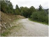
From the parking lot, we continue on the road closed to traffic, which after a few dozen steps brings us to Planina Kuk, where in the summer time we can buy homemade dairy products (sour milk, cheese, curd).
The road ahead starts gently ascending and brings us after a while to the next gate. After the gate, the path goes into the forest and ascends almost imperceptibly, occasionally even slightly descending. After one hour of walking, the path brings us to Planina Razor, where there is the mountain hut.
From the hut, we go on the path in the direction of Škrbina and Vogel. After a few minutes of gentle walking, the path brings us to the next junction, where we continue straight in the direction of Škrbina (right Vogel).
The path ahead turns slightly to the left and moderately ascends over slopes covered with dwarf pines. When the path brings us to the next junction at an altitude of approximately 1500 m, we continue left in the direction of Škrbina saddle (right Vrh nad Škrbino - south path). The path soon comes out of the dwarf pines onto interesting slopes, where on our right side we will notice steep rocky slabs, which form an interesting wall for climbers, which is not too steep. The path ahead ascends transversely over the scree to Škrbina saddle, which is at an altitude of 1910 m.
From the saddle, where there is also a junction, we continue right on the south side of the ridge in the direction of Vrh nad Škrbino (left Tolminski Kuk). The path then brings us on a steep, slightly crumbly slope to steep northern slopes. Here we come to the first steel cables along which we ascend steeply. The path then turns to the right, where with the help of a few pegs we ascend again to the south side of the ridge. On the south side, the path steeply ascends a few more times by the steel cable, then the path gradually becomes less demanding. There follows approximately ten minutes of walking on a panoramic ridge towards the summit. A few meters below the summit a somewhat easier direct path from Planina Razor also joins from the right.
Planina Kuk - Planina Razor 1:00 Planina Razor - Škrbina 2:00, Škrbina - Vrh nad Škrbino 45 minutes.

Photos:
 1
1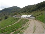 2
2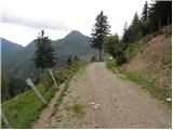 3
3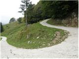 4
4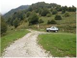 5
5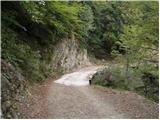 6
6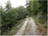 7
7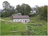 8
8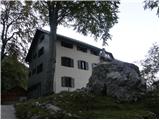 9
9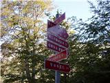 10
10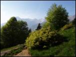 11
11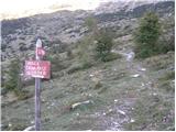 12
12 13
13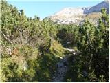 14
14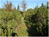 15
15 16
16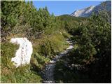 17
17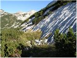 18
18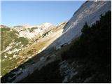 19
19 20
20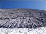 21
21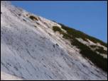 22
22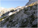 23
23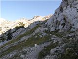 24
24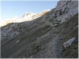 25
25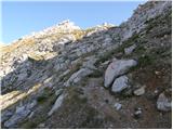 26
26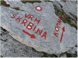 27
27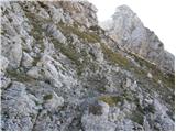 28
28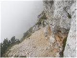 29
29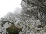 30
30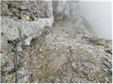 31
31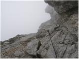 32
32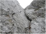 33
33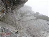 34
34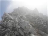 35
35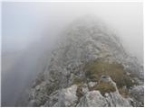 36
36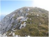 37
37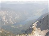 38
38 39
39
Discussion about the trip Planina Kuk - Vrh nad Škrbino (via Škrbina)
|
| LISO2. 07. 2008 |
Nice trip! Congrats to the girls who on Saturday 28 June powered up the slope to the top. Real chamois.
|
|
|
|
| skrajnik6. 10. 2008 |
I'm interested if anyone knows anything about the latest conditions on this path?
thanks!
|
|
|
|
| skrajnik18. 06. 2009 |
Hi!
Tomorrow I'm going somewhere.. and looking for a dry, i.e. "safe" ferrata..
anyone know about the conditions around there?
|
|
|
|
| tadeya18. 06. 2009 |
A dry or safe ferrata is Gradiška tura, but it depends where you'd like to go? Which part of Slovenia?
|
|
|
|
| viharnik18. 06. 2009 |
Skrajnik, the Silva Korena ferrata from Drežnica to Krn should probably be completely dry by now. It's in SW exposure and Gomilščkovo shelter opens up. Check how the path is and take safety gear and good shoes with good torsional sole stiffness with you.
|
|
|
|
| skrajnik18. 06. 2009 |
Yes, actually I'm asking about this path...
Gradiško I went 1 month ago already...
Is Silvo Koren muddy? Great!
|
|
|
|
| husky19. 06. 2009 |
As seen from the Kobarid - Bovec road, at the start of the Western Drežniška path, there's still quite a nice snowfield. This snowfield has a slope of about 30°, sometimes the passage is secured with wire, sometimes not. The crossing is usually quite annoying...
|
|
|
|
| obscurity27. 08. 2009 |
Hi!
I'm interested (if anyone knows), how is it with this climbing path to Škrbina? Is it well secured? Is a via ferrata set needed? 
Thanks!
|
|
|
|
| skrajnik27. 08. 2009 |
The path is well secured, but very short in this climbing section.
In my opinion, the set is not needed..
|
|
|
|
| maiden30. 10. 2009 |
Has anyone been to Škrbina recently? I plan to go up tomorrow (via Škrbina).
|
|
|
|
| maiden31. 10. 2009 |
I'm back already. It was great. Weather maximal. Only when the climbing part starts, you need to be careful because there's ice accumulated in the chimneys and on the ground....
|
|
|
|
| maremw19. 11. 2009 |
Has anyone been up there in the last few days?
|
|
|
|
| godovčan3. 01. 2011 |
I'm interested in how much walking there is from Škrbina saddle to Komna (summer conditions)
thanks
|
|
|
|
| tilka20. 07. 2011 |
The via ferrata is excellently secured, suitable for gaining experience, the path from Vrh to planina Razor has some new steps supported by beams and even cables. The relatively short trip to Vrh nad Škrbino from planina Razor I extended a bit and along the way also climbed Tolminski Migovec and Tolminski Kuk. Views really awesome - to one side directly to Bohinjsko jezero, to the other towards the sea, in between all beautiful hills ... Also praise to the hut keepers for friendliness and tidiness!
|
|
|
|
| ales5021. 07. 2011 |
another blood-soaked peak above Tolmin that I haven't visited yet, but nice photos,
|
|
|
|
| peter25. 09. 2011 |
We ascended Vrh nad Škrbino yesterday and found that one day before us the path markers from Tolmin installed additional cables on the section before the ridge, so the secured part of the trail is now really impeccable. Recommend.
The overheated air didn't allow nice photos, but a couple are at the usual place: www.petersfoto.si
|
|
|
|
| jax24. 06. 2012 |
Was up there today. The path is super, gear is fine and almost all new. The lower gully is a bit awkwardly loaded, at the end one slightly harder spot (the one with brackets). But overall a nice path. The only problem is that as soon as you get a bit used to the cables and your pulse rises a little, it's already over. The climbing part lasts only about 15 minutes.
Oh, and the time is a bit exaggerated in my opinion. I needed 3 hours 20 including stops. Especially the part from Planina Razor to Škrbina, which is rated here as 2 hours, the signpost even says 2.5, but I arrived in 1 hour 20 with just moderate and constant pace. Just that.
|
|
|
|
| Igor8318. 11. 2012 |
How is the difficulty on the route through Škrbina, are helmet and self-belay kit really necessary?
|
|
|
|
| jax18. 11. 2012 |
A helmet is always highly recommended on such paths, as for the kit you have to decide yourself: it won't hurt, but from first hand I can say it goes perfectly fine without it too.
|
|
|
|
| vulpes18. 11. 2012 |
Was up there last Friday. Snow and quite a bit of ice on the path (path always in shade), wire ropes slippery. Requires great caution. Would recommend this path at this time only to really well-prepared hikers.
As for helmet and kit, it's like this. Can be done nicely without. But right now it might come in handy since you have to kick steps with your feet and rocks and snow roll down because of it.
You can go to Škrbina, assess the conditions based on your abilities and decide there. If not, better go to Tolminski Kuk instead.
|
|
|
|
| katja8711. 07. 2013 |
On Wednesday, 10.7.2013, a group of 10 Hribolazcev with guide Sašo Benetk headed up this path to the summit.
We did a circular tour: Planina Kuk - Koča na planini Razor - Vrh nad Škrbino (via Škrbino) - Koča na planini Razor (via direct path) - Planina Kuk.
We had a great time and enjoyed the magnificent views on the summit for a whole hour
When we arrived back at the hut, a thunderstorm was already forming over the surrounding peaks, so we just barely escaped it 
Pictures from the hike can be viewed on the website of Planinsko društvo Matica Murska Sobota: http://www.mojalbum.com/pdmaticams/20130710-vrh-nad-skrbino/zacetek-poti-proti-koci-na-planini-razor/20921532
|
|
|
|
| keti114. 09. 2016 |
Yesterday I walked the mentioned trail. The fixed protection is excellent. The trail is very nice, the views are wonderful. I highly recommend it. Regards
|
|
|
To post a comment you must log in:
If you do not yet have a username, you must first
register.