Planina Kuk - Žabiški Kuk (via planina Razor)
Starting point: Planina Kuk (1150 m)
| Latitude/Longitude: | 46,21120°N 13,78720°E |
| |
Route name: via planina Razor
Walking time: 3 h
Difficulty: easy unmarked way
Elevation gain: 694 m
Elevation difference along the route: 735 m
Map: TNP 1:50.000
Recommended equipment (summer):
Recommended equipment (winter): ice axe, crampons
Views: 13.442
 | 2 people like this post |
Access to starting point:
Between Most na Soči and Tolmin, the road branches off to Poljubinj. From Poljubinj we drive further towards the village Ljubinj, where behind the church we turn left towards the mountain pasture Razor and Stador. The road brings us to the parking lot on the mountain pasture Stador, where nearby there is a mountain hut. We drive further to the mountain pasture Lom and further along the road following the signs to mountain pasture Razor. At an altitude of 1150 m we arrive at the mountain pasture Kuk, where there is a parking lot on which we park. Further driving is forbidden.
Route description:
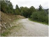
From the parking lot, we continue on the road closed to traffic, which after a few dozen steps brings us to Planina Kuk, where in the summer time we can buy homemade milk products (sour milk, cheese, curd).
The road ahead starts gently ascending and brings us after some time to the next gate. After the gate, the path goes into the forest and ascends almost imperceptibly, occasionally even slightly descending. After one hour of walking, the path brings us to Planina Razor, where there is the mountain hut.
From the hut, we continue in the direction of Vogel on a gentle path to the next junction, where we turn right again in the direction of Vogel (left Tolminski Kuk). Here the path moderately ascends over a panoramic slope and after a short ascent brings us into the forest, where it continues for the next few minutes to the next junction. Here we continue right in the direction of Vogel, left Globoko and the path soon brings us among the dwarf pines, where it ascends amid increasingly beautiful views. A little higher, the path bypasses Krnica on the left side and in a moderate traverse ascent over the increasingly steep slope ascends to the saddle between Vogel and Žabiški Kuk.
Here we continue right (left Vogel) along the ridge initially slightly downhill. The path, which is increasingly poorly visible, then moderately ascends along and on the ridge, which is in places very precipitous, but the path is nowhere seriously exposed. A little higher, the path crosses to the right western side of the ridge and with the help of cairns crosses the slopes towards the south. A little below the summit, the path ascends somewhat more steeply again and brings us to the summit of Žabiški Kuk.
Planina Kuk - Planina Razor 1:00, Planina Razor - Žabiški Kuk 2:00.

The trip can be extended to the following destinations: Vogel
Photos:
 1
1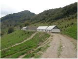 2
2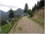 3
3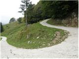 4
4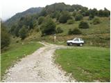 5
5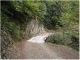 6
6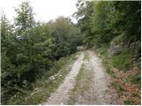 7
7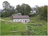 8
8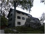 9
9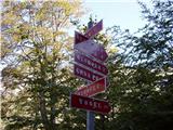 10
10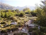 11
11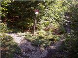 12
12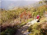 13
13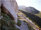 14
14 15
15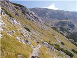 16
16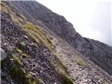 17
17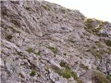 18
18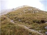 19
19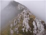 20
20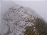 21
21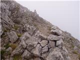 22
22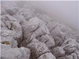 23
23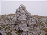 24
24
Discussion about the trip Planina Kuk - Žabiški Kuk (via planina Razor)
|
| damijanp26. 08. 2018 |
From Planina Kuk there is also a marked direct path to Žabiški Kuk. The path branches off from the path to Planina Razor; the junction is well marked. Some pictures at:
Žabiški Kuk, Vogel
|
|
|
|
| darinka421. 07. 2020 |
Yesterday we decided for Žabijski Kuk from Planina Kuk. Let me say that part of the road has been renovated. Last time it was in much worse condition. All four of us for the first time on this steep but scenic trail. We were alone at the summit. With beautiful views. Continued to Vogel, as it's quick to get there. There was a lot of visitors. Descended to the Bohinj side via Globoko saddle and to Planina Razor and the starting point.
|
|
|
To post a comment you must log in:
If you do not yet have a username, you must first
register.