Planina pod Golico (Betel) - Belska planina (Svečica)
Starting point: Planina pod Golico (Betel) (980 m)
| Latitude/Longitude: | 46,47060°N 14,05990°E |
| |
Walking time: 2 h 15 min
Difficulty: easy unmarked way
Elevation gain: 720 m
Elevation difference along the route: 720 m
Map: Karavanke - osrednji del 1:50.000
Recommended equipment (summer):
Recommended equipment (winter): ice axe, crampons
Views: 9.193
 | 1 person like this post |
Access to starting point:
From the Ljubljana - Jesenice motorway we take the Lipce exit (or Hrušica) and continue on the road towards Jesenice, where signs for Planina pod Golico direct us onto the ascending road (the junction is marked and located at the health centre in Jesenice). The relatively steep road soon brings us to the mentioned village, where in May we can admire the blooming of narcissi in the surrounding meadows. From Planina pod Golico we continue to the next intersection, where numerous hiking signposts are visible. Here we continue right and drive another good 50 m to the parking area below Savske jame.
Route description:
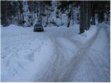
From the parking area we continue straight along the road, beside which we notice signs for Golica and the Savske jame toboggan run (if we walk a few steps back from the parking area the path leads past Kmečki turizem Betel).
After 10 minutes of walking the toboggan run and one of the marked paths towards Golica turn left and begin to ascend more steeply from Korlnov rov. We continue straight and keep ascending along the wider road that runs beside Črni potok.
The path then brings us to a junction where we cross another road and continue straight in the direction of the marked path towards Golica. We continue ascending along a poorer and in places quite overgrown cart track. About 10 minutes higher we cross the road once more (if we continue left along it we reach the lower station of the freight cableway leading to Koča na Golici; to the right we return to the starting point). After the road we also cross a pasture fence and then step onto the grassy slopes of Markljev Rovt, where a few private houses stand.
At Markljev Rovt the path forks. We take the right trail that ascends gently beside the torrent bed (slightly left leads the path to Golica via Sedlo Suha). Higher up the path becomes somewhat steeper, crosses the torrent and then turns right, where after a few more minutes of walking it joins the road from Pusti Rovt.
We follow the road to the left (right leads to Pusti Rovt and Križovec) and quickly reach a fork where we turn right following the signs for Struška (here too one of the paths to Golica leads left). Just a few steps further we reach a newer forest road and follow it to the right (straight ahead the old marked path and Sedlo Kočna continue).
The road subsequently passes onto the slopes of Struška, across which we ascend transversely to the right. The path first leads through forest, then higher across a scenic avalanche slope. The gradient eases higher up and we ascend through the last belt of dense forest to Belska planina or Svečica, where a mountain shepherd's hut stands and from where a splendid view opens.
Starting point - Korlnov rov 0:10, Korlnov rov - Markljev Rovt 0:50, Markljev Rovt - Pusti Rovt 0:15, Pusti Rovt - turn-off for Struška 0:05, turn-off for Struška - Belska planina 0:55.

Photos:
 1
1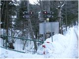 2
2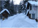 3
3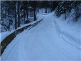 4
4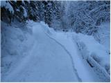 5
5 6
6 7
7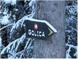 8
8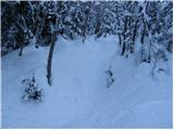 9
9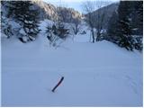 10
10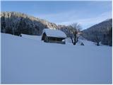 11
11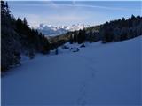 12
12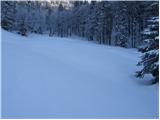 13
13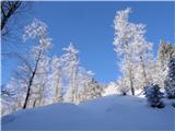 14
14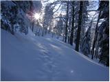 15
15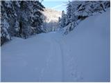 16
16 17
17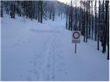 18
18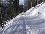 19
19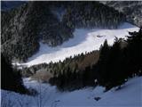 20
20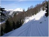 21
21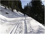 22
22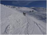 23
23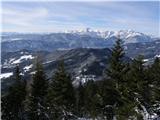 24
24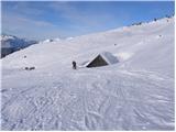 25
25
Discussion about the trip Planina pod Golico (Betel) - Belska planina (Svečica)
|
| srečko5514. 08. 2024 22:00:54 |
Inhospitality in the hut on Belska planina. On August 12, 24, I went from Stol to Golica. By unfortunate coincidence, I ran out of water shortly before the hut on Belska planina. When I arrived at the hut, I asked if it was possible to get or buy some water to have until the hut below Golica. The arrogant reply of the plump lady cooling her ass in the shade was: WE BRING OUR OWN WATER UP HERE!! Such a reply and unwillingness to help in the mountains only shows the attitude of some who have their asses full of everything. They should be ashamed to the bottom of their hearts, also the couple watching nearby, like what are you even looking for here. Well, with a bit more effort I still reached Golica, where I thoroughly quenched my thirst. I must also say that from Belska planina to the hut on Golica it's a good two hours walk. Still, I must thank the lady for the "hospitality", but all others stay far away from the hut on Belska planina.
|
|
|
|
| ljubitelj gora19. 08. 2024 12:47:40 |
Some take such things as sarcasm and will return there, others won't. You don't go back there anymore and if most of us are like that, not tolerating such behavior, they will quickly realize where the cause is.
|
|
|
|
| Svečica 20. 08. 2024 15:33:37 |
There is a shepherd's hut on Belska planina. Anyone who kindly asks for water gets it, but it's true that the tap water is not drinkable. The gentleman has already shown his culture and friendliness with what was written. Arrogance doesn't belong in the mountain pasture.
|
|
|
|
| jprim21. 08. 2024 15:55:01 |
@srečko 55
Your statements also point to your arrogant ass.
Best regards!
|
|
|
|
| Majdag6. 06. 2025 13:56:37 |
4.6.... Hikers, you retirees from Jav. Kor. Bela, we roamed around Belska planina on Wednesday. No more Avrikeljna, but still plenty of Zojsovih vijolic and gentians. We ascended to the planina via the forest road. On the way back, we took steps past Korenščica and along the border to sedlo Kočna. A bit steep, but a nice path. It was nice..
https://jelenkamenmajdag.blogspot.com/2025/06/med-rozice-na-belsko-planino.html
|
|
|
|
| lepenatka6. 06. 2025 16:46:50 |
We met on Belska planina
|
|
|
To post a comment you must log in:
If you do not yet have a username, you must first
register.