Planina pod Golico (Betel) - Koča na Golici (winter way)
Starting point: Planina pod Golico (Betel) (980 m)
| Latitude/Longitude: | 46,47060°N 14,05990°E |
| |
Route name: winter way
Walking time: 1 h 35 min
Difficulty: partly demanding marked way
Elevation gain: 602 m
Elevation difference along the route: 602 m
Map: Karavanke - osrednji del 1:50.000
Recommended equipment (summer):
Recommended equipment (winter): ice axe, crampons
Views: 10.423
 | 1 person like this post |
Access to starting point:
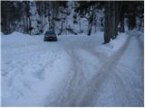
Leave the Gorenjska motorway (Ljubljana–Jesenice) at the Lipce exit (or possibly Hrušica) and follow the road towards Jesenice. In the town, directional signs for Planina pod Golico direct us right (if coming from the direction of Hrušica, left) onto the ascending road (the junction is marked and is located at the Jesenice Health Centre). The relatively steep road soon takes us to the mentioned village, where in May we can admire the blooming of narcissi in the surrounding meadows. From Planina pod Golico we continue driving to the next intersection with numerous mountain trail signs. Here we turn right in the direction of Golica, then after the end of the settlement we drive another good 50 metres to the parking lot under Savske jame.
Route description:
From the parking lot we walk back a few dozen steps and head towards Kmečki turizem Betel (if we continue up the road, we can reach Golica via the path past Korlnov rov or via Savske jame). A short ascent follows on the asphalt road and we soon arrive at Kmečki turizem Betel; after it we turn right from the junction in the direction of Golica.
A few minutes higher we reach the hut Pri Fencu (Apartments Pri Fencu); here we pay attention to the marked trail branching off to the right that starts behind the apartments.
We continue on the wide marked path that first ascends across a small meadow, then enters a narrow strip of forest and a little higher a dense forest. About 15 minutes of ascent through the forest follows, guided near a stream, after which we reach a gravel road that we follow to the right. On it we walk to the marked junction at the lower station of the freight cable car that leads towards Koča na Golici.
Here we join the previously mentioned path that leads past Korlnov rov, but we go only a little further left in the direction of Koča na Golici and Golica, where the path immediately branches again.
At the lower station of the freight cable car we notice a directional sign with the inscription "zimska pot", which directs us slightly left into the forest (slightly right leads the usual summer path). Our path ascends transversely, then enters a strip of sparse forest where it crosses a short, slightly avalanche-prone slope. Further on we enter a gully that we follow only briefly, as the markings soon direct us left onto a steep, forest-covered slope. After a few minutes the steepness eases and we reach a side ridge where the path turns right. We ascend along the ridge, which later even descends slightly, then it brings us to a steep jump. Up to the middle of the jump we climb straight up, after which we have two options for continuing: we can head slightly right along an exposed ledge (risk of slipping) or continue straight on steep, partly rocky terrain (both options are exposed to avalanche and slip).
Only a little higher the two paths rejoin and lead us over increasingly scenic terrain to Koča na Golici.
Starting point - lower station of the freight cable car 0:35, lower station of the freight cable car - Koča na Golici 1:00

Along the route: Kmečki turizem Betel (1000m), Apartments pri Fencu (1050m), Sp. postaja tovorne žičnice (1205m)
Photos:
 1
1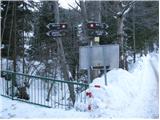 2
2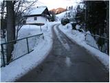 3
3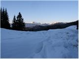 4
4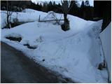 5
5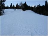 6
6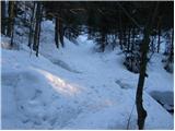 7
7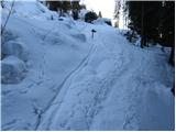 8
8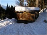 9
9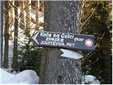 10
10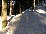 11
11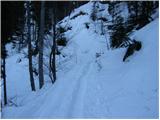 12
12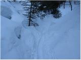 13
13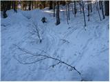 14
14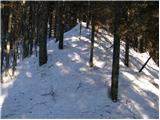 15
15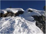 16
16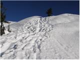 17
17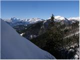 18
18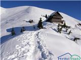 19
19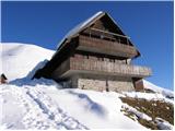 20
20
Discussion about the trip Planina pod Golico (Betel) - Koča na Golici (winter way)
|
| marezt8. 01. 2018 |
Has anyone hiked here in the last few days?
|
|
|
|
| trdi9. 01. 2018 |
I was up there on 7.1.2018. From the lower cable car station both summer and winter paths were trodden. I went on the winter path, which was quite well trodden, but the snow sank considerably due to high temperatures. Still, it went fine without crampons or snowshoes, only the last part right before the hut, where there are a couple of pegs, was a bit dangerous, as you could easily slip in the south-facing snow. On the way back, I put on crampons (small ones) for that part. From the hut I first wanted to descend the summer path, but from the hut to the start of the forest there was quite deep snow, so it sank to my waist right from the hut, so I went back down the winter path too.
|
|
|
To post a comment you must log in:
If you do not yet have a username, you must first
register.