Planina Ravne - Kocbekov dom na Korošici (via Vrtače)
Starting point: Planina Ravne (1500 m)
| Latitude/Longitude: | 46,34930°N 14,69970°E |
| |
Route name: via Vrtače
Walking time: 3 h 15 min
Difficulty: easy marked way
Elevation gain: 308 m
Elevation difference along the route: 625 m
Map: Kamniške in Savinjske Alpe 1:50.000
Recommended equipment (summer):
Recommended equipment (winter): ice axe, crampons
Views: 4.810
 | 1 person like this post |
Access to starting point:
A) First, we drive to Kamnik, then continue driving towards Stahovica and the Črnivec pass. A few hundred meters before the Črnivec pass, we leave the main road leading towards Gornji Grad and continue sharply left towards the Volovljek pass (Kranjski Rak). From the said pass, we continue straight ahead (left road to Velika planina, right Štajerski Rak) and begin descending towards Luče. Lower down, the road levels out somewhat and takes us into the Podvolovljek valley. Further on, we first drive past the junction of the road leading into the Lučka Bela valley, then also past the bar at Gams. After the bar, we pay attention, as just a few hundred meters further a road branches off to the left towards the mountain pastures Podvežak and Ravne and the Planinšek farm (at the spot where we leave the main road, the road sign indicates approximately 11 km). Further on, we drive on the initially still asphalted road, which then ascends towards the Dleskovska plateau. Higher up, the road to Planinšek branches off to the right, but we continue on the upper left road, which shortly brings us to the next junction, where we go straight towards the Ravne mountain pasture (left Podvežak mountain pasture). Further on a somewhat rougher road, which we follow to the start of the Ravne mountain pasture, where we park in a suitable spot by the road.
From the main road to the Ravne mountain pasture is approximately 10 km.
B) First, we drive to Luče, then continue driving towards Kamnik. When we notice the road sign by the road indicating 10.5 km, we pay attention to the right junction, as shortly after a road branches off to the right towards the mountain pastures Podvežak and Ravne and the Planinšek farm. Further on, we drive on the initially still asphalted road, which then ascends towards the Dleskovska plateau. Higher up, the road to Planinšek branches off to the right, but we continue on the upper left road, which shortly brings us to the next junction, where we go straight towards the Ravne mountain pasture (left Podvežak mountain pasture). Further on a somewhat rougher road, which we follow to the start of the Ravne mountain pasture, where we park in a suitable spot by the road.
Route description:
At the beginning of the mountain pasture Ravne (also Ravni) we notice wooden mountain signposts for Veliki vrh, Korošica, Molička planina and Dolgo trato, which direct us left towards the nearby cottage located on the edge of the mountain pasture. We bypass the cottage on the left side, then enter a narrow strip of forest where the blazes lead us left. The path ahead leads across a clearing, across which it ascends transversely into the forest. Further on, we ascend through the forest, where we soon cross a grazing fence. Higher up, the forest begins to thin out or turns into a belt of dwarf pines. In some places somewhat less trodden but always nicely followable, the path levels out higher and brings us to the lower edge of the pastures of Dolgih trat. Here the path completely levels out and in a few dozen steps of further walking brings us to the shepherd's hut on Dolgih tratah.
From the shepherd's hut we continue left in the direction of Molička planina, Korošica, Veliki vrh and Zelenih trat (slightly right Dleskovec). The path ahead leads across the pastures of Dolge trate and ascends gently to moderately. Higher up, the path levels out and brings us to a smaller saddle, behind which it leads us past a watering hole for animals. We bypass the watering hole on the left side, and the path brings us just a few meters further to a small junction, where we continue slightly left in the direction of Korošica via Vrtač (slightly right Veliki vrh and Korošica via Zelenih trat).
From the junction onwards, the path begins to descend transversely to the right, crossing mainly dwarf pine-covered slopes of Dleskovec. Lower down, from the slope we arrive in a flat plateau world full of sinkholes and smaller depressions. The well-marked and nicely followable path continues with some shorter ascents and occasionally somewhat longer descents. A little further, we arrive at a marked junction, where the path to Molička planina and Korošica via Molička planina branches off to the right, but we continue left in the direction of Planina Podvežak. In the direction of Planina Podvežak we walk only a few steps, then continue right in the direction of Korošica. From the junction onwards, the path gradually begins to ascend moderately, bringing us a little higher to the point where we join the usual path Planina Podvežak - Korošica.
We continue right in the direction of Korošica and follow the path which continues with some shorter ascents and descents, running past numerous sinkholes. With a view of Ojstrica, Velika Zelenica and Veliki vrh, we gradually arrive at the spot where the path crosses a steeper rocky slope. On the section where we cross the steep slope, a nice view opens towards Olševa, Peca and Raduha, and the path shortly brings us into a small valley, where a marked path from Robanov kot and Molička planina joins from the right.
We continue in the direction of Korošica and ascend transversely to Sedelce, where the next marked junction is.
We continue straight downhill (left Prag, right Ojstrica via Mala Ojstrica) along the marked path which begins descending towards Korošica. After a few minutes of descent, we step onto the extensive grassy slopes of Korošica, across which we then walk in a few minutes to the mountain hut.

Photos:
 1
1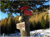 2
2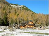 3
3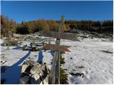 4
4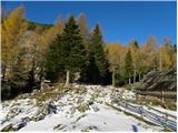 5
5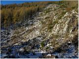 6
6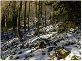 7
7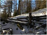 8
8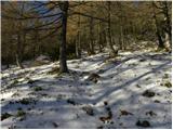 9
9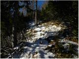 10
10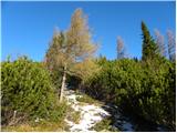 11
11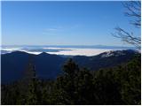 12
12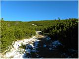 13
13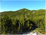 14
14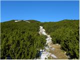 15
15 16
16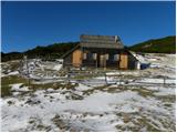 17
17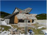 18
18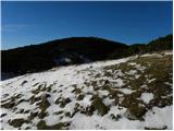 19
19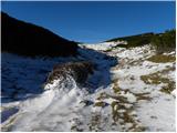 20
20 21
21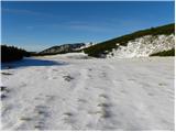 22
22 23
23 24
24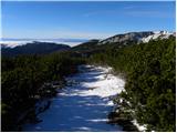 25
25 26
26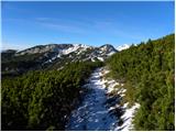 27
27 28
28 29
29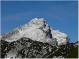 30
30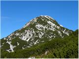 31
31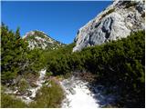 32
32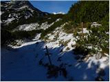 33
33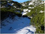 34
34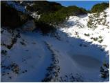 35
35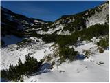 36
36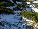 37
37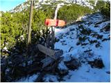 38
38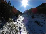 39
39 40
40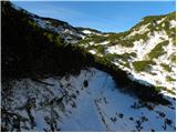 41
41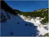 42
42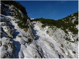 43
43 44
44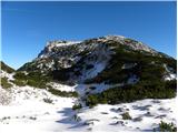 45
45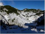 46
46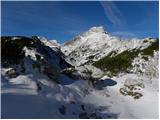 47
47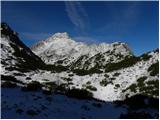 48
48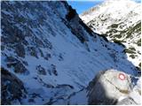 49
49 50
50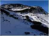 51
51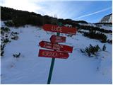 52
52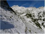 53
53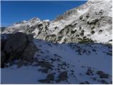 54
54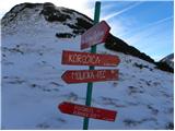 55
55 56
56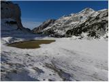 57
57 58
58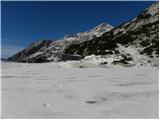 59
59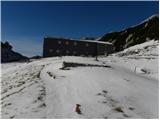 60
60
Discussion about the trip Planina Ravne - Kocbekov dom na Korošici (via Vrtače)
To post a comment you must log in:
If you do not yet have a username, you must first
register.