Planinski dom Kalnik - Vranilac (Kalnik) (climbing way)
Starting point: Planinski dom Kalnik (480 m)
Route name: climbing way
Walking time: 30 min
Difficulty: difficult marked way
Elevation gain: 163 m
Elevation difference along the route: 163 m
Map:
Recommended equipment (summer):
Recommended equipment (winter):
Views: 4.493
 | 1 person like this post |
Access to starting point:
From the Zagreb - Varaždin motorway, take the Sveta Helena exit, then follow the road towards Vrbovec. The motorway (in 2012 only half-built, as it is still under construction) takes us to the village of Gradac, where we turn right towards Sveti Ivan Žabno, from where we continue towards Križevci. From Križevci onwards, orientation is easy, as the mountain hut and Stari grad Veliki Kalnik can be seen from afar. We reach the mentioned mountain hut without major difficulties by car, which we park in the large parking lot near the hut.
Route description:
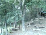
From the hut we head west, first through sparse forest, then through partly spruce forest. The path continues past two junctions, where we keep towards the Vranilac summit at both. About 10 minutes higher we reach the asphalt road leading to the TV tower (the road is for TV tower purposes and closed to public traffic).
While walking on the road, the path from Borje village joins from the left, two minutes higher the normal path to the summit branches right. We continue on the road only to the fence of the nearby TV tower, then left along the fence (at first it looks like there is no path). We continue briefly along the fence, then enter the forest on a steep slope.
Just after the fence ends, we notice the sign for Vranilac, directing us to a steep and slightly overgrown path. Upon reaching the overhanging cliff, go right, and at the next bend the demanding section begins. Initially the ascent is quite challenging, then we reach a rocky ridge where we can rest briefly.
Further, the marker on the overhanging rock directs us right towards the east, soon reaching the most difficult part. We continue on a very narrow path under a small overhang above exposed overgrown slopes (there used to be a fixed cable here, but it is gone now). After crossing the exposed passage, easier climbing on partly rocky slopes awaits. The path quickly leads to the ridge, where we go left to the nearby summit.

Photos:
 1
1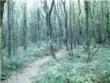 2
2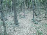 3
3 4
4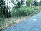 5
5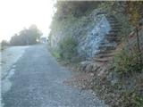 6
6 7
7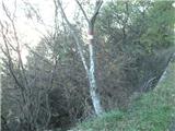 8
8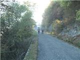 9
9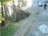 10
10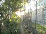 11
11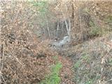 12
12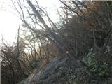 13
13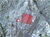 14
14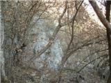 15
15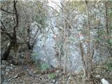 16
16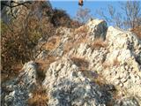 17
17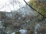 18
18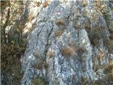 19
19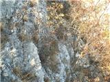 20
20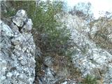 21
21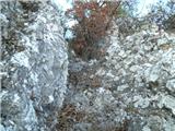 22
22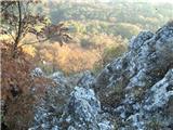 23
23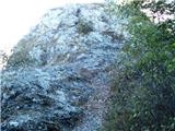 24
24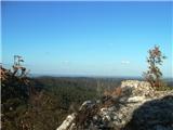 25
25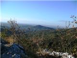 26
26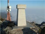 27
27
Discussion about the trip Planinski dom Kalnik - Vranilac (Kalnik) (climbing way)
|
| jprim22. 11. 2012 |
I'm wondering who rates the difficulty of newly described paths.
Is the difficulty taken from some guidebook or is it completely subjective.
Best!
|
|
|
|
| Tadej22. 11. 2012 |
The difficulty of the path is always marked subjectively, although we try to mark it as objectively as possible (according to the classification of hiking path difficulties).
|
|
|
|
| Marx22. 11. 2012 |
Okay, I'll try comparing it to difficult paths that I've visited myself...
Sedam zubi / Kalnik - easier in individual sections
Pogačnikova pot na Grmadi - a tiny bit easier
Presedljaj-Konj (KSA) - a tiny bit harder
Skala na Konjski gori - harder
Lavamünd - easier
Velike pečine/Ravna gora - easier
Donačka gora - harder
Hudičev graben - harder
Krvavica (okno) harder
Okić(Samobor) - harder than both paths (Žohar and Dragojla)
But, as Tadej also said, difficulty is really subjective and differs for each individual. When I first went to Skala (Konjice) it seemed easy to me, but the second time I realized how demanding it really is... On Donačka gora I gave up on the first jeklenica, now I walk it with one hand. The only problem on that climbing path is that there's nothing to assist us, unfortunately the jeklenica that disappeared a couple of years ago hasn't been renewed yet. When we reach the overhanging traverse, we need to very carefully search for handholds on the rock and then it goes...
Why didn't I give that path a very difficult rating? Because strength in the arms isn't decisive. Why not partially difficult? Because we'll have to use our hands in any case.
|
|
|
|
| Marx4. 08. 2013 |
Today (03.08.2013.) I climbed the path. Unfortunately, the entrance to the climbing section where we branch off from the small bypass is even more overgrown and the rock in picture 14 is harder to find... but it goes.
|
|
|
|
| smatjaz7. 10. 2018 |
Was up there today, from the Kalnik hut along the ridge 7 teeth and then a short via ferrata officially rated C/D and it is indeed so.
|
|
|
To post a comment you must log in:
If you do not yet have a username, you must first
register.