Planinski dom pri Gospodični - Trdinov vrh
Starting point: Planinski dom pri Gospodični (822 m)
| Latitude/Longitude: | 45,76540°N 15,29550°E |
| |
Walking time: 55 min
Difficulty: easy marked way
Elevation gain: 356 m
Elevation difference along the route: 356 m
Map: Dolenjska 1:50.000
Recommended equipment (summer):
Recommended equipment (winter): ice axe, crampons
Views: 48.624
 | 2 people like this post |
Access to starting point:
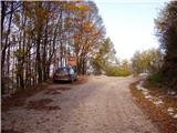
a) From the direction of Dolenjska (Novo mesto or Otočec): From the motorway we head to the exit Novo mesto or Otočec and continue driving towards the village Velike Brusnice. From there we follow the main road towards the village Gabrje. Just before entering the built-up area of Gabrje we reach a junction where we turn left (the right direction leads to the centre of the village Gabrje). The road then takes us past the church and begins to ascend towards Gorjanci. We follow the signs for Planinski dom pri Gospodični at all times until we reach a larger arranged parking area by the road, located approximately 100 metres above the mountain hut itself.
b) From the direction of Bela krajina (Metlika): From Metlika we drive along the main road towards Novo mesto, but only as far as the Vahta road pass. At the pass we turn right onto a forest gravel road. We then follow this road for approximately 10 kilometres, always keeping the direction towards Gospodična. The road leads us to the parking area by the road, located approximately 100 metres above the mountain hut.
Route description:
From the parking area we return a few dozen steps in the direction of access to the starting point, then turn onto the footpath towards Trdinov vrh. After a short moderate ascent we reach the indistinct side ridge of Logarjev kogel, which the path soon leaves and leads us to a forest road that we merely cross. This is followed by some more ascent along the slopes of Logarjev kogel, where the marked path bypasses the summit on the right side, then temporarily descends to the forest road we crossed a few minutes earlier.
We continue along the road for a short time, where another marked path from Jugorje pri Metliki joins from the right. In the middle of a longer left bend we turn right onto a footpath that ascends somewhat more steeply through the forest. Higher up the forest thins out and with fine views we reach the registration box and the viewpoint plaque on Trdinov vrh.
A little further on are the chapel of sv. Jere and the transmitters visible from afar.
Photos:
 1
1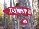 2
2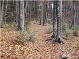 3
3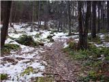 4
4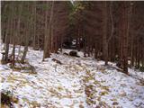 5
5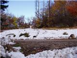 6
6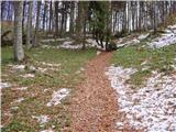 7
7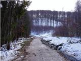 8
8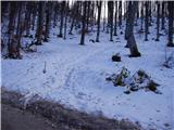 9
9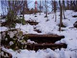 10
10 11
11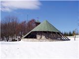 12
12
Discussion about the trip Planinski dom pri Gospodični - Trdinov vrh
|
| andrej jerina19. 10. 2008 |
Today we did a family trip to the mentioned summit. Beautiful autumn trip through a forest of golden colors. On some sections the path is a bit steeper, but with persistent coaxing of the children, it all pays off. Today there were no nice views due to fog, but satisfaction remains. Highly recommend for a family trip with children.
|
|
|
|
| brankobr21. 11. 2008 |
for all "dolenjska" former members of AO section
PD zeleznicar LJ - obligatory tour, at least once a year, or once a month
and specifically only downhill.
|
|
|
|
| brankobr20. 12. 2009 |
winter is back and early morning winter visits to trdinov vrh will settle into the soul. especially if there's dry snow..
|
|
|
|
| balon13. 11. 2023 11:58:14 |
Hello,
I'm interested in where the stamp is located.
Best regards,
Alen
|
|
|
|
| DVas13. 11. 2023 14:53:51 |
The Trdinov vrh stamp is located at that circle with the map. Around it you'll find at least 2 stamps. I think there are three.
|
|
|
|
| balon7. 12. 2023 08:12:38 |
Thanks for the reply.
Alen
|
|
|
|
| belarutka25. 12. 2025 16:44:57 |
Hello.
Does anyone know if the trail to the summit is well-trodden and suitable for a family hike (of course with proper footwear and clothing)?
Thank you very much for your reply.
|
|
|
To post a comment you must log in:
If you do not yet have a username, you must first
register.