Plöckenpass - Cresta Verde / Grüne Schneid
Starting point: Plöckenpass (1360 m)
| Latitude/Longitude: | 46,60270°N 12,94470°E |
| |
Walking time: 2 h 10 min
Difficulty: easy marked way
Elevation gain: 726 m
Elevation difference along the route: 735 m
Map: Tabacco 09 1:25.000
Recommended equipment (summer):
Recommended equipment (winter): ice axe, crampons
Views: 1.330
 | 2 people like this post |
Access to starting point:
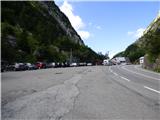
From Trbiž / Tarvisio we head onto the motorway towards Videm / Udine. We leave the motorway at the exit for Tolmezzo. Then we follow the signs for Austria and the pass Passo di Croce Carnico / Plöckenpass. Still on the Italian side of the pass, we park on a large parking lot.
Route description:
At the parking lot, we head onto a narrow road following the signs for Rifuggio Marinelli (path 146). Already after a few dozen meters, we come to a junction where we go right onto the military mule track, along which we then ascend through a sparse forest and meadows below the steep slopes of the mountain Creta di Collinetta (2238m). The military mule track turns into a footpath and soon we come to a marked junction, where the path to Creta di Collinetta and to Cresta Verde branches off to the right.
We can already here turn right towards Cresta Verde or continue left towards the mountain hut Marinelli. If we continue left, our path first gently ascends across grassy slopes and leads us to a small plain. From the left, an unmarked path from the mountain pasture Collinetta di Sotto joins here, and just a little after that we come to a marked junction.
Left leads path 146 towards the mountain hut Marinelli, but this time we turn right onto path 147 towards the ridge Cresta Verde. The gently sloping path first leads us across the alpine pasture and then below a steep rocky slope where we will also notice some military ruins. Here the path begins to ascend more steeply up the grassy slope and increasingly beautiful views of the surrounding peaks begin to open up. The path ascends mostly in zigzags and a little higher the already mentioned path joins from the right, which branches off from the path to Creta di Collinetta.
Further on, we continuously ascend the mostly grassy slope all the way to the ridge of Cresta Verde where along the path we will again notice numerous military ruins from the time of the First World War. From the right the path from the summit of Creta di Collinetta also joins here. On the ridge we can then continue left to the saddle where an unmarked path from the Austrian side also joins. Also around the saddle there are quite a few military trenches from the First World War.

Photos:
 1
1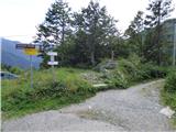 2
2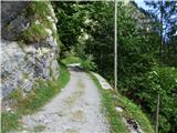 3
3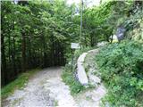 4
4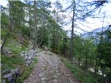 5
5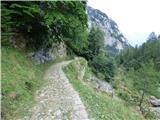 6
6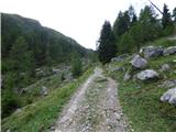 7
7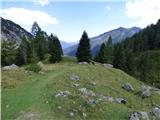 8
8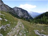 9
9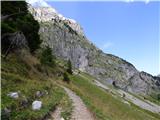 10
10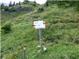 11
11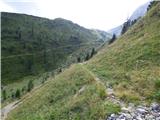 12
12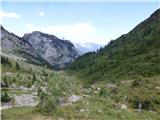 13
13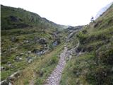 14
14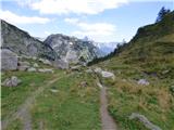 15
15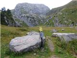 16
16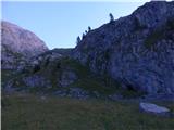 17
17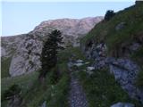 18
18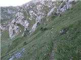 19
19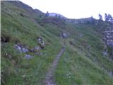 20
20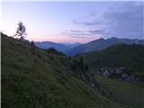 21
21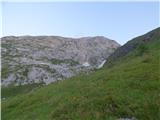 22
22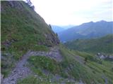 23
23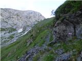 24
24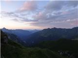 25
25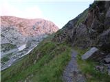 26
26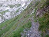 27
27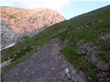 28
28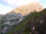 29
29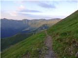 30
30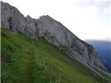 31
31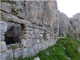 32
32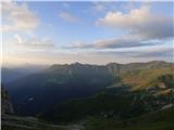 33
33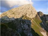 34
34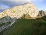 35
35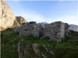 36
36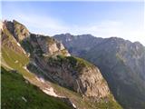 37
37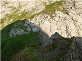 38
38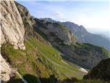 39
39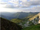 40
40
Discussion about the trip Plöckenpass - Cresta Verde / Grüne Schneid
To post a comment you must log in:
If you do not yet have a username, you must first
register.