Plöckenpass - Creta della Chianevate / Kellerspitzen (via Cresta Verde)
Starting point: Plöckenpass (1360 m)
| Latitude/Longitude: | 46,60270°N 12,94470°E |
| |
Route name: via Cresta Verde
Walking time: 5 h
Difficulty: very difficult marked way
Elevation gain: 1409 m
Elevation difference along the route: 1510 m
Map: Tabacco 09 1:25.000
Recommended equipment (summer): helmet, self belay set
Recommended equipment (winter): helmet, self belay set, ice axe, crampons
Views: 1.450
 | 2 people like this post |
Access to starting point:
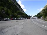
From Trbiž / Tarvisio, we head onto the highway towards Videm / Udine. We leave the highway at the exit for Tolmezzo. Continuing, we follow the signs for Austria and the mountain pass Passo di Croce Carnico / Plöckenpass. Still on the Italian side of the pass, we park on a large parking lot.
Route description:
At the parking lot, we head onto a narrow road following the signs for Rifuggio Marinelli (path 146). Already after a few dozen meters, we come to a junction where we go right onto a military mule track, up which we then ascend through a sparse forest and meadows below the steep slopes of the mountain Creta di Collinetta (2238m). The military mule track turns into a footpath and soon we come to a marked junction, where the path to Creta di Collinetta and to Cresta Verde branches off to the right.
We can already here turn right towards Cresta Verde or continue left towards the mountain hut Marinelli. If we continue left, our path first gently ascends across grassy slopes and brings us to a smaller plain. From the left, an unmarked path from the mountain pasture Collinetta di Sotto joins us here, and just a little further we come to a marked junction.
Left leads path 146 towards the mountain hut Marinelli, but this time we turn right onto path 147 towards the ridge Cresta Verde. The gently sloping path first leads us across the pasture and then brings us below a steep rocky slope where we will also notice some military ruins. Here the path starts to ascend more steeply across the grassy slope and increasingly beautiful views of the surrounding peaks begin to open up. The path ascends mostly in zigzags and a little higher, the already mentioned path that branches off from the path to Creta di Collinetta joins us from the right.
Further on, we continuously ascend the mostly grassy slope all the way to the ridge of Cresta Verde where along the path we will again notice numerous military ruins from the time of the First World War. From the right, the path from the peak Creta di Collinetta also joins here. We continue left along the grassy ridge, which brings us below the eastern slopes of the peak Creta di Collina. Here from the Austrian side, an unmarked footpath also joins.
After that, the path becomes more demanding and mostly runs along steep grassy slopes, and occasionally some easy climbing is also needed. A little higher, the path turns left and brings us onto somewhat more rocky terrain. The slope becomes a shade steeper and at the somewhat more exposed crossing, a short rope also helps us. The path then turns right and along the gully brings us back onto grassy terrain where the steepness eases slightly. The path then turns left and brings us onto the southeastern slopes along which the ascent is no longer demanding. The footpath here is somewhat less visible; for orientation, the blazes (red dots) and cairns help us. Continuing, we ascend towards the ridge, and the slope becomes increasingly rocky. When we reach the ridge, which is precipitous on the northern side, we continue left and soon reach the summit.
From the summit, we continue along the initially exposed ridge, then the path turns slightly left and descends to a junction near the bivouac.
From the left, path 171 joins, down which we can later descend. At the junction, we continue right along a wide ledge past the bivouac and some military ruins to a smaller notch. Here the path turns left and becomes more demanding. It is an old military path that was recently re-equipped with steel cables. Further, the path runs along the left southern side of the ridge towards the west. The path is occasionally quite exposed but on the more difficult sections is well secured with a steel cable. The path then bypasses the somewhat less pronounced summit Krone (2744m) and approaches the ridge again. Along the path, we will also notice a natural window and a few shorter military trenches. Continuing west along somewhat exposed ledges, we often also ascend somewhat more steeply. In the final section, we first descend slightly, then follows the final ascent up a steep chute, which is well secured with a steel cable. At the top of the chute, the path turns right and after a short ascent we soon reach the panoramic summit.
The described path to the summit of Creta di Collina is not secured and for the less experienced, additional protection with a rope is recommended.
We descend back to the bivouac and then descend along path 171, which runs along the southern side of the mountain Creta di Collina. Lower down, we join path 146, which leads towards the mountain hut Marinelli. In the lower part, the path is secured with a steel cable. Along path 146, we then return to the starting point at Plöckenpass.
The description and pictures refer to the conditions in 2018 (July).

Photos:
 1
1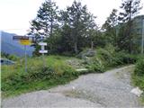 2
2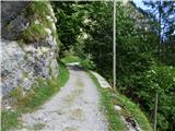 3
3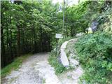 4
4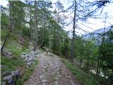 5
5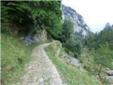 6
6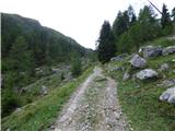 7
7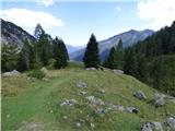 8
8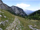 9
9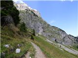 10
10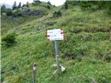 11
11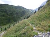 12
12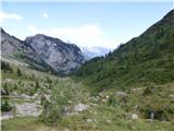 13
13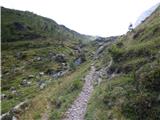 14
14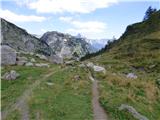 15
15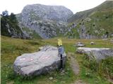 16
16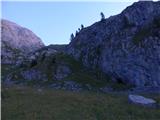 17
17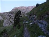 18
18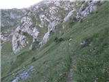 19
19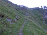 20
20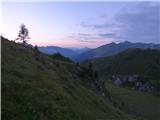 21
21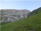 22
22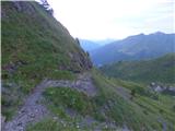 23
23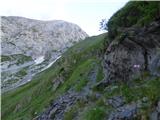 24
24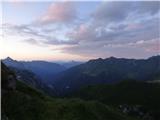 25
25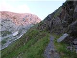 26
26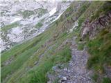 27
27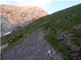 28
28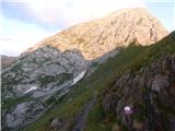 29
29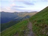 30
30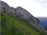 31
31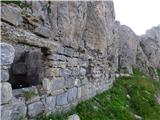 32
32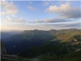 33
33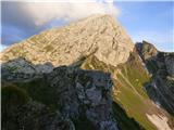 34
34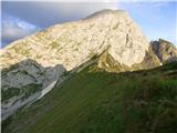 35
35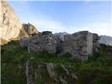 36
36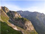 37
37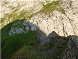 38
38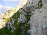 39
39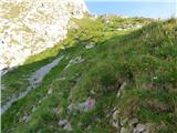 40
40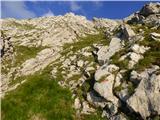 41
41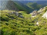 42
42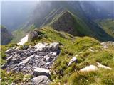 43
43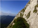 44
44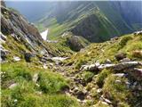 45
45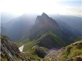 46
46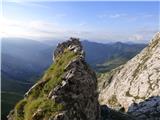 47
47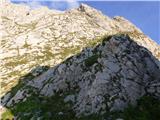 48
48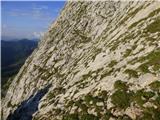 49
49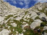 50
50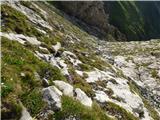 51
51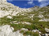 52
52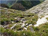 53
53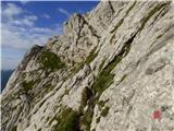 54
54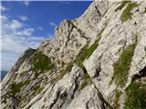 55
55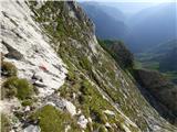 56
56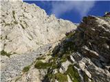 57
57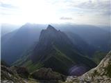 58
58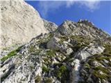 59
59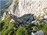 60
60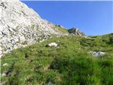 61
61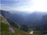 62
62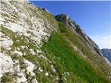 63
63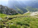 64
64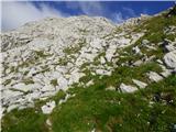 65
65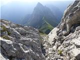 66
66 67
67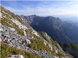 68
68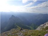 69
69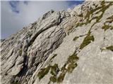 70
70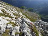 71
71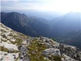 72
72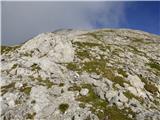 73
73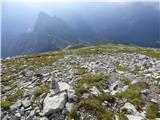 74
74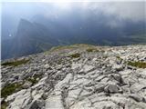 75
75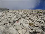 76
76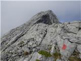 77
77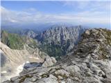 78
78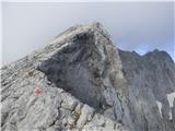 79
79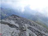 80
80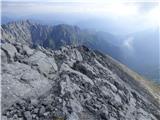 81
81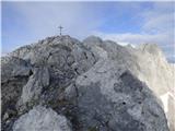 82
82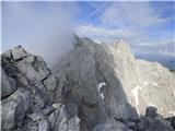 83
83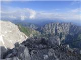 84
84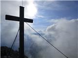 85
85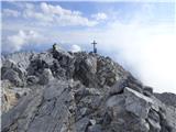 86
86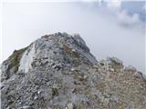 87
87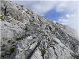 88
88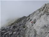 89
89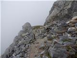 90
90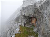 91
91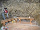 92
92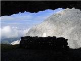 93
93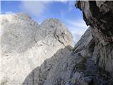 94
94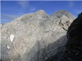 95
95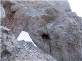 96
96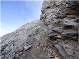 97
97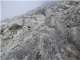 98
98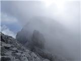 99
99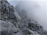 100
100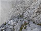 101
101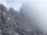 102
102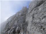 103
103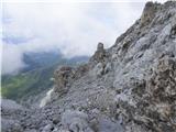 104
104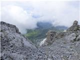 105
105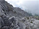 106
106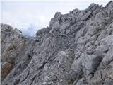 107
107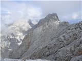 108
108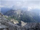 109
109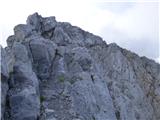 110
110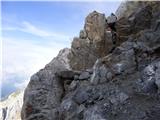 111
111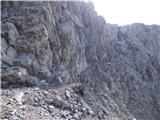 112
112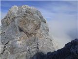 113
113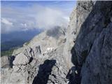 114
114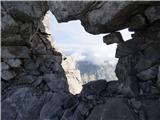 115
115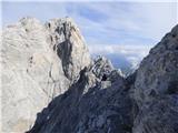 116
116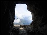 117
117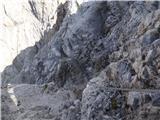 118
118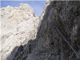 119
119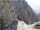 120
120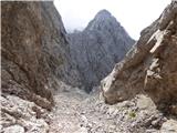 121
121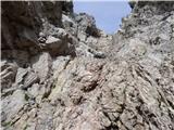 122
122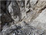 123
123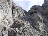 124
124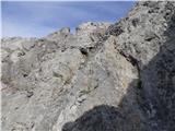 125
125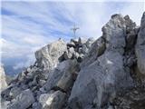 126
126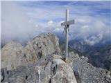 127
127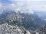 128
128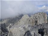 129
129 130
130
Discussion about the trip Plöckenpass - Creta della Chianevate / Kellerspitzen (via Cresta Verde)
|
| darinka422. 02. 2019 |
Nice interesting tour but quite a few years ago when we went. And we didn't have great views. Clouds covered the summit. And fog on descent. And I remember we met only one hiker the whole way. No bivouac that I remember. Maybe again sometime?
|
|
|
|
| Rok22. 02. 2019 |
I went on this path in July and the bivouac and protections were brand new. At some places the protections weren't attached yet, in the bivouac there was still equipment and tools for the secured path.
|
|
|
To post a comment you must log in:
If you do not yet have a username, you must first
register.