Plockenpass - Creta di Collinetta / Cellon (Ferata Senza Confini)
Starting point: Plockenpass (1360 m)
| Latitude/Longitude: | 46,60270°N 12,94470°E |
| |
Route name: Ferata Senza Confini
Walking time: 3 h 45 min
Difficulty: extremely difficult marked way
Via ferrata: D
Elevation gain: 878 m
Elevation difference along the route: 880 m
Map: Tabacco 09
Recommended equipment (summer): helmet, self belay set, lamp
Recommended equipment (winter): helmet, self belay set, ice axe, crampons, lamp
Views: 13.419
 | 4 people like this post |
Access to starting point:
From Ljubljana on the Gorenjska motorway, exit Hrušica, continuation over the border crossing Rateče to Trbiž. There we turn onto the motorway, which we leave at exit Tolmezzo. Here at the roundabout, we choose the second exit and continue in the direction of Passo di Monte Croce (Plöckenpass). We drive past the places Arta Terme, Paluzza, and Timau. The road from here on starts to rise steeply and in the upper part with its zigzags takes care of loosening up the arms and the car steering wheel. We drive to the upper platform of the mountain pass, where we can park. For the entire route from Ljubljana to the parking lot, we need 2 hours and 30 minutes.
The route over the Gailtal valley is 10 minutes shorter.
Route description:
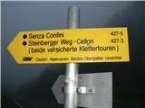
From the parking lot, we continue in the direction towards Austria (wind power plant) and on the left edge of the upper road we notice yellow markers for the path or ferrata "Senza Confini" with sign 427-5. The path on the right side of the hill rises gently to the next junction, where we choose the variant "Sentiero Storico". This runs through a tunnel, built for supply purposes in World War I, and here we can see with our own eyes the follies that they committed to maintain strategic positions at that time. The tunnel is high enough that one can walk normally, but it is very steep and mostly unsecured. It overcomes 100 elevation meters over a length of approx. 200 m and is not passable without a headlamp. The "Sentiero Storico" path simply must be experienced and I warmly recommend it.
After exiting the tunnel, there is a short ascent to the ridge Schulter right below our goal, where the signs again direct us towards our route. When continuing around the ridge towards the ferrata "Senza Confini", one must be careful. The signs are not always clearly visible and we may stray. Our direction is the wall above us, specifically the left side with a slanting gully, to which a small scree slope leads. Here we will pick up the markers again. Before entering the ferrata, there is a sign with the route designation and description as well as information on equipment and emergency calls. (It is wise to save these numbers in your phone so that in case of an accident we do not waste time figuring out the correct numbers). We equip ourselves with a helmet, climbing gloves, and self-belaying gear.
The ferrata is not easy to describe. It is extremely varied and everyone will find something for themselves in it. The initial rock above the warning sign warms us up and loosens us before the first big challenge. In front of us is a very steep, smooth slab to which no end is visible. It is equipped with brackets; the easiest way to tackle it is to have the cable between the legs and ascend the slab by pulling and stepping over between the brackets. At its top, the ferrata transitions into a mostly ridge traverse that is difficult to describe. Ascents, passages, and crossings constantly alternate. The difficulty here reaches all levels from A to D.
Exposure is mostly extreme, as there are deep vistas below us. The protections are good, the rock excellent. We progress quickly and soon spot the summit mass with the cross. The ferrata ends a little below it. On the continuation of the path to the summit, we can also view the remains of military positions. At the top, we can congratulate ourselves.
DESCENT: The easiest descent follows path 147 along the western slopes. To find its start, we first return to the junction in the summit area that we encountered on the ascent. We choose the right path and continue the descent along it. At junctions, always choose the direction leading downward. After crossing the rocky slope, the path turns into a good mule track that diagonally traverses the grassy steep slopes. Be careful at the junction for the Schulter ridge and the tunnels we see ahead. Do not go there. Our path turns downward a little before them and joins path 146 a bit lower. Through the valley, we continue to our starting point at Plöckenpass.

Photos:
 1
1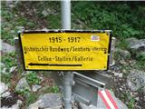 2
2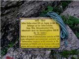 3
3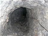 4
4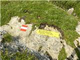 5
5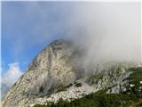 6
6 7
7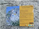 8
8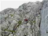 9
9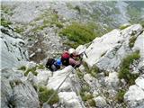 10
10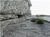 11
11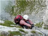 12
12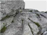 13
13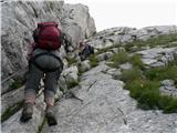 14
14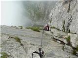 15
15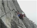 16
16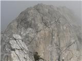 17
17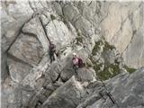 18
18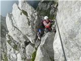 19
19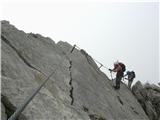 20
20 21
21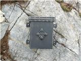 22
22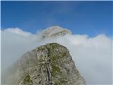 23
23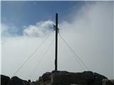 24
24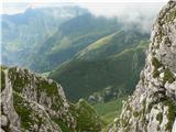 25
25 26
26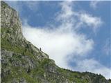 27
27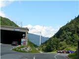 28
28 29
29
Discussion about the trip Plockenpass - Creta di Collinetta / Cellon (Ferata Senza Confini)
|
| mikk31. 07. 2010 |
Wonderful description...
I'm curious how much time you needed altogether, up and down with stops?
|
|
|
|
| bagi31. 07. 2010 |
Mikk. Altogether a bit less than 8 hours mainly due to the very interesting trail, photo-taking and enjoying views both into the depths and upwards  Can be done in about 7 hours, but on such a beautiful trail speed records make no sense. Can be done in about 7 hours, but on such a beautiful trail speed records make no sense.
LP Bagi
|
|
|
|
| bandy1. 07. 2012 |
Climbed the mentioned via ferrata. It should be noted that there is a new via ferrata at the start, which allows a nice loop tour (up the new via ferrata, Ferata Senza Confini descent via path 147 and then through the tunnel on return), which is much easier (the tunnel is very slippery so descent through it is easier). I highly recommend this tour, though it is physically demanding. Bagi has a very good description, it helped me a lot
|
|
|
|
| mirank1. 07. 2012 |
To above: ~5h tour not physically demanding at all to me. Ascent on slippery rocks in cave/gallery definitely easier than descent - both checked month ago. Just my humble opinion, judge yourself by experience; good luck.
|
|
|
|
| borlepadrino30. 08. 2016 |
Ferrata Senza Confini harder or easier compared to the initial part of ferrata 26 to Coglians???
|
|
|
|
| don kihott1. 09. 2016 |
Weg der 26er is the most difficult via ferrata in the Carnic Alps...
|
|
|
To post a comment you must log in:
If you do not yet have a username, you must first
register.