Plockenpass - Creta di Collinetta / Cellon (Via ferrata Steinberger Weg)
Starting point: Plockenpass (1360 m)
| Latitude/Longitude: | 46,60270°N 12,94470°E |
| |
Route name: Via ferrata Steinberger Weg
Walking time: 3 h
Difficulty: very difficult marked way
Elevation gain: 878 m
Elevation difference along the route: 900 m
Map: Tabacco 9, 1:25.000
Recommended equipment (summer): helmet, self belay set
Recommended equipment (winter): helmet, self belay set, ice axe, crampons
Views: 7.997
 | 2 people like this post |
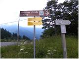
Access to starting point:
From Trbiž/Tarvisio we head onto the motorway towards Videm/Udine. At the settlement Carnico, we leave the motorway and first follow the signs towards the settlement Tolmezzo, then the signs for Austria and the pass Pso di Croce Carnico / Plöckenpass. Still on the Italian side of the pass, we park on the large parking lot.
Route description:
At the parking lot, we head onto the narrow road following the signs for Cellon (path 146). Already after a few tens of meters we come to a junction where we turn right onto the military mule track along which we then ascend through sparse forest and meadows under the steep slopes of Cellon mountain. The military mule track turns into a footpath and soon we also come to a junction, where we leave the path to the Marinelli hut and head right upwards. Here the path begins to ascend a bit more steeply across grassy slopes and then brings us to a path junction. We head right following the signs “Via ferrata Steinberger Weg”. The wide path continues crossing the precipitous slopes of the mountain towards the east and also leads us through a tunnel. The tunnel is short, so a lamp is not necessarily needed. Later the slope becomes less steep and the path turns left upwards. After a short ascent through sparse dwarf pines we soon come again to a junction. We continue right following the signs “Via ferrata Steinberger Weg”, while to the left leads the extremely demanding path “Via ferrata senza confini”. The mentioned path is difficulty grade D and is overhanging on some sections; due to steep ascents through the tunnel a lamp is also necessary.
The right path which we take first ascends across scree and brings us to slightly grassier slopes on the eastern side of the mountain. Here a nice view also opens towards the Plöckenpass pass. The path then descends slightly and brings us to the entry into the climbing section of the path.
At the beginning of the climbing section the path ascends steeply on partly rocky and partly grassy slope. After the steep ascent the path turns to the left and along the steel cable crosses steep slopes. Follows a short descent with the help of stemple pegs into a gully and then ascent up the mentioned gully. The path in the gully is mostly unsecured so more caution is needed. The path later withdraws from the gully to the left side and begins to ascend more steeply again along the steel cable. Such path brings us to a small saddle where from the left two other paths to the mountain also join. Here along the path we will also notice many remains from the First World War. In continuation only ascent on a slightly less steep slope of the mountain to the summit follows.

Photos:
 1
1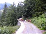 2
2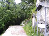 3
3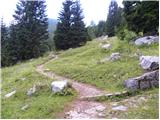 4
4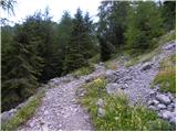 5
5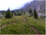 6
6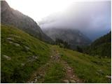 7
7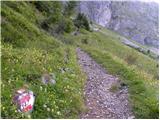 8
8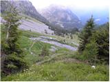 9
9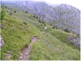 10
10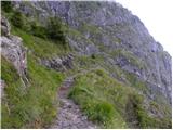 11
11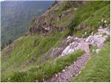 12
12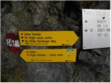 13
13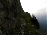 14
14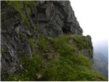 15
15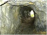 16
16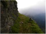 17
17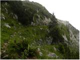 18
18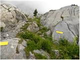 19
19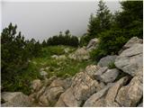 20
20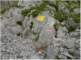 21
21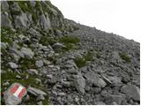 22
22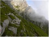 23
23 24
24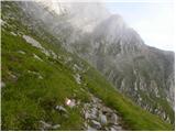 25
25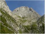 26
26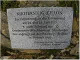 27
27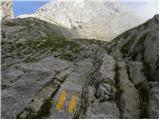 28
28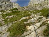 29
29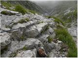 30
30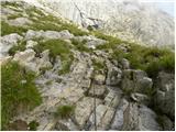 31
31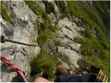 32
32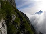 33
33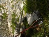 34
34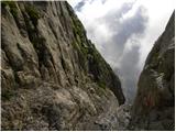 35
35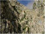 36
36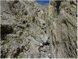 37
37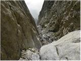 38
38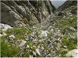 39
39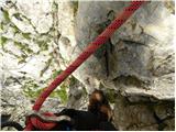 40
40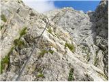 41
41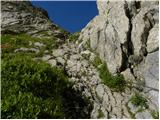 42
42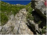 43
43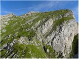 44
44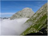 45
45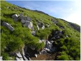 46
46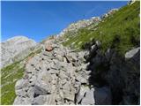 47
47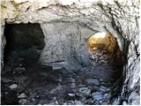 48
48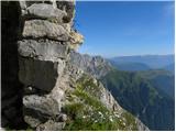 49
49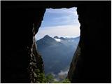 50
50 51
51
Discussion about the trip Plockenpass - Creta di Collinetta / Cellon (Via ferrata Steinberger Weg)
|
| Robie16. 08. 2025 08:16:10 |
Beautiful path and nicely equipped ferrata but upper part of the ferrata in poor condition - pulled-out pegs and torn cables. Risk of rockfall!
Also check before departure if the ferrata is CLOSED - from Italian starting points there are no signs about path condition, apparently on Austrian side info that it's closed - info we got at the top.
|
|
|
To post a comment you must log in:
If you do not yet have a username, you must first
register.