Starting point: Pod Krnico (1250 m)
| Latitude/Longitude: | 46,43460°N 14,40830°E |
| |
Walking time: 1 h 15 min
Difficulty: easy unmarked way
Elevation gain: 490 m
Elevation difference along the route: 490 m
Map: Karavanke - osrednji del 1:50.000
Recommended equipment (summer):
Recommended equipment (winter): ice axe, crampons
Views: 16.069
 | 2 people like this post |
Access to starting point:
From the highway Ljubljana - Jesenice we go to the exit Ljubelj. From this road before the gas station, we turn right to Tržič. The road then quickly brings us to Tržič, and we follow it further in the direction of the villages Jelendol and Medvodje. In the village Medvodje we turn left towards Košuta on the forest road which we follow to the crossroads at Košutnik (house) approximately at 1000 m. Here we go right and drive to the parking lot at a smaller quarry.
Route description:
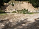
From the parking lot, we go on a cart track which branches off left from the road. The cart track goes into the forest and ascends moderately, first crossing a smaller and then a larger stream. The cart track, which has some shortcuts, makes some turns and after a good 15 minutes brings us to the pastures of the mountain pasture Spodnja Dolga njiva.
After a short walk on the mountain pasture, the path brings us to a junction, where there are signposts. We go right in the direction of the path Košutnikov turn eastern approach. A gently sloping path brings us after a few dozen steps of walking to the shepherd's hut on the mountain pasture Spodnja Dolga njiva.
Further, we continue upwards on the mountain pasture, in the middle of which runs a wide cart track, which after a good 15 minutes of walking brings us out of the forest onto the mountain pasture Zgornja Dolga njiva.
The steepness of the path, which was moderate until now, eases and the path soon brings us through nice grassy terrain to the central part of the mountain pasture, where the blazes end. We continue on a slightly ascending path which runs along a smaller but very distinct gully. A little further ahead the unmarked path splits into two parts.
We continue slightly right (left Tolsta Košuta) on the path which a little further ascends to the border ridge. The ridge a little further turns left, and the path first descends from the forepeak, then brings us along and on the ridge in a few minutes of scenic walking to the summit of Mala Košuta.
Orientation is difficult in the fog.
Starting point - Spodnja Dolga njiva 20 minutes, Spodnja Dolga njiva - Zgornja Dolga njiva 25 minutes, Zgornja Dolga njiva - Mala Košuta 30 minutes.

Photos:
 1
1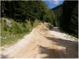 2
2 3
3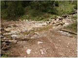 4
4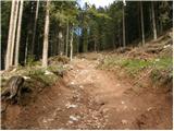 5
5 6
6 7
7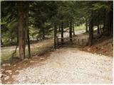 8
8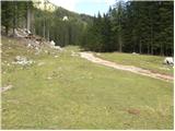 9
9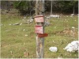 10
10 11
11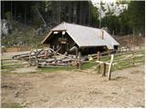 12
12 13
13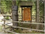 14
14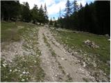 15
15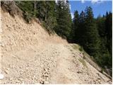 16
16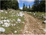 17
17 18
18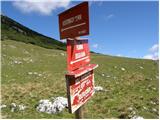 19
19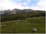 20
20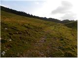 21
21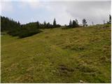 22
22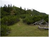 23
23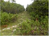 24
24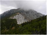 25
25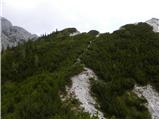 26
26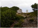 27
27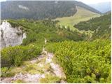 28
28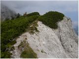 29
29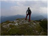 30
30
Discussion about the trip Pod Krnico - Mala Košuta
|
| Edina22. 09. 2009 |
Very nice connection with the tour to Tolsta Košuta. I discovered it only on the return after prior scouting from both summits of T. Košuta. This way we elegantly avoid searching for passages through the scrub. Nice and scenic, but lasts unfortunately only about four hours. When I head to such a less "attractive" and unmarked mountain even on weekdays, I usually meet more animals than people, today there were surprisingly many visitors up there. I was pleasantly surprised also by the refreshment stand at D. Njiva. Conditions from a few years ago have changed. Nice.
Enter here
|
|
|
|
| Lunca28. 06. 2011 |
At the refreshment stand in Dolga Njiva there's one of the friendliest "mountain hosts", Mateja! Always smiling and cheerful... we'd easily take her as a model elsewhere!
|
|
|
|
| robter27. 08. 2011 |
If you want to quickly enjoy fresh air and views of Košuta, KSA and the hills around Jezersko, this is a very suitable excursion. Towards the summit, stick to the border ridge, as bushes elsewhere prevent passage. For a moment today it even clouded over, then the wind cleared the clouds.
Masovnik at Dolga Njiva is awesome anyway.
|
|
|
|
| tulipan18. 08. 2012 |
I think Lidija figured out,
that the description applies to Meli Košuta.
|
|
|
|
| anazala3. 09. 2022 15:34:13 |
Isn't that the same. Mala or Meli. I've been there. Meli is just crossing to the Austrian side. If not, please write. At least I'll know where I was.
|
|
|
|
| anazala3. 09. 2022 15:34:28 |
Isn't that the same? Mala or Meli. I was there. Meli is just a crossing to the Austrian side. If not, please write. At least I'll know where I was.
|
|
|
|
| djimuzl4. 09. 2022 09:45:18 |
The name Meli Košuta refers to the characteristic crumbly area on the north side of this part of the Košuta ridge - below Tolsta and Mala Košuta. A geological trail also leads through that area from the Austrian side.
|
|
|
|
| turbo4. 09. 2022 11:10:20 |
|
|
|
To post a comment you must log in:
If you do not yet have a username, you must first
register.