Pod Luknjo - Matajurski vrh
Starting point: Pod Luknjo (950 m)
| Latitude/Longitude: | 46,24880°N 13,91450°E |
| |
Walking time: 3 h 50 min
Difficulty: partly demanding marked way, easy pathless terrain
Elevation gain: 986 m
Elevation difference along the route: 1200 m
Map: TNP 1:50.000
Recommended equipment (summer):
Recommended equipment (winter): ice axe, crampons
Views: 8.452
 | 1 person like this post |
Access to starting point:
From the Ljubljana–Jesenice motorway, take the Lesce exit and follow the road towards Bled and further towards Bohinjska Bistrica. From Bohinjska Bistrica, continue left in the direction of Tolmin and Soriška planina. Soon we will notice by the road signs for Črna prst to the right, but we continue straight. Only a little later we come to a crossroads, where a signpost directs us right towards the village of Ravne. We turn onto this road, which brings us to the end of the village, where the asphalt ends. Further we continue on a gravel road, which leads us past the former home of Dr. Janeza Mencingerja (today a private house). We follow this road for approximately 4 km to the spot where a worse forest road joins from the right side (nearby is a hunting observation post, numerous cart tracks and a mountain signpost for Črna prst).
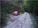
We park on one of the several smaller parking areas by the road, but in such a way that we do not hinder forestry work.
Route description:
Because of forestry work and consequently numerous tractor tracks, the start of the path is relatively hard to find. Between the hunting observation post and the mountain signpost for Črna prst there are three larger cart tracks that from the road go left upwards (direction of our arrival). We choose the "first", that is the one closest to the hunting observation post (the mountain signpost for Črna prst directs us to the "last" cart track, but if we follow the direction of this signpost we will quickly get lost).
So if we have decided for the ascent along the "first" cart track we will already after a few minutes of ascent notice the markings (the path comes across from the "last" cart track and is completely overgrown). We follow the wide tractor tracks somewhat to the left, but only to the spot where the markings direct us right onto a somewhat narrower cart track. Further on, orientation is much easier, as the labyrinth of cart tracks ends. From the occasionally somewhat steeper path, a marked path towards Orožnova koča soon branches off to the left.
We continue straight along the cart track, which higher up brings us into a smaller valley, up which we ascend to a forest road (about 30 minutes to here). When we step onto the road we continue a few steps to the left, then the mountain signpost for Črna prst directs us right into the forest, where it starts to ascend steeply. The path somewhat higher crosses an overgrown clearing (ferns and raspberry bushes) and then returns to the forest, where it continues all the way to the mountain pasture Osredki.
From the mountain pasture, where there are two smaller wooden huts (one converted into a bivouac), we continue along the left side of the watering trough, on a poorly visible path that starts to ascend moderately among bushes and individual trees. The still poorly visible but well-marked path then brings us higher to a somewhat larger meadow, at the edge of which we notice the next pond. The path then ascends ever more steeply and slowly turns to the left. At the top of the ascent we step onto a smaller saddle, behind which the path turns right and ascends across. A few more minutes of ascent follow on the slope overgrown with dwarf pines, and the path brings us to the main ridge of the Lower Bohinj Mountains.
From the ridge, from where a beautiful view opens towards the south, we continue right in the direction of Vogel (left to Črna prst 10 minutes). The path ahead becomes more demanding as, with the aid of fixed cables (mostly without them), it crosses very steep grassy slopes that are dangerous for slipping. The path then levels out somewhat and brings us to the Vrata saddle (1721 m). The path then retreats from the ridge to the left again and thereafter ascends across the next steep slope. That the path is not entirely easy is indicated by a memorial plaque. The steepness of the slopes then gradually eases and the path approaches the main ridge again (here we can ascend to Četrt in 15 minutes - easy pathless terrain).
We continue along the panoramic ridge, mostly covered in grass (towards the west), which gently ascends towards Konjski vrh, bypassing it on the left side. Thereafter the path descends slightly and brings us to an indistinct saddle between Konjski vrh and Poljanski vrh. The latter, where the path starts to ascend gently again, is also bypassed on the left side, bringing us to the foot of Matajurski vrh, which we will notice on the left. At the place where the path approaches Matajurski vrh we will notice on the left a poorly trodden path that initially ascends gently towards the south. The path, which becomes ever worse, turns somewhat to the right and after a short steep ascent brings us to a side ridge. When we step onto the ridge we continue slightly left along a poorly visible path beside which we notice some old faded markings. We then follow this increasingly panoramic "path" to the summit, which we reach after another 10 steps or so.
Since the path for most of its length follows the ridge, due to the risk of lightning strike, set out on the path only in fine weather.
Starting point - Planina Osredki 1:15, Planina Osredki - Matajurski vrh 2:35

The trip can be extended to the following destinations: Črna prst
Photos:
 1
1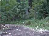 2
2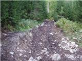 3
3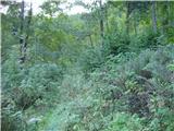 4
4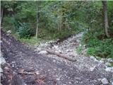 5
5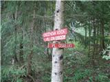 6
6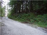 7
7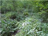 8
8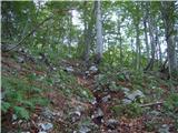 9
9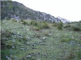 10
10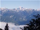 11
11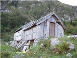 12
12 13
13 14
14 15
15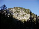 16
16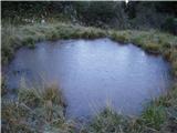 17
17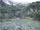 18
18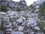 19
19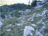 20
20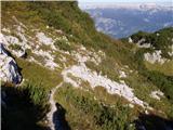 21
21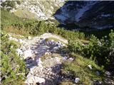 22
22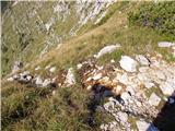 23
23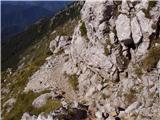 24
24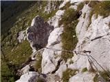 25
25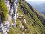 26
26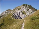 27
27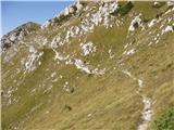 28
28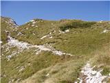 29
29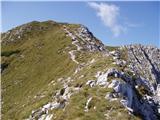 30
30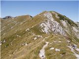 31
31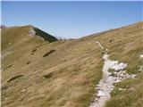 32
32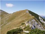 33
33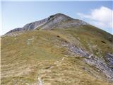 34
34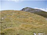 35
35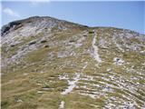 36
36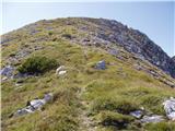 37
37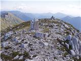 38
38
Discussion about the trip Pod Luknjo - Matajurski vrh
|
| Loerst1. 06. 2020 |
Otherwise a completely correct description, but it still requires a small correction - foresters have carried out extensive work in the starting area, so the cart track indicated by the sign (and described above as the one we will take) is now a real "highway" that joins the described one after about 10 minutes.
Off-trail enthusiasts can significantly shorten the path if, instead of heading to Črna prst, they head to the Vrata saddle at the top of Četrt. The ascent to the ridge is very easy.
|
|
|
To post a comment you must log in:
If you do not yet have a username, you must first
register.