Pod Prevalom - Petzen (Kordeschkopf) (Peca (Kordeževa glava))
Starting point: Pod Prevalom (1413 m)
| Latitude/Longitude: | 46,48903°N 14,74211°E |
| |
Walking time: 2 h 45 min
Difficulty: easy unmarked way, easy marked way
Elevation gain: 712 m
Elevation difference along the route: 780 m
Map:
Recommended equipment (summer):
Recommended equipment (winter): ice axe, crampons
Views: 49
 | 1 person like this post |
Access to starting point:
a) We drive to Črna na Koroškem (from the Koroška side from Raven or from Šoštanj via the Spodnje Sleme pass), then continue driving towards Koprivna. The road leads us along the Meža river, which we follow to the junction where the road to the Topla valley branches off to the right. The route continues along the Topla stream, and we drive along the ascending asphalt road to the junction by the former mine in Topla, where we turn left. This is followed by an ascent past the Končnik farm, after which the road levels out somewhat. At the NOB memorial park we turn left onto a forest road, which after a short descent begins to ascend through the forest. We follow the forest road connecting the settlements of Topla and Koprivna. After two hairpin bends we ascend transversely to the right over the slopes of Čofatijev vrh (or more precisely the slightly lower Šoparjev vrh) to a small junction at the Pod Prevalom pass. We park in one of the suitable places along the road so as not to obstruct traffic or the work of locals or foresters.
b) We drive to Luče (from Mozirje or from Kamnik via the Volovljek pass (Kranjski Rak)), then continue driving towards Logarska dolina. In the village of Solčava we leave the main road towards Logarska dolina and continue right in the direction of Podolševa, the Spodnje Sleme pass and Črna na Koroškem. Further on the road loses its asphalt surface, and after a few kilometres at the junction in Podolševa we turn right towards Črna na Koroškem. The road, which mainly ascends transversely, brings us after some time to the Spodnje Sleme pass. From the pass the road begins to descend, and we follow it in the direction of Črna na Koroškem. After descending into the valley after a few kilometres, at the junction we turn right towards Črna na Koroškem (left Koprivna). We descend along the main road for only a short time, then the signs for the Topla valley direct us left onto the ascending road. The route continues along the Topla stream, and we drive along the ascending asphalt road to the junction by the former mine in Topla, where we turn left. This is followed by an ascent past the Končnik farm, after which the road levels out somewhat. At the NOB memorial park we turn left onto a forest road, which after a short descent begins to ascend through the forest. We follow the forest road connecting the settlements of Topla and Koprivna. After two hairpin bends we ascend transversely to the right over the slopes of Čofatijev vrh (or more precisely the slightly lower Šoparjev vrh) to a small junction at the Pod Prevalom pass. We park in one of the suitable places along the road so as not to obstruct traffic or the work of locals or foresters.
Route description:
From the smaller junction still before the pass we go right onto a side road, which in a few dozen steps takes us to a clearing where two older crosses stand, one to the left of the road and one at a smaller junction.
Here we choose the left, somewhat wider road, which then begins to ascend transversely to the left (here right at the start a rather inconspicuous hunting path branches off to the right, which in the lower part is quite overgrown in places, above the hunting hut Anijeva bajta it is very steep, and joins the marked path at approximately 1800 meters above sea level).
Along the mentioned road we ascend transversely to an altitude of 1485 meters, where we join the marked path from Koprivna. Here the road turns right, but at the end of the bend we leave it and continue the ascent along the marked path, which at first still crosses a few cart tracks where we follow the markings, then the path enters a predominantly spruce forest where it becomes quite steep.
In the area called Travniček the previously mentioned path joins from the right, leading past Anijeva bajta; a little further the slopes on the right side become quite steep and in places also precipitous, while the marked path stays to the left of the cliffs.
On a fairly grassy section a still unmarked path branches slightly to the right from the marked path, leading along the edge of the cliffs to Knepsovo sedlo, but we follow the markings which then lead us along the state border, where a cut border strip is still visible today, along which we ascend for some time, after which the path turns more to the right and flattens further.
Higher up the horizon begins to open more and more, and we also get a view of the highest peak of Peca, Kordeževa glava; we then continue with a light transverse ascent to the right along a partly poorly trodden path.
At approximately 2050 meters above sea level we reach the indistinct southern ridge of Končnikov vrh, from where a light transverse descent follows to the marked junction on the Slovenian side of Knepsovo sedlo.
Here we keep to the right path leading towards Kordeževa glava (left Končnikov vrh and the cable car to Peca) and descend a little further to a small valley where an unmarked path from the mine in Topla also joins from the right.
We continue straight in the direction of Peca and Dom na Peci and from the small valley ascend along a well-trodden path running along the western slopes of Velika glava. Here a passage soon opens to the left towards the mentioned peak, but we follow the marked path to a small pass between Velika glava on the left and the indistinct, dwarf-pine-covered peak Ranta on the right.
It is only a few meters to the latter, but direct access is prevented by a dense belt of dwarf pine. We continue following the markings leading towards Kordeževa glava, the highest peak of Peca.
A short descent follows to the small valley separating Velika glava and Kordeževa glava. We merely cross the small valley, then with ever better views begin to ascend again. The path at first still leads through dwarf pine, higher up we ascend along a predominantly grassy slope to the 2125-meter-high peak.
Starting point - joining the marked path 0:15, joining the marked path - Travniček 0:50, Travniček - Knepsovo sedlo 0:50, Knepsovo sedlo - Kordeževa glava 0:50.
The description refers to the situation in July 2026, the pictures are from various periods.

Along the route: Priključitev na markirano pot (1485m), Travniček (1806m), Knepsovo sedlo (2011m)
Photos:
 1
1 2
2 3
3 4
4 5
5 6
6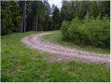 7
7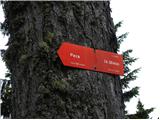 8
8 9
9 10
10 11
11 12
12 13
13 14
14 15
15 16
16 17
17 18
18 19
19 20
20 21
21 22
22 23
23 24
24 25
25 26
26 27
27 28
28 29
29 30
30 31
31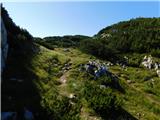 32
32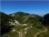 33
33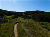 34
34 35
35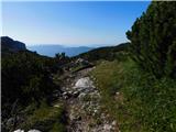 36
36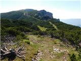 37
37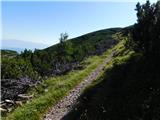 38
38 39
39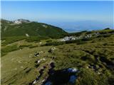 40
40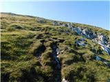 41
41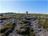 42
42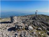 43
43
Discussion about the trip Pod Prevalom - Petzen (Kordeschkopf) (Peca (Kordeževa glava))
To post a comment you must log in:
If you do not yet have a username, you must first
register.