Starting point: Pod Zjabci (745 m)
| Latitude/Longitude: | 46,32610°N 13,69820°E |
| |
Walking time: 4 h 45 min
Difficulty: difficult unmarked way, easy pathless terrain
Elevation gain: 1507 m
Elevation difference along the route: 1530 m
Map: TNP 1 : 50.000
Recommended equipment (summer): helmet
Recommended equipment (winter): helmet, ice axe, crampons
Views: 23.763
 | 2 people like this post |
Access to starting point:
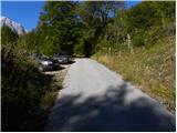
A) First, we drive to Kranjska Gora, then continue driving over the Vršič pass towards Bovec. Soon after the Berebica gallery, we arrive in the village of Soča, where we turn left over the bridge across the Soča River (direction tourist farm Jelinčič and camp Korita). After the bridge, we do not turn left towards the camp, but continue straight on the ascending asphalt road. Further on, we ascend over vast meadows, in the middle of which stand a few individual huts, then the road enters the forest. Higher up, the road turns sharply left and brings us to Pod Zjabcev, where we notice mountain signposts for Planina Za skalo, Dom na Komni and Triglav Lakes. We park in a suitable spot by the road.
B) From the Primorska side, we first drive to Bovec, then continue towards Trenta. Towards the end of the village of Soča, we turn right in the direction of the tourist farm Jelinčič and camp Korita. After the bridge, we do not turn left towards the camp, but continue straight on the ascending asphalt road. Further on, we ascend over vast meadows, in the middle of which stand a few individual huts, then the road enters the forest. Higher up, the road turns sharply left and brings us to Pod Zjabcev, where we notice mountain signposts for Planina Za skalo, Dom na Komni and Triglav Lakes. We park in a suitable spot by the road.
Route description:
From Pod Zjabci we head onto the marked path that bypasses the nearby huts on the right side. Behind the huts the path goes into the forest and quickly brings us to a smaller junction, where we continue right over a stream. On the other side of the stream, the path turns left and begins to ascend moderately through dense forest. We continue the ascent along an old mule track that is already quite eroded in several places, and this brings us higher to a short steep rocky section. A well-maintained and wide mule track leads us through this section, and the path above it brings us to a vantage point from which a beautiful view opens onto Bavški Grintavec.
From the vantage point, the path returns to the forest and quickly ascends to an old water trough (there is a small spring by the path here, which dries up in dry periods). Above the trough, the path turns slightly left, then ascends in numerous zigzags through the forest. Higher up, the trail levels out somewhat and brings us to a less noticeable junction, where an abandoned path to Planina Za skalo branches off to the left.
From here we continue straight ahead; a somewhat steeper path then brings us, after 10 minutes of further walking, to the next junction, which is this time completely unmarked. Here a unmarked trail branches off to the right leading to the nearby hunting hut and further to Planina za Črnim vrhom, to the left a hunting path branches off to Planina Za skalo, while we continue straight to the next nearby junction, which is somewhat better marked.
Here we continue left towards Planina Za skalo (straight ahead the path continues to Komna and the Triglav Lakes) along the path that crosses the slopes to the left. Soon we step out of the forest, where the trail descends slightly to the left (here another trail, not mentioned in the description, joins from the left), but we continue along the initially clearly visible trail that descends to Planina Za skalo and the TNP hut there.
From the mountain pasture we return a little and ahead of us on the slope we notice a trail that ascends across the scree towards Travnikova dolina. We head onto this unmarked trail, which ascends over already slightly overgrown scree. The path then transitions to a grassy slope, turns slightly right and ascends steeply. On this section of the path a steel cable assists us. The path then becomes less steep and continues along the grassy slope past increasingly sparse trees. The trail then runs along the right side of the valley, where on our right we notice the entrance to an abyss. We continue ascending up the valley and soon a view opens towards Čelo on the right side. On this section the trail becomes increasingly hard to follow, but orientation is not overly difficult as we simply continue up the wide valley. Ahead we can already see the summit of Travnik. When the valley starts turning right, we head left and begin ascending steep grass towards Travniška škrbina (the saddle left of Travnik). The summit of Travnik can also be reached via the saddle at the end of the valley on the right side of Travnik. Upon reaching Travniška škrbina we turn right and continue up the panoramic ridge to the summit of Travnik.
Pod Zjabci - Planina Za skalo 2:15, Planina Za skalo - Travnik 2:30.

Photos:
 1
1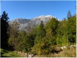 2
2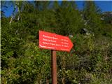 3
3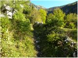 4
4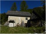 5
5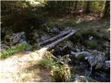 6
6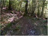 7
7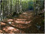 8
8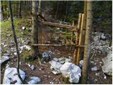 9
9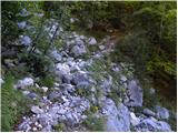 10
10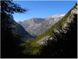 11
11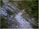 12
12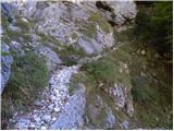 13
13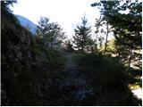 14
14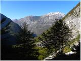 15
15 16
16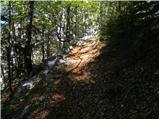 17
17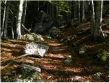 18
18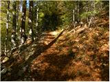 19
19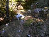 20
20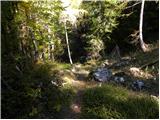 21
21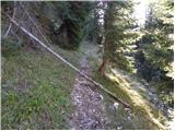 22
22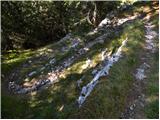 23
23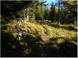 24
24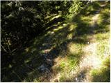 25
25 26
26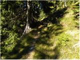 27
27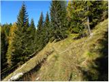 28
28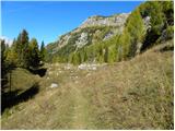 29
29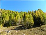 30
30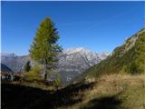 31
31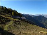 32
32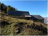 33
33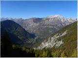 34
34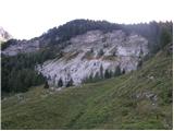 35
35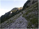 36
36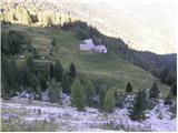 37
37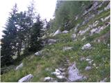 38
38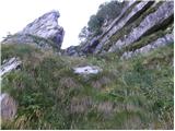 39
39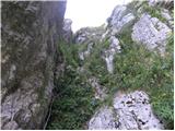 40
40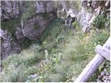 41
41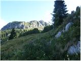 42
42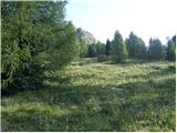 43
43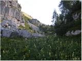 44
44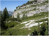 45
45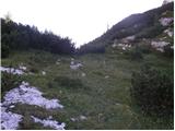 46
46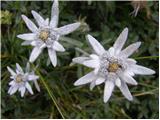 47
47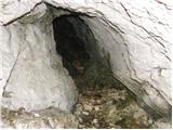 48
48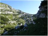 49
49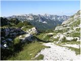 50
50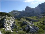 51
51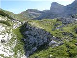 52
52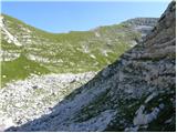 53
53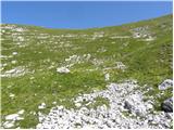 54
54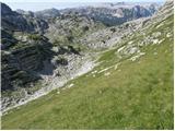 55
55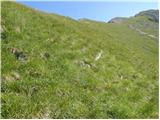 56
56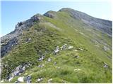 57
57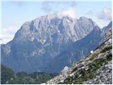 58
58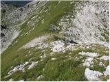 59
59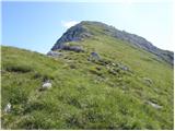 60
60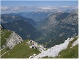 61
61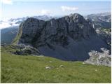 62
62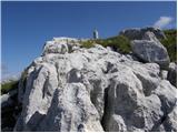 63
63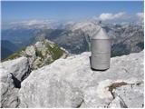 64
64
Discussion about the trip Pod Zjabci - Travnik
|
| igorf28. 06. 2010 |
On Sunday 27.06.10 we did the above described trip. Weather and views excellent (summer very hot, no water), flowers so abundant it takes your breath away, especially the ridge to Travnik full of beautiful gentians. The spring by the tree above the rock jump has enough water to refill (dries in summer). Incredibly many people, at least 50.
|
|
|
|
| damijanp17. 08. 2015 |
Really a fairy-tale world, worth visiting. Some photos are at:
Travnik
|
|
|
|
| boštjanko1. 08. 2020 |
A few days ago visited the wonderful Travnik Valley and Travnik. Judging by the size of nettles by the fixed cable, I'd say at least 1 week no hikers here. The path through Travnik Valley itself is quite trodden and followable for a good while. Flowers enchant you at every step. Whole day saw only 2 mountaineers, on the path towards the end of Travnik Valley. Next time I'll come also for the wonderful views from the summit, which were obscured by light fog...
|
|
|
|
| Spelcarocket2. 07. 2022 20:01:00 |
Today I went to collect views. When the markings end, the path is really nicely traceable; only at the viewpoint above the pasture behind the rock should one pay attention not to continue straight where there are traces of the path, and a little before the ridge of the summit, when crossing into the valley to the left side, the path is a bit less noticeable. The views that this somewhat forgotten and lonely world offers are beautiful.
|
|
|
|
| darinka429. 07. 2022 12:58:31 |
I join Damjan, who says that this world is beautiful and fairy-tale like. Since it was our first time, we were even more surprised by the beauty of the flowers and rocky formations. We walked the tour circularly. Viewing all the peaks around. Only one hiker went before us. We saw him as he was descending from Travnik.
|
|
|
|
| mikkeni14. 01. 2023 20:04:13 |
Winter ascent via Travnik Valley - planned Travnik, but eventually chose Planja  Winter conditions, interesting... snow unfortunately quite soft, sinking up to knees or even to the butt... otherwise, one more dry day tomorrow, then precipitation and change of conditions safe steps Winter conditions, interesting... snow unfortunately quite soft, sinking up to knees or even to the butt... otherwise, one more dry day tomorrow, then precipitation and change of conditions safe steps
http://ma-uc.blogspot.com/2023/01/travniska-dolina.html
|
|
|
|
| ppegan15. 01. 2023 07:39:57 |
This one will be the real Travnik  Bravo for the tour, these are really beautiful areas. Definitely easier with snowshoes or skis, as someone mentioned under Conditions Bravo for the tour, these are really beautiful areas. Definitely easier with snowshoes or skis, as someone mentioned under Conditions
|
|
|
|
| lepenatka19. 06. 2025 08:31:30 |
When is the best time to visit the flowering Travniška dolina and Travnik?
|
|
|
|
| mirank19. 06. 2025 12:24:07 |
It was already all in bloom last week, of course June and the beginning of July have the most flowers, but every period has its own little flowers
|
|
|
|
| smatjaz20. 06. 2025 16:23:31 |
lepenatka, when do you plan to go up?
|
|
|
|
| lepenatka20. 06. 2025 16:40:03 |
I don't have an exact date yet. The driver still needs to adjust.
Probably we'll go in 2 days and visit some other hill.
Drive to the starting point is about 3 hours.
|
|
|
|
| smatjaz21. 06. 2025 10:10:27 |
We're going very early tomorrow to avoid the heat pot and cross to pl. za Skalo before the scorching heat. Then we'll see how it goes further so we don't get fried.
|
|
|
|
| lepenatka21. 06. 2025 21:49:59 |
Let me know how it goes
|
|
|
To post a comment you must log in:
If you do not yet have a username, you must first
register.