Starting point: Podbrdo (508 m)
| Latitude/Longitude: | 46,21320°N 13,97170°E |
| |
Walking time: 3 h 15 min
Difficulty: easy marked way
Elevation gain: 1336 m
Elevation difference along the route: 1336 m
Map: Škofjeloško in Cerkljansko hribovje 1:50.000
Recommended equipment (summer):
Recommended equipment (winter): ice axe, crampons
Views: 47.108
 | 1 person like this post |
Access to starting point:
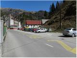
A) First, we drive to Škofja Loka, and then we continue driving towards Železniki, Podbrdo and Tolmin. When we get to Podbrdo, we park at an appropriate place in the center of the settlement.
B) From the road Idrija - Most na Soči, at the settlement Bača pri Modreju we turn right, or left, if we come from the direction of Posočje, and we continue driving towards Podbrdo. When we get to Podbrdo, we park at an appropriate place in the center of the settlement.
Route description:
From the center of Podbrdo we continue by the main road towards Tolmin. The road first leads under the railway, and then it brings us to a crossroad, where the road towards the village Porezen branches off to the left, and right towards Bača pri Podbrdu. From here we continue on the main road only a few dozen meters, and then signs for the village Trtnik and Črna prst point us on a narrower and ascending road. The somewhat narrower road, which is ascending west from Podbrdo, we follow all the way to the village Trtnik, which we reach after approximately 20 minutes of walking.
In Trtnik signs for Črna prst point us straight upwards on a marked footpath, which at first leads up the stairs of the nearby residential house, and then passes on a grassy slope, where it steeply ascends beside the orchard. The path higher passes into the forest and gradually flattens. The path continues through the forest and soon joins a partly stony cart track, which we follow to the right. On the cart track, we further ascend diagonally towards the right, and it occasionally leads over steeper slopes. Since the path is wide enough, the steepness of the slope does not cause bigger problems; we have to be careful mainly on one spot, where there is usually a lot of leaves and the path is consequently quite slippery. Higher, we cross a somewhat larger gully, and then the cart track brings us to a forest road, on which in a few minutes we ascend to the nearby saddle Sedlo, where there is a marked junction.
From Sedlo, where the path from the village Kal and the path from Kocenpohar join us, we continue straight on the cart track, which we follow only a short time, as the markings then point us left on a footpath, which starts to ascend steeper and steeper through the forest. Higher, the footpath temporarily flattens a little, and then it brings us to a viewpoint with a bench. A little after the bench the footpath splits into two parts (the right path is more trodden), and after approximately 15 minutes they join again. Only a little above the junction of both paths, we get to the next bench, from which a beautiful view opens towards Kobla and the peaks above Soriška planina.
From the bench we continue through the forest for a short time, and then the path passes on increasingly panoramic grassy slopes. When we step out of the forest, the path slowly starts turning a little towards the right, and then turns left and ascends diagonally to the saddle Čez Suho, where the path from the Bohinj side joins.
Here we continue left and with views on Baška grapa, Bohinj and the highest peaks of the Julian Alps, in a few minutes we ascend to the mountain hut Dom na Črni prsti, which is situated only a few meters below the summit.
The mountain hut Dom Zorka Jelinčiča we bypass on the left side and over a short steep slope in a few steps we ascend to the panoramic peak.

Along the route: Trtnik (656m), Sedlo (985m), Čez Suho (1760m)
Photos:
 1
1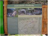 2
2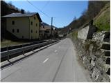 3
3 4
4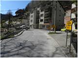 5
5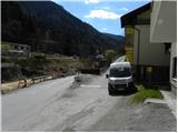 6
6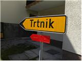 7
7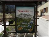 8
8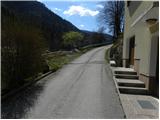 9
9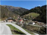 10
10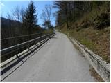 11
11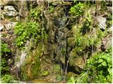 12
12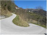 13
13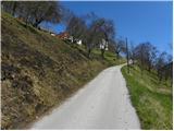 14
14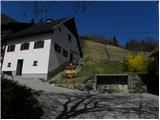 15
15 16
16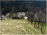 17
17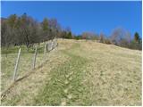 18
18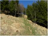 19
19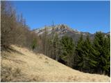 20
20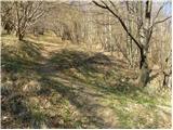 21
21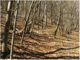 22
22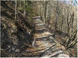 23
23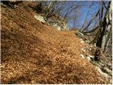 24
24 25
25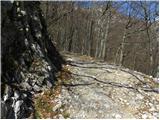 26
26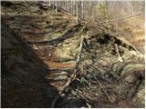 27
27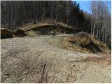 28
28 29
29 30
30 31
31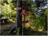 32
32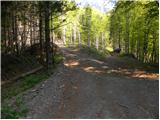 33
33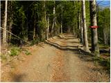 34
34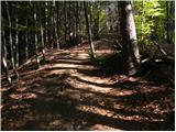 35
35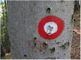 36
36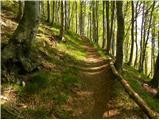 37
37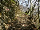 38
38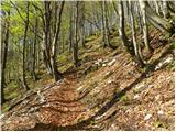 39
39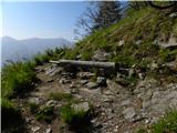 40
40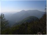 41
41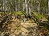 42
42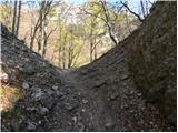 43
43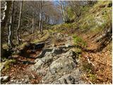 44
44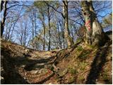 45
45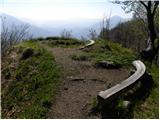 46
46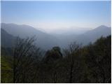 47
47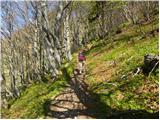 48
48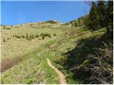 49
49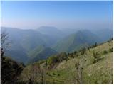 50
50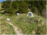 51
51 52
52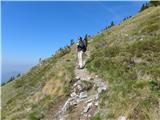 53
53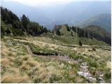 54
54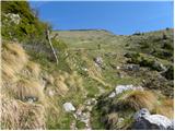 55
55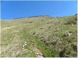 56
56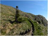 57
57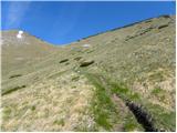 58
58 59
59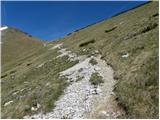 60
60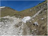 61
61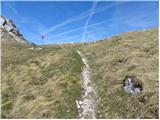 62
62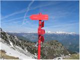 63
63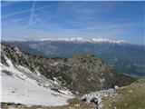 64
64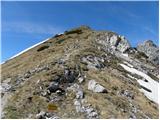 65
65 66
66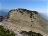 67
67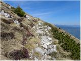 68
68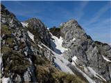 69
69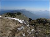 70
70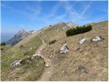 71
71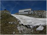 72
72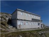 73
73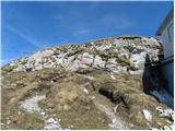 74
74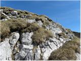 75
75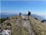 76
76 77
77
Discussion about the trip Podbrdo - Črna prst
|
| darinka416. 04. 2018 |
I'm interested in Podbrdo - Črna prst, does anyone know what the conditions are like?
|
|
|
|
| darinka418. 04. 2018 |
You'll have to wait a bit longer Thanks. Thanks.
|
|
|
|
| darinka419. 12. 2018 |
Today we were on Črna prst from Podbrdo. We had winter gear with us but didn't use it. On the path there's quite a bit of leaves, higher up there's snow but not much. The bivouac is exemplarily well-maintained. When we left it around 14:00 the temperature suddenly dropped a bit below zero and for the first time my phone died from the cold. Lower down it wasn't so cold anymore.
|
|
|
|
| ejas123417. 07. 2019 |
Yesterday we went from Podbrdo to Črna prst and down to Bohinjska Bistrica past Orožnova hut.
At Zorka Jelinčič house we ate excellent minestrone and drank a glass of excellent red wine.
The caretakers very friendly.
Walking time from 6:45 to 15:00, with all stops and views of the really beautiful surroundings.
|
|
|
|
| darinka45. 05. 2022 07:41:41 |
4.5.2022. From Podbrdo past Trtnik to Črna prst. Some snow patches under the summit. On the other side towards Orožnova koča, no footprints were visible except ski tracks. There's still snow. The gully is steep. There were a few of us on the path and at the top. If it weren't for the wind, it would probably be too warm.
|
|
|
|
| KARAMELICA25. 06. 2023 18:59:22 |
Today we went on this path. Wonderful day, beautiful weather, priceless view.
|
|
|
|
| sbirsa28. 08. 2023 08:09:32 |
Started from Podbrdo yesterday - path nicely marked to the top, had coffee and pancakes at Zorka J. hut, sat in the sun and slowly back past Orožnova koča to Bohinjska B. I took the right path to Ravne and missed the trail somewhere, so I had to go on the asphalt road for quite a stretch. Where did I miss it?
It was really a nice day, beautiful views, few people
|
|
|
To post a comment you must log in:
If you do not yet have a username, you must first
register.