Podhom - Sveta Katarina na Homu
Starting point: Podhom (590 m)
| Latitude/Longitude: | 46,39030°N 14,08500°E |
| |
Walking time: 45 min
Difficulty: easy unmarked way
Elevation gain: 44 m
Elevation difference along the route: 44 m
Map: TNP 1 : 50.000
Recommended equipment (summer):
Recommended equipment (winter):
Views: 4.307
 | 2 people like this post |
Access to starting point:
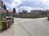
A) From the highway Ljubljana - Jesenice we go to the exit Lipce (Jesenice east), where we turn left (direction Blejska Dobrava and Spodnje Gorje). After 100 meters of driving, immediately after we have driven through the railway underpass, we find ourselves at the next crossroad, where we go right in the direction of Gorje, Bled (left Blejska Dobrava). After the steeper ascent we drive through the settlement Kočna and continue towards Spodnje Gorje, where soon after we cross the bridge over the river Radovna and the road ascends a little, we run into the left turn-off of the road with signs "Zasip, Vintgar, Podhom". Here we turn left and already after a few 10 meters at the crossroad again left, in the direction of "Vintgar". Soon we are again at the crossroad, where we don't continue downwards towards Vintgar, but only slightly right or straight uphill to the parking lot (sign by the road at the crossroad). The right road runs into the village. We park on the well-maintained parking lot by the playground.
B) From Bled we go towards Pokljuka and Spodnje Gorje. In Spodnje Gorje we follow the signs Jesenice, Vintgar. At the crossroad which is situated a few meters ahead of the inn Fortuna we turn right, in the direction of "Zasip, Vintgar, Podhom". Already after a few 10 meters at the crossroad we turn left, in the direction of "Vintgar". Soon we are again at the crossroad, where we don't continue downwards towards Vintgar, but only slightly right or straight uphill to the parking lot (sign by the road at the crossroad). The right road runs into the village. We park on the well-maintained parking lot by the playground.
Route description:
From the parking lot we continue forward across the pasture, towards the hill Hom, which we see in front of us. The path across the pasture turns slightly right and soon begins to ascend. In a short time, when the path turns more sharply right, we overlook the left turn-off of the cart track uphill towards the forest (path to Hom), and continue on our wide and level path, which takes us towards the east. While walking on the open grassy slope we soon enjoy nice views across a significant part of Gorenjska with the Julian Alps, Pokljuka and Jelovica, and later the Karavanks and Kamnik Alps in the background. On the path we cross the pasture fence several times, and we also encounter benches on which we can take a rest. When the path brings us above the last village lying below the slope (Zasip), we spot the somewhat distant church of St. Katarina, and soon cross the pasture fence for the last time, and step onto the larger macadam parking lot at Sveta Katarina na Homu. On the left we notice the catering facility, and in the direction slightly right or straight along the path into the valley the ancient little church. We can take a rest and enjoy the view on the nearby benches.

Photos:
 1
1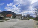 2
2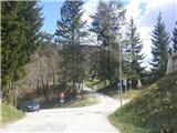 3
3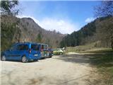 4
4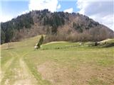 5
5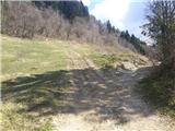 6
6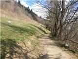 7
7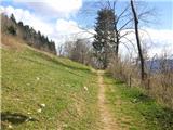 8
8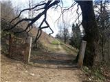 9
9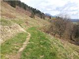 10
10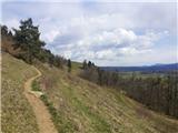 11
11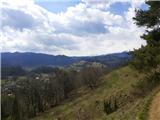 12
12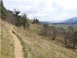 13
13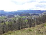 14
14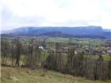 15
15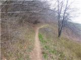 16
16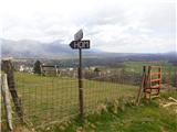 17
17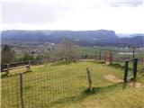 18
18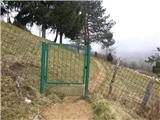 19
19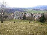 20
20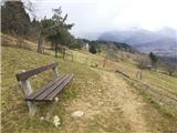 21
21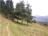 22
22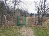 23
23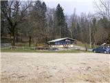 24
24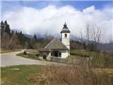 25
25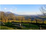 26
26
Discussion about the trip Podhom - Sveta Katarina na Homu
To post a comment you must log in:
If you do not yet have a username, you must first
register.