Podkanja vas / Wildenstein - Waterfall Podkanjski slap / Wildensteiner Wasserfall
Starting point: Podkanja vas / Wildenstein (511 m)
| Latitude/Longitude: | 46,53880°N 14,50900°E |
| |
Walking time: 20 min
Difficulty: easy marked way
Elevation gain: 129 m
Elevation difference along the route: 129 m
Map: Karavanke - osrednji del 1:50.000
Recommended equipment (summer):
Recommended equipment (winter): ice axe, crampons
Views: 2.769
 | 1 person like this post |
Access to starting point:
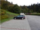
A) Via the Ljubelj border crossing we drive to Austria, then in the settlement Podljubelj / Unterloibl we turn right in the direction of the Hofer store. When we get to Borovlje / Ferlach, at the intersection a little behind the railway track we turn left (right from the intersection there is the Eurospar store), and at the next intersection after a few 100 meters we turn right in the direction of Železna Kapla / Bad Eisenkappel. Towards Železna Kapla we drive to the settlement Podkanja vas / Wildenstein, where signs for Podkanjski slap / Wildensteiner Wasserfall point us to the right. There follows some ascent on a somewhat narrower road, and then we get to the well-maintained parking lot (by the starting point there are also a guesthouse and museum).
B) Via the Jezerski vrh border crossing we drive to Austria, then past Železna Kapla we continue left towards Celovec / Klagenfurt and Borovlje / Ferlach. We continue along the main road towards Borovlje to the settlement Podkanja vas / Wildenstein, where signs for Podkanjski slap / Wildensteiner Wasserfall point us to the left. There follows some ascent on a somewhat narrower road, and then we get to the well-maintained parking lot (by the starting point there are also a guesthouse and museum).
C) We drive to Podjuno, then we follow the signs for Železna Kapla / Bad Eisenkappel. After the settlement Miklavčevo / Miklauzhof, we leave the road towards Železna Kapla and continue right towards Celovec / Klagenfurt and Borovlje / Ferlach. We continue along the main road towards Borovlje to the settlement Podkanja vas / Wildenstein, where signs for Podkanjski slap / Wildensteiner Wasserfall point us to the left. There follows some ascent on a somewhat narrower road, and then we get to the well-maintained parking lot (by the starting point there are also a guesthouse and museum).
Route description:
From the starting point, we continue on the wide tourist path in the direction towards Podkanjski slap and Obir. At first, we ascend in a few hairpin turns, then after a short panoramic part the path passes into the forest and narrows a little. After a few minutes of additional walking a marked path to Obir branches off to the right from the wide path, we continue straight and after a minute of additional walking we get to the well-maintained viewpoint on Podkanjski slap.
Description and pictures refer to the condition in the year 2017 (August).
Photos:
 1
1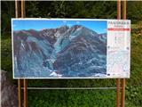 2
2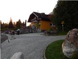 3
3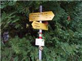 4
4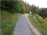 5
5 6
6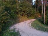 7
7 8
8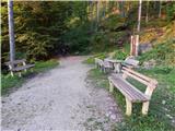 9
9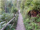 10
10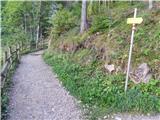 11
11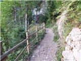 12
12 13
13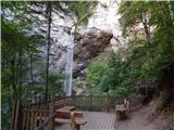 14
14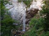 15
15
Discussion about the trip Podkanja vas / Wildenstein - Waterfall Podkanjski slap / Wildensteiner Wasserfall
To post a comment you must log in:
If you do not yet have a username, you must first
register.