Podkraj - Križna gora (Hrušica) (gentle path)
Starting point: Podkraj (798 m)
| Latitude/Longitude: | 45,86390°N 14,06300°E |
| |
Route name: gentle path
Walking time: 1 h 20 min
Difficulty: easy marked way
Elevation gain: 364 m
Elevation difference along the route: 364 m
Map: Nanos 1:50.000
Recommended equipment (summer):
Recommended equipment (winter):
Views: 12.856
 | 1 person like this post |
Access to starting point:
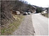
From Logatec we drive towards Idrija. Only a little after the village Kalce we will notice a road which goes left in the direction of village Podkraj and Col. We go on this quite winding road and we follow it to the village Podkraj. We park on a smaller parking lot by the road right next to the sign for the end of the village Podkraj (there are also hiking signposts by the parking lot).
From Primorska we first drive to Col, and then we continue driving in the direction of village Podkraj. When the road brings us to the beginning of the village we don't continue right into the village, but we continue on the left upper road which bypasses the center of the village. Near the sign for the beginning of Podkraj we park on a smaller parking lot by the road.
Route description:
From the starting point, we head onto an ascending cart track in the direction of Sveti Duh and Javornik. The cart track already after a few steps turns to the right and then ascends diagonally across a grassy slope. Higher, we pass through a short strip of forest, after which the path brings us to a marked junction.
We continue left (right Javornik) on a gently sloping path, which crosses the slopes towards Križna gora, which we can clearly see in front of us. The well-marked path continues along the cart track, from which soon a rather steep path branches off to the right for a short time. Higher, the path enters the forest, where it ascends transversely towards the northwest. When we step out of the forest, the path turns a bit more to the right and, with the help of a steel cable (undemanding), brings us to the next junction.
We continue straight uphill in the direction of Sveti Duh (not left towards Križna gora) on a path that steeply ascends for a short time, then leads us into the forest, where it flattens. After a few minutes of further walking, the path brings us to a marked junction, where we continue left towards Križna gora (right Sveti Duh). We follow the path, which further mostly slightly ascends through the forest, all the way to the top of Križna gora.

Photos:
 1
1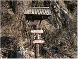 2
2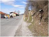 3
3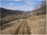 4
4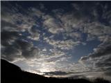 5
5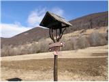 6
6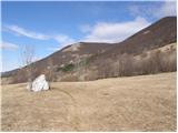 7
7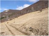 8
8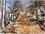 9
9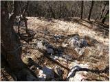 10
10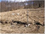 11
11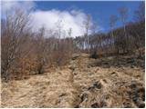 12
12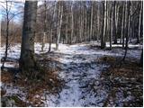 13
13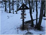 14
14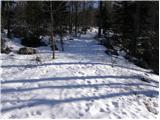 15
15 16
16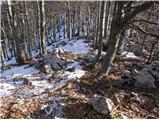 17
17 18
18
Discussion about the trip Podkraj - Križna gora (Hrušica) (gentle path)
|
| planinska_rozica1237. 08. 2010 |
The trip can also be extended and when we arrive at Križna gora we can continue to Sveta gora and along the hunting path to the bunker, large iron bath across the planina to the water trough
|
|
|
To post a comment you must log in:
If you do not yet have a username, you must first
register.