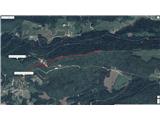
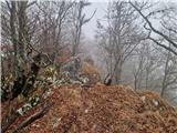
 | Selo - Tošč
Tošč, which became the highest peak of the Polhov Gradec Hills decades ago when the Yugoslav army lowered Pasja ravan by 9 metres, is located nor...
1 h |
 | Polharski dom Krim - Krim
Krim is a 1,107-metre-high mountain rising south of the Ljubljana Marsh. From the summit, where a mountain hut and several transmitters stand, th...
1 h 35 min |
 | Radlek - Slivnica
Slivnica is a 1,114-meter-high peak located north of the Cerknica Field and the intermittent Lake Cerknica. The summit itself is quite rounded, p...
1 h 20 min |
 | Potoki - Ajdna
Ajdna is a peak with a nice view towards Stol, Jelovica, Pokljuka, and the Julian Alps. There is also a good view of part of the Upper Sava Valle...
1 h |
 | Koroška Bela - Ajdna
Ajdna is a peak with a nice view towards Stol, Jelovica, Pokljuka, and the Julian Alps. There is also a good view of part of the Upper Sava Valle...
1 h 30 min |
 | Krnica - Kucelj (on Čaven) (via Veliki Rob)
Kucelj is located on the southern slopes of the Trnovski Forest, northwest of the Vipava Valley. From the bare summit, where a cross stands, ther...
1 h 40 min |
 | Polomova rajda - Veliki Modrasovec (via Koča na Čavnu)
Veliki Modrasovec is located on the southern part of the Trnovski Forest near Predmeja. On the summit stands an old military building, which we m...
1 h 25 min |
 | Volče - Vremščica
Vremščica is a mountain range stretching between Senožeče, Pivka and Divača. Its highest peak is Velika Vremščica. The view from the summit exten...
1 h 30 min |
 | Loščica - Vremščica
Vremščica is a mountain range stretching between Senožeče, Pivka and Divača. Its highest peak is Velika Vremščica. The view from the summit exten...
1 h 15 min |
 | Podmeja - Mrzlica
In recent years, Mrzlica has become an extremely popular excursion spot, especially for visitors from Savinjska valley and Zasavje. At 1,122 mete...
1 h 15 min |
 | Podmeja - Mrzlica
In recent years, Mrzlica has become an extremely popular excursion spot, especially for visitors from Savinjska valley and Zasavje. At 1,122 mete...
1 h 15 min |
 | Prvine - Črni vrh (Čemšeniška planina)
Črni vrh is the highest peak of Čemšeniška planina and, at 1,204 m, the second-highest peak in Posavsko hribovje. The summit has a logbook box bu...
1 h |
 | Planinski dom Vrhe - Črni vrh (Čemšeniška planina)
Črni vrh is the highest peak of Čemšeniška planina and, at 1,204 m, the second-highest peak in Posavsko hribovje. The summit has a logbook box bu...
1 h 30 min |
 | Begunje - Velika Špička (via Cemarovnik)
Velika Špička or Špičasto Stražišče is a peak located north of Slivnica. From the summit, which has a logbook box with a stamp, there is a nice v...
1 h |
 | Begunje - Velika Špička
Velika Špička or Špičasto Stražišče is a peak located north of Slivnica. From the summit, which has a logbook box with a stamp, there is a nice v...
1 h |
 | Studeno - Gora (Sveti Lovrenc)
Gora, or Sveti Lovrenc, is a peak above Studeno, a village north of Postojna that serves as a suitable starting point for the ascent to this pano...
1 h 5 min |
 | Gorenje - Gora (Sveti Lovrenc)
Gora, or Sveti Lovrenc, is a peak above Studeno, a village north of Postojna that serves as a suitable starting point for the ascent to this pano...
1 h 15 min |
 | Lome - Javornik (above Črni Vrh)
Javornik is a forested peak located southeast of Črni Vrh. In 1972, a wooden observation tower was built on it, rising above the treetops and off...
1 h 5 min |
| Črni Vrh (Grom) - Javornik (above Črni Vrh)
Javornik is a forested peak located southeast of Črni Vrh. In 1972, a wooden observation tower was built on it, rising above the treetops and off...
1 h 15 min |
 | Vodice (Mali Školj) - Javornik (above Črni Vrh)
Javornik is a forested peak located southeast of Črni Vrh. In 1972, a wooden observation tower was built on it, rising above the treetops and off...
1 h 35 min |
 | Kalce - Veliki Javornik (Javorniki)
Veliki Javornik is a 1,268-meter-high peak of the forested hills named Javorniki. The extensive Javorniki forests stretch from Postojna to Cerkni...
1 h 30 min |
 | Sovodenj - Bevkov vrh (steep way)
Bevkov vrh, a control point on the Slovenian Mountain Trail, is located between Cerkno and Spodnja Idrija. The peak is forested, but the stamp is...
1 h 15 min |
| Sovodenj - Bevkov vrh (gentle path)
Bevkov vrh, a control point on the Slovenian Mountain Trail, is located between Cerkno and Spodnja Idrija. The peak is forested, but the stamp is...
1 h 30 min |
 | Podlanišče - Bevkov vrh
Bevkov vrh, a control point on the Slovenian Mountain Trail, is located between Cerkno and Spodnja Idrija. The peak is forested, but the stamp is...
1 h 30 min |
 | Jazne (Lanišar) - Sivka
Sivka is a forested peak located west of Žiri and north of Idrija. At the summit there is a stamp for the Slovenian Mountain Trail and a logbook ...
1 h 30 min |
 | Ledinsko Razpotje - Sivka
Sivka is a forested peak located west of Žiri and north of Idrija. At the summit there is a stamp for the Slovenian Mountain Trail and a logbook ...
1 h 15 min |
| Govejk - Sivka
Sivka is a forested peak located west of Žiri and north of Idrija. At the summit there is a stamp for the Slovenian Mountain Trail and a logbook ...
1 h 40 min |
 | Hunting cottage Gozdnik - Gozdnik
Gozdnik is a hill that rises steeply above the village of Zabukovica. There is no view from the summit due to the forest, but a bivouac has been ...
1 h 10 min |
 | Zagreben (pri Dikcu) - Gozdnik
Gozdnik is a hill that rises steeply above the village of Zabukovica. There is no view from the summit due to the forest, but a bivouac has been ...
1 h 30 min |
 | Zagreben (pri Dikcu) - Malič
Malič is a 936-meter-high peak situated between Celje and Laško, more precisely above Spodnja Rečica. From the summit, which has a transmitter, b...
1 h 30 min |
 | Kamna Gora - Stolpnik
Stolpnik, at 1012 meters, is the highest peak of Konjiška gora, a range stretching southwest from Slovenske Konjice. A 25-meter-high observation ...
1 h |
 | Čretvež - Stolpnik (via Hunting cottage Štepih)
Stolpnik, at 1012 meters, is the highest peak of Konjiška gora, a range stretching southwest from Slovenske Konjice. A 25-meter-high observation ...
1 h 25 min |
 | Šentvid pri Planini - Koprivnik (Bohor)
Koprivnik, or Veliki Koprivnik, is one of numerous peaks on Bohor. It is located between Koča na Bohorju and Veliki Javornik. From the summit, wh...
1 h 30 min |
 | Komarna vas - Gače
Gače is a popular excursion spot for nature lovers and the only ski center in Dolenjska (SC Bela), offering pleasant skiing in winter and enjoyab...
1 h |
 | Juršče - Kršičevec
Kršičevec is a lesser-known mountain located east of Jurišče village in the Pivka basin. From its grassy summit, which has a logbook box with a s...
1 h 30 min |
 | Hrib-Loški Potok - Koča na Kamnem griču
The Koča na Kamnem griču mountain hut is located on Kamni grič, a panoramic hill rising southwest of Sodražica. From the grassy summit surrounded...
1 h 15 min |
 | Lipa - Tolsti vrh (Dobrovlje)
Tolsti vrh, together with Šentjoški vrh (1,077 m), is the highest peak of the Dobroveljska planota plateau. From the summit, which has a logbook ...
1 h 40 min |
 | Sovodenj - Ermanovec (through Miklavževa grapa)
Ermanovec is a 1,026-meter-high peak situated between Cerkno and Gorenja vas, more precisely above Sovodenj and Trebija. Just a few steps from th...
1 h 40 min |
 | Sovodenj - Ermanovec (by road)
Ermanovec is a 1,026-meter-high peak situated between Cerkno and Gorenja vas, more precisely above Sovodenj and Trebija. Just a few steps from th...
1 h 40 min |
| Podlanišče - Ermanovec
Ermanovec is a 1,026-meter-high peak situated between Cerkno and Gorenja vas, more precisely above Sovodenj and Trebija. Just a few steps from th...
1 h 35 min |
 | Zagrad - Ostrič
Ostrič (marked as Žabnik on some maps) is a 1056 m high peak on the Slovenian side of Čičarija. From the bare summit, where there is a round summ...
1 h 5 min |
 | Zagrad - Razsušica (zahodna pot)
Razsušica, at 1083 meters, is the highest peak of Slovenian Istria. Although the summit is partly vegetated, it offers a nice view towards the ne...
1 h 15 min |
 | Steljnik - Stene svete Ane
Stene Svete Ane is a vegetated peak located near the Planinska Koča pri Sveti Ani on Mala Gora. A small observation tower stands on the summit, e...
1 h 20 min |
| Seljan - Stene svete Ane (gentle path)
Stene Svete Ane is a vegetated peak located near the Planinska Koča pri Sveti Ani on Mala Gora. A small observation tower stands on the summit, e...
1 h 5 min |
 | Suhi Dol - Sivka (through forest)
Sivka is a grassy peak at the far western end of Polhograjsko hribovje. On clear days, it offers breathtaking views from Snežnik across Javorniki...
1 h 30 min |
| Suhi Dol - Sivka (by road)
Sivka is a grassy peak at the far western end of Polhograjsko hribovje. On clear days, it offers breathtaking views from Snežnik across Javorniki...
1 h 40 min |
 | Col - Kovk
Kovk is a panoramic peak west of Col on an elongated ridge rising steeply above the Vipava Valley. From the summit cross, beautiful views extend ...
1 h |
 | Črni Vrh - Čelkov vrh
Čelkov vrh is a 1,106-meter peak south of Črni vrh. From the summit, which has a logbook box and stamp, there are fine views toward the Julian Al...
1 h 30 min |
 | Zadlog - Špičasti vrh
Špičasti vrh is a forest-covered mountain located south of the village of Zadlog. To ensure the summit is not without a view, a 13-meter-high woo...
1 h 15 min |
 | Cenc - Špičasti vrh (on marked path)
Špičasti vrh is a forest-covered mountain located south of the village of Zadlog. To ensure the summit is not without a view, a 13-meter-high woo...
1 h 30 min |
 | Podmeja - Sveta planina (Partizanski vrh)
Sveta planina, also Partizanski vrh, is a 1,011-meter-high mountain located between Čemšeniška planina and Mrzlica. From the summit, where there ...
1 h 30 min |
 | Brest - Žbevnica (gentle path)
Žbevnica is a 1,014-meter-high peak situated above the village of Brest, on the Slovenian-Croatian border. From the summit, a beautiful view open...
1 h |
 | Ravne - Cerk
Cerk, at 1,192 meters, is the highest peak of Borovška gora, a range situated between the Kolpa River valley and Goteniški Snežnik. From the summ...
1 h 30 min |
 | Radeljski prelaz - Kapunar / Kapunerkogel
Kapunar is a 1,051-meter-high peak above Radlje ob Dravi. Just below the summit stands an old customs post and border guardhouse, now used by ama...
1 h 40 min |
 | Suhi Dol - Goli vrh (Official marked path)
Goli vrh (also Golni vrh on maps) is an indistinct, forest-covered peak above the dispersed settlement of Goli Vrh. There is no view from the sum...
1 h |
 | Kalce - Mali Javornik (Javorniki)
Mali Javornik is a 1219 m high mountain located in the forested ridge of Javorniki. There is no view from the summit itself due to the forest, bu...
1 h |
 | Sovodenj - Štor (through Miklavževa grapa)
Štor is a 1005 m high peak located directly above the Koča na Ermanovcu hut. The summit itself is forested, but from a meadow just a few dozen me...
1 h 25 min |
| Sovodenj - Štor (by road)
Štor is a 1005 m high peak located directly above the Koča na Ermanovcu hut. The summit itself is forested, but from a meadow just a few dozen me...
1 h 35 min |
 | Čepulje - Sveti Mohor (Zabrekve)
The Church of St. Mohor is located on a 952 m high hill between Zgornja Besnica and Selci. From the church or its nearby surroundings, there is a...
1 h 30 min |
 | Sveta Jedert (Lajše) - Sveti Mohor (Zabrekve)
The Church of St. Mohor is located on a 952 m high hill between Zgornja Besnica and Selci. From the church or its nearby surroundings, there is a...
1 h 30 min |
| Podblica - Sveti Mohor (Zabrekve)
The Church of St. Mohor is located on a 952 m high hill between Zgornja Besnica and Selci. From the church or its nearby surroundings, there is a...
1 h 40 min |
 | Ledinsko Razpotje - Loncmanova Sivka (Mrzli Vrh)
Loncmanova Sivka is a panoramic peak above the village Mrzli Vrh near Žiri. From the bare summit, on clear days, there are views of Golaki, Škofj...
1 h 25 min |
| Govejk - Loncmanova Sivka (Mrzli Vrh)
Loncmanova Sivka is a panoramic peak above the village Mrzli Vrh near Žiri. From the bare summit, on clear days, there are views of Golaki, Škofj...
1 h 40 min |
 | Jazne (Lanišar) - Loncmanova Sivka (Mrzli Vrh)
Loncmanova Sivka is a panoramic peak above the village Mrzli Vrh near Žiri. From the bare summit, on clear days, there are views of Golaki, Škofj...
1 h 30 min |
 | Hunting sports association Vinska Gora - Ramšakov vrh
Ramšakov vrh is the highest point of the circular path around Vinska Gora. At the 970 m high summit, next to the benches, there is also a stamp b...
1 h |
 | Solarji - Nagnoj
Nagnoj is the second-highest peak of the Kolovrat range at 1193 m. The range lies between Tolmin and Venetian Slovenia. From the summit, which ha...
1 h 40 min |
 | Cvetrež - Lašček (by road)
Lašček, at 1071 m, is the highest peak of the Banjška planota plateau, rising above Čepovanski dol, the Soča valley, and the Idrijca valley. From...
1 h 20 min |
 | Jereka - Vodnikov razglednik
Vodnikov razglednik is a 1,017-meter-high mountain located between Jereko and Koprivniki in Bohinj. From the summit, which features a large cross...
1 h 15 min |
 | Source of Ljubija - Sveti Križ above Bele Vode
The Church of St. Cross is located on Kriška gora, formerly called Oslovska gora. Kriška gora rises above Beli Vodi, or above the streams Ljubija...
1 h 5 min |
| Bele Vode (Sveti Andrej) - Sveti Križ above Bele Vode (lower path)
The Church of St. Cross is located on Kriška gora, formerly called Oslovska gora. Kriška gora rises above Beli Vodi, or above the streams Ljubija...
1 h 15 min |
| Bele Vode (Sveti Andrej) - Sveti Križ above Bele Vode (upper path)
The Church of St. Cross is located on Kriška gora, formerly called Oslovska gora. Kriška gora rises above Beli Vodi, or above the streams Ljubija...
1 h |
 | Dom na Paškem Kozjaku - Štrukljev vrh
Štrukljev vrh is, alongside Špik (1,108 m) and Basališče (1,272 m), one of the three main peaks of Paški Kozjak, a roughly 10 km long, narrow and...
1 h 30 min |
 | Dom na Paškem Kozjaku - Ostrica
Ostrica is an indistinct peak of Paški Kozjak, a 10-kilometer-long, quite narrow and steep limestone ridge between the gorges of the Paka and Hud...
1 h |
 | Sovodenj - Planinska koča Mrzl'k
The Planinska koča Mrzl'k mountain hut lies just a few meters below the Mrzlik summit. From the hut opens up a fine view of the neighboring Mrzli...
1 h 40 min |
| Jazne (Lanišar) - Planinska koča Mrzl'k
The Planinska koča Mrzl'k mountain hut lies just a few meters below the Mrzlik summit. From the hut opens up a fine view of the neighboring Mrzli...
1 h 10 min |
| Govejk - Planinska koča Mrzl'k
The Planinska koča Mrzl'k mountain hut lies just a few meters below the Mrzlik summit. From the hut opens up a fine view of the neighboring Mrzli...
1 h 40 min |
| Ledinsko Razpotje - Planinska koča Mrzl'k
The Planinska koča Mrzl'k mountain hut lies just a few meters below the Mrzlik summit. From the hut opens up a fine view of the neighboring Mrzli...
1 h 25 min |
 | Čemernica / Tschemernitzen - Arihova peč / Arichwand
Arihova peč / Arichwand is a panoramic rocky cliff located near the Bleščeča planina / Rossalm pasture. A wooden hut stands on top of the cliff, ...
1 h 25 min |
 | Avsa - Srednji vrh (on Matajur) (old path)
Srednji vrh is a 1,320-meter-high grassy peak located in the Matajur mountain range. From the summit, a paragliding takeoff point, there is a fin...
1 h 20 min |
 | St. John the Baptist on Ojstrica - Kozji vrh (at Košenjak)
Kozji vrh is a 1,383-meter-high peak located above Pernice; it is also the highest peak in the Municipality of Muta....
1 h 35 min |
 | Malenski Vrh - Malenski vrh
Malenski vrh is a 1,051-meter-high mountain located west of the settlement of Javorje. The summit features a small bench and a cairn, but the vie...
1 h 5 min |
| Dolenčice - Malenski vrh
Malenski vrh is a 1,051-meter-high mountain located west of the settlement of Javorje. The summit features a small bench and a cairn, but the vie...
1 h 15 min |
 | Široko - Veliki vrh (above Lom) (direct way)
Veliki vrh is located on the northeastern part of the Banjška planota plateau, which rises above Čepovani dol, the Soča river valley, and the Idr...
1 h 30 min |
 | Zelovo - Orlove stine (western path)
Orlove stine is a panoramic peak above Peručko Lake. It lies southeast of the better-known Svilaja. From the top, there is a fine view toward the...
1 h 20 min |
 | Zelovo - Umac (at Svilaja)
Umac is a small indistinct peak located southeast of Svilaja. The summit is just 5 minutes from the road leading below Svilaja. At the top are ro...
1 h 30 min |
 | Planinska koča Promina - Čavnovka (Promina) (on footpath)
Čavnovka is the highest summit of Promina, a smaller range above the town of Drniš. There are two summits: the southern one features an antenna, ...
1 h |
 | Planinska koča Promina - Čavnovka (Promina) (on road)
Čavnovka is the highest summit of Promina, a smaller range above the town of Drniš. There are two summits: the southern one features an antenna, ...
1 h |
 | Budaci - Velinac
Velinac is a panoramic peak in Central Velebit located above Karlobag. The summit is quite rocky and has a logbook and two stamps, one for HPO an...
1 h |
 | Račja vas - Orljak (Čičarija)
Orljak is a panoramic peak in Čičarija. The summit features a cross and a logbook. It is a point on the HPO and Istrian mountain trail. From the ...
1 h 30 min |
 | Rašpor - Gomila (Čičarija)
Gomila is a scenic grassy summit in the Čičarija area, located in Croatian Istria. The summit is a waypoint on the Istrian Mountain Trail. A conc...
1 h 15 min |
 | Crossroads below Zvonik - Bitoraj
Bitoraj (also Veliki Bitoraj or Burni Bitoraj) is a 1,386-meter-high peak located south of the settlement Vrata. The peak is an HPO point. From t...
1 h 30 min |
 | Omar - Kolevrat
Kolevrat is a lesser-known peak situated above Klenovica. It lies near the path to Kolovratske stijene. From the grassy summit, which has a logbo...
1 h |
 | Brest - Muzari (čez Žbevnico)
Muzari is a grassy peak located between Špičasti vrh and the better-known Žbevnica, specifically on the marked path from Golič to Žbevnica. On th...
1 h |
| Brest - Muzari (gentle path)
Muzari is a grassy peak located between Špičasti vrh and the better-known Žbevnica, specifically on the marked path from Golič to Žbevnica. On th...
1 h 10 min |
 | Podmeja - Homič
Homič is one of the peaks on the Prebold mountain trail, located northwest of the slightly higher and more famous Mrzlica. From the summit, where...
1 h |
 | Sošice - Pliješ
Pliješ (Pleš on some maps) is a partially grassy summit above Sošice, near Slovenia, on Žumberačka gora. The summit is an HPO point, part of the ...
1 h 20 min |
 | Brest - Špičasti vrh (pri Žbevnici) (čez Žbevnico)
Pointed Peak is a scenic grassy peak along the marked path between Golič and Žbevnica, near the Slovenian border. The peak has a summit book box ...
1 h 15 min |
| Brest - Špičasti vrh (pri Žbevnici) (gentle path)
Pointed Peak is a scenic grassy peak along the marked path between Golič and Žbevnica, near the Slovenian border. The peak has a summit book box ...
1 h 25 min |
 | Mala Učka - Suhi vrh (Učka)
Suhi vrh is a forested peak located south of the better-known Vojak. At the highest point of the peak there are rocks; slightly further south is ...
1 h 15 min |